Category:Ponds in the canton of Aargau
Jump to navigation
Jump to search
Cantons of Switzerland: Aargau (AG) · Appenzell Ausserrhoden (AR) · Bern (BE) · Geneva (GE) · Obwalden (OW) · Schwyz (SZ) · St. Gallen (SG) · Thurgau (TG) · Valais (VS) · Vaud (VD) · Zug (ZG) · Zürich (ZH)
Subcategories
This category has only the following subcategory.
W
Media in category "Ponds in the canton of Aargau"
The following 35 files are in this category, out of 35 total.
-
 2013 Bruno Weber Skulpturenpark-Führung - Wasserpark 2013-08-02 12-06-43.JPG 4,800 × 3,200; 4.83 MB
-
 Auenrenaturierung Chly Rhy, neue Stillgewässer.JPG 6,000 × 4,000; 12.84 MB
-
 Auenrenaturierung Chly Rhy, neues Stillgewässer 2.JPG 6,000 × 4,000; 11.31 MB
-
 Auenrenaturierung Chly Rhy, neues Stillgewässer.JPG 6,000 × 4,000; 12.94 MB
-
 Besimoos von Norden.JPG 4,496 × 3,000; 3.24 MB
-
 Besimoos von Nordwesten.JPG 4,496 × 3,000; 3.24 MB
-
 Betonierter Teich.jpg 4,128 × 2,322; 5.15 MB
-
 Biotop im Besimoos 1.JPG 4,496 × 3,000; 3.37 MB
-
 Biotop im Besimoos 2.JPG 4,496 × 3,000; 3.42 MB
-
 Böttsteiner Mühleweiher. Im Hintergrund das Gästehaus an Stelle der einstigen "Oberen Mühle".jpg 5,984 × 3,366; 10.72 MB
-
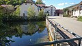
 Dättwiler Weiher 2023.jpg 3,492 × 2,582; 1.3 MB
-
 Froschweiher, Wohlen - panoramio (2).jpg 3,144 × 2,311; 3.87 MB
-
 Girizkanal2.jpg 3,264 × 2,448; 10.63 MB
-
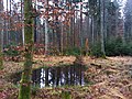
 Lauffohr Amphibientümpel an der Aare.jpg 2,080 × 1,372; 1,003 KB
-
 Lauffohr Baustelle Amphibientümpel.jpg 2,072 × 1,350; 1.22 MB
-
 Marsh in Langholz near Rothrist - panoramio (2).jpg 2,592 × 1,936; 2.6 MB
-
 Marsh in Langholz near Rothrist - panoramio (3).jpg 2,592 × 1,936; 2.28 MB
-
 Marsh in Langholz near Rothrist - panoramio (5).jpg 2,592 × 1,936; 2.55 MB
-
 Marsh in Langholz near Rothrist - panoramio (6).jpg 2,592 × 1,936; 2.17 MB
-
 Marsh in Langholz near Rothrist - panoramio (8).jpg 2,592 × 1,936; 2.18 MB
-
 Marsh in Langholz near Rothrist - panoramio (9).jpg 2,592 × 1,936; 2.48 MB
-
 Marsh in Langholz near Rothrist - panoramio.jpg 2,592 × 1,936; 2.55 MB
-
 Naturschutz-Schild mit Baustelle im Hintergrund 1.JPG 4,496 × 3,000; 3.08 MB
-
 Naturschutz-Schild mit Baustelle im Hintergrund 2.JPG 4,496 × 3,000; 3.36 MB
-
 Naturschutz-Schild mit Baustelle im Hintergrund 3.JPG 4,496 × 3,000; 3.39 MB
-
 Neu angelegter Tümpel im Besimoos mit Baustelle im Hintergrund.JPG 4,496 × 3,000; 3.33 MB
-
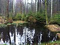
 Tümpel im Besimoos 1.JPG 4,496 × 3,000; 3.42 MB
-
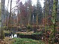
 Tümpel im Besimoos 2.JPG 4,496 × 3,000; 3.42 MB
-
 Tümpel im Besimoos 3.JPG 4,496 × 3,000; 3.46 MB
-
 Tümpel im Besimoos 4.JPG 4,496 × 3,000; 3.46 MB
-
 Weidende Galloway neben Feuchtstelle im Besimoos.JPG 4,496 × 3,000; 3.21 MB
-
 Weidende Galloway-Rinder im Besimoos neben Feuchtstelle.JPG 4,496 × 3,000; 3.29 MB
-
 Weiher in einem Altarm der Aare im Umiker Schachen.jpg 3,398 × 2,552; 4.61 MB
-
 Wettingen Bussberg Teich 2013-12-31 01.jpg 2,592 × 1,936; 2.43 MB
-
 Wettingen Bussberg Teich 2013-12-31 02.jpg 3,888 × 2,592; 4.26 MB


.jpg)


.jpg)
.jpg)
.jpg)
.jpg)
.jpg)
.jpg)


