Category:Political maps of Antarctica
Jump to navigation
Jump to search
Subcategories
This category has the following 4 subcategories, out of 4 total.
Media in category "Political maps of Antarctica"
The following 24 files are in this category, out of 24 total.
-
 "Antarctic region" CIA World Factbook.jpg 1,340 × 1,704; 1.55 MB
-
 1956 Antarctica Claims (30252922504).jpg 5,825 × 4,500; 18.82 MB
-
 Antarctic political map.png 2,550 × 3,300; 1.6 MB
-
 Antarctica research station.png 1,134 × 1,278; 505 KB
-
 Antarctica, Central unclaimed zone.svg 806 × 806; 43 KB
-
 Antarctica, territorial claims including Brazil-ca.svg 512 × 573; 70 KB
-
 Antarctica, territorial claims including Brazil.svg 512 × 573; 77 KB
-
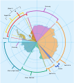
 Antarctica, territorial claims.svg 820 × 820; 72 KB
-
 Antartic - Revendicacions territòrialas.png 1,572 × 1,459; 307 KB
-
 Antartida Uruguaya.png 1,600 × 1,600; 482 KB
-
-
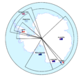
 Argentine and Chilean Antarctic claims (1946–present (as of 2023)).svg 728 × 845; 732 KB
-
 Capitaniachileterraaustralismejor.png 15,322 × 32,000; 3.22 MB
-
 Capitaniachileterraaustralismejor.svg 512 × 512; 489 KB
-
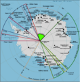
 Chilean Antarctic Territory in Antarctica.svg 1,200 × 1,200; 347 KB
-
 Disputa antártica entre Argentina y Chile (1946-presente).svg 728 × 845; 740 KB
-

-
 Flag map of Chilean Antarctic Territory.svg 177 × 336; 227 KB
-
 Flag map of Terra Australis, Spain.svg 1,958 × 3,543; 175 KB
-
 Kaart territoriale claims Antarctica.jpg 4,032 × 3,024; 2.6 MB
-
 Keep watch land claim.png 581 × 590; 57 KB
-
 MAUD.png 90 × 90; 8 KB
-
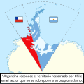
 Territorio Chileno Antártico y la Antártida Argentina según Chile.svg 727 × 720; 972 KB
-
 アルゼンチンとチリの南極請求(1946年~現在(2023年時点)).svg 512 × 594; 603 KB

.jpg)


).svg)


.svg)


