Category:Pok Oi Kong Ha Wai Village
Jump to navigation
Jump to search
| Object location | | View all coordinates using: OpenStreetMap |
|---|
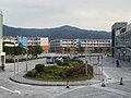
English: Transitional housing. Address: No. 71 Kam Sheung Road, Yuen Long District, Hong Kong.
中文:博愛江夏圍
Media in category "Pok Oi Kong Ha Wai Village"
The following 12 files are in this category, out of 12 total.
-
 ATENU1341 KMB 251C 05-10-2023.jpg 4,032 × 3,024; 2.14 MB
-
 KMB sell KMB Monthly Pass in Kong Ha Wai 05-10-2023(2).jpg 4,032 × 3,024; 4.02 MB
-
 KMB sell KMB Monthly Pass in Kong Ha Wai 05-10-2023.jpg 4,032 × 3,024; 3.08 MB
-
 Kong Ha Wai 13-06-2022(1).jpg 4,032 × 3,024; 2.94 MB
-
 Kong Ha Wai 13-06-2022(2).jpg 4,032 × 3,024; 3.48 MB
-
 Kong Ha Wai KMB 251C bus stop 13-06-2022.jpg 4,032 × 3,024; 3.63 MB
-
 Kong Ha Wai name board 13-06-2022.jpg 4,032 × 3,024; 3.87 MB
-
 Pok Oi Kong Ha Wai Village 05-10-2023(1).jpg 4,032 × 3,024; 3.04 MB
-
 Pok Oi Kong Ha Wai Village 05-10-2023(2).jpg 4,032 × 3,024; 2.77 MB
-
 Pok Oi Kong Ha Wai Village 05-10-2023(3).jpg 4,032 × 3,024; 2.59 MB
-
 Pok Oi Kong Ha Wai Village Brillant Food Supermarket 05-10-2023.jpg 4,032 × 3,024; 4.05 MB
-
 Pok Oi Kong Ha Wai Village name board 05-10-2023.jpg 4,032 × 3,024; 3.38 MB

.jpg)

.jpg)
.jpg)


.jpg)
.jpg)
.jpg)

