Category:Photos from Panoramio ID 1710195
Jump to navigation
Jump to search

Media in category "Photos from Panoramio ID 1710195"
The following 200 files are in this category, out of 784 total.
(previous page) (next page)-
 64490 Lescun, France - panoramio (1).jpg 3,025 × 1,602; 520 KB
-
 64490 Lescun, France - panoramio (10).jpg 2,878 × 1,737; 2.58 MB
-
 64490 Lescun, France - panoramio (11).jpg 2,550 × 1,541; 2.33 MB
-
 64490 Lescun, France - panoramio (2).jpg 2,688 × 1,441; 2.83 MB
-
 64490 Lescun, France - panoramio (3).jpg 3,264 × 2,448; 1.93 MB
-
 64490 Lescun, France - panoramio (4).jpg 2,970 × 1,554; 2.82 MB
-
 64490 Lescun, France - panoramio (5).jpg 2,636 × 1,715; 2.55 MB
-
 64490 Lescun, France - panoramio (6).jpg 3,086 × 1,620; 3.41 MB
-
 64490 Lescun, France - panoramio (7).jpg 3,264 × 2,448; 3.89 MB
-
 64490 Lescun, France - panoramio (8).jpg 2,713 × 1,664; 2.57 MB
-
 64490 Lescun, France - panoramio (9).jpg 2,724 × 1,477; 2.28 MB
-
 64490 Lescun, France - panoramio.jpg 3,264 × 2,448; 3.51 MB
-
 64490 Sarrance, France - panoramio.jpg 3,264 × 2,448; 1.77 MB
-

-
 A 18km du sommet... encore facile, à cet endroit - panoramio.jpg 2,048 × 1,401; 985 KB
-
 A 1km du Petit Saint-Bernard - panoramio.jpg 2,048 × 1,536; 598 KB
-
 A 2km du col d'Ispéguy - panoramio.jpg 5,312 × 2,988; 9.06 MB
-
 A Gavarnie - panoramio.jpg 2,930 × 1,706; 3.69 MB
-
 A Gavarnie, vue vers le nord - panoramio.jpg 2,448 × 1,437; 2.46 MB
-
 A Gavarnie. Faute de vélo adapté, je n'irai pas plus loin... - panoramio.jpg 2,852 × 1,753; 4.07 MB
-
 A la petite station de ski d'Issarbe - panoramio.jpg 3,264 × 2,448; 4.51 MB
-
 A la sortie de Saint-Palais - panoramio.jpg 5,312 × 2,988; 3.9 MB
-
 A quelques hectomètres du port de Larrau, début décembre 2015 - panoramio.jpg 3,264 × 2,448; 1.44 MB
-
 Agen, ville départ d'un biketrip de 3 jours - panoramio.jpg 2,400 × 1,873; 910 KB
-
 Aiguillon - panoramio.jpg 3,140 × 1,592; 2.52 MB
-
 Aiguillon, écluse sur le Lot - panoramio.jpg 2,412 × 1,252; 1.59 MB
-
 Aime - panoramio.jpg 2,048 × 1,536; 613 KB
-
 Albi (81) - panoramio.jpg 2,547 × 1,751; 978 KB
-

-
 Amou, Landes - panoramio.jpg 5,312 × 2,988; 7.45 MB
-
 Aoste - panoramio (23).jpg 2,048 × 1,536; 684 KB
-
 Aoste - panoramio (8).jpg 2,048 × 1,536; 638 KB
-
 Arette, France - panoramio (1).jpg 2,811 × 1,655; 2.75 MB
-
 Arette, France - panoramio (2).jpg 2,216 × 1,618; 714 KB
-
 Arette, France - panoramio (3).jpg 2,226 × 1,433; 2.06 MB
-
 Arette, France - panoramio.jpg 3,264 × 2,448; 1.79 MB
-
 Arreau, km0 - panoramio.jpg 5,312 × 2,988; 9.88 MB
-

-
 Arrivée au Cirque de Troumouse, 2100m - panoramio.jpg 3,264 × 2,448; 3.49 MB
-
 Arrivée au cirque de Troumouse, 2100m - panoramio.jpg 2,845 × 1,757; 3.71 MB
-
 Arrivée au col d'Ispéguy - panoramio.jpg 5,312 × 2,988; 8.78 MB
-
 Arrivée au col du Tourmalet - panoramio.jpg 2,822 × 1,772; 3.43 MB
-
 Arrivée dans le Morbihan, vers Camoël - panoramio.jpg 2,448 × 984; 703 KB
-
 Arrivée dans le Tarn - panoramio.jpg 2,048 × 817; 315 KB
-
 Arrivée dans le Tarn et Garonne, par Montclar de Quercy (82) - panoramio.jpg 2,289 × 1,238; 612 KB
-
 Arrivée dans les Hautes-Pyrénées - panoramio.jpg 2,048 × 1,391; 922 KB
-
 Arrivée en Aveyron, mon 91e atteint en vélo - panoramio.jpg 1,969 × 1,202; 597 KB
-
 Arrivée en Dordogne - panoramio.jpg 2,048 × 1,308; 763 KB
-
 Arrivée en Espagne au col de Lizuniaga, par un brouillard. - panoramio.jpg 2,048 × 1,114; 501 KB
-
 Arrivée en Navarre - panoramio.jpg 2,048 × 1,111; 547 KB
-

-
 Arrivée sur le fort de Bard - panoramio.jpg 2,048 × 1,536; 777 KB
-
 Arrivée à Barèges - panoramio.jpg 3,264 × 2,448; 4.57 MB
-
 Arrivée à Beaupréau (49), avec son château et hippodrome - panoramio.jpg 3,264 × 2,448; 2.11 MB
-
 Arrivée à Cahors, sous la pluie - panoramio.jpg 2,389 × 1,377; 1.13 MB
-
 Arrivée à Carmaux (81) - panoramio.jpg 2,567 × 1,948; 610 KB
-
 Arrivée à Collonges-la-Rouge, un des plus beaux villages de France - panoramio.jpg 1,015 × 1,463; 929 KB
-
 Arrivée à Dax - panoramio.jpg 2,448 × 3,264; 1.79 MB
-
 Arrivée à Foix - panoramio.jpg 2,013 × 1,155; 294 KB
-
 Arrivée à Gavarnie - panoramio.jpg 3,264 × 2,448; 4.43 MB
-
 Arrivée à l'Hôpital-Saint-Blaise - panoramio.jpg 3,056 × 1,507; 701 KB
-
 Arrivée à Nantes - panoramio.jpg 3,201 × 1,383; 771 KB
-
 Arrivée à Pomarez - panoramio.jpg 5,312 × 2,988; 5.07 MB
-
 Arrivée à Saint-Emilion - panoramio.jpg 2,048 × 1,536; 797 KB
-
 Arrivée à Sare, un des plus beaux villages de France - panoramio.jpg 2,910 × 1,081; 539 KB
-
 Arrivée à St-Jean-Pied-de-Port - panoramio.jpg 5,312 × 2,988; 6.32 MB
-
 Arthez d'Asson, au pied des Pyrénées - panoramio.jpg 2,560 × 1,470; 1.02 MB
-
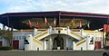 Arènes de Pomarez - panoramio.jpg 3,122 × 1,601; 3.18 MB
-
 Attention aux animaux^ Au col du Tourmalet, versant Est - panoramio.jpg 2,756 × 1,815; 3.65 MB
-
 Attention, animaux en estive - panoramio.jpg 2,702 × 1,428; 2.28 MB
-
 Attention, chevaux en liberté^ Vers le col du Soulor - panoramio.jpg 2,875 × 1,260; 877 KB
-
-
 Au col d'Aspin - panoramio.jpg 5,312 × 2,988; 4.13 MB
-
 Au col d'Aubisque, 1710m - panoramio.jpg 3,264 × 2,448; 3.62 MB
-
 Au col d'Azet, vue sur la petite de ski de Val Louron - panoramio.jpg 5,312 × 2,988; 6.35 MB
-
 Au col d'Erroymendi, à 1350m - panoramio.jpg 3,264 × 2,448; 4.7 MB
-
 Au col d'Ispéguy, sur le versant espagnol - panoramio.jpg 5,312 × 2,988; 9.85 MB
-
 Au col de la Hourcère - panoramio.jpg 2,448 × 1,446; 2.42 MB
-
 Au col de La Pierre Saint-Martin - panoramio.jpg 3,264 × 2,448; 1.06 MB
-
 Au col de la Pierre Saint-Martin, 1765m - panoramio.jpg 2,938 × 1,510; 903 KB
-
 Au col de la Pierre-St-Martin. Derrière moi, l'Espagne. - panoramio.jpg 2,448 × 3,264; 1.88 MB
-
 Au col de Labays, départ d'une descente sinueuse et fraîche - panoramio.jpg 2,926 × 1,709; 3.91 MB
-
 Au col de Lie (600m, Lourdios-Ichère) - panoramio.jpg 3,264 × 2,448; 4.3 MB
-
 Au col de Marie-Blanque - panoramio.jpg 3,264 × 2,448; 3.71 MB
-
 Au col de Marie-Blanque, vue ouest. - panoramio.jpg 3,264 × 2,448; 2.18 MB
-
 Au col de Saint-Ignace, avec une lumière tombant petit à petit - panoramio.jpg 2,602 × 1,209; 549 KB
-
 Au col de Soudet - panoramio.jpg 2,448 × 3,264; 2.55 MB
-
 Au col de Soudet. - panoramio.jpg 3,111 × 1,607; 2.91 MB
-
 Au col de Suscousse - panoramio.jpg 3,023 × 1,654; 4.62 MB
-
 Au col des Tentes, paysage grandiose - panoramio.jpg 3,264 × 2,448; 3.8 MB
-
 Au col des Tentes, point culminant routier des Pyrénées, 2210m, en novembre - panoramio.jpg 3,221 × 2,195; 1.98 MB
-
 Au col du Somport , sur le chemin de St-Jacques - panoramio.jpg 3,264 × 2,448; 3.31 MB
-
 Au col du Somport, 1640m - panoramio.jpg 3,264 × 2,448; 3.35 MB
-
 Au col du Tourmalet - panoramio.jpg 2,698 × 1,853; 2.95 MB
-
 Au col et au tunnel d'Aritxulegi (440m) - panoramio.jpg 2,048 × 1,107; 604 KB
-
 Au col, à la frontière française, port de Larrau. - panoramio.jpg 3,264 × 2,448; 2.75 MB
-
 Au confluent de l'Adour et des Gaves réunis - panoramio.jpg 3,264 × 2,448; 1.85 MB
-
 Au confluent de l'Adour et des Gaves Réunis, avec la Rhune en arrière plan. - panoramio.jpg 3,130 × 1,566; 1.48 MB
-
 Au début de l'escalade du port de Larrau, 1,5km avant le village - panoramio.jpg 2,742 × 1,698; 1.2 MB
-
 Au lac d'Agès, vers Hagetmau - panoramio.jpg 2,940 × 1,701; 1.16 MB
-
 Au pied du col d'Azet, à la sortie de Bazus-Aure - panoramio.jpg 5,312 × 2,988; 6.65 MB
-
 Au pied du col d'Ispéguy - panoramio.jpg 2,600 × 1,923; 3.47 MB
-
 Au pied du col de Marie-Blanque - panoramio (1).jpg 3,033 × 1,874; 804 KB
-
 Au pied du col de Marie-Blanque - panoramio.jpg 3,264 × 2,448; 2.51 MB
-
 Au pied du col de Marie-Blanque, vue sur Bilhères - panoramio.jpg 2,729 × 1,687; 2.75 MB
-
 Au pied du col du Soudet - panoramio.jpg 2,048 × 1,346; 725 KB
-
 Au port d'Ibañeta - panoramio.jpg 3,264 × 2,448; 1.76 MB
-

-
 Au port d'Otxondo - panoramio.jpg 5,312 × 2,988; 9.12 MB
-
 Au port de Boucharo, frontière franco-espagnole - panoramio.jpg 3,264 × 2,448; 3.27 MB
-
 Au port de Larrau, 1570m - panoramio.jpg 3,264 × 2,448; 3.13 MB
-
 Au port de Larrau, 1575m, avec vue sur la France. - panoramio.jpg 3,264 × 2,448; 1.85 MB
-
 Au port de Larrau, 1578m. - panoramio.jpg 3,264 × 2,448; 3.93 MB
-
 Au port de Larrau, vue Est. - panoramio.jpg 3,264 × 2,448; 2.72 MB
-

-
 Au-dessus de l'Adour - panoramio.jpg 3,264 × 2,448; 3.71 MB
-
 Au-dessus des nuages - panoramio.jpg 3,050 × 1,640; 2.77 MB
-
 Avant Capbis - panoramio.jpg 2,994 × 1,728; 1.37 MB
-
 Avant d'atteindre Savigny sous Malain, en haut du Garmois - panoramio.jpg 2,667 × 1,179; 866 KB
-
 Avant le tunnel du Somport - panoramio.jpg 2,876 × 1,739; 3.15 MB
-
 Azeglio - panoramio.jpg 1,536 × 2,048; 564 KB
-
 Azur, un bien nommé village - panoramio.jpg 2,048 × 1,536; 660 KB
-
 Aïe... col des tentes, à 2200m, fermé^ Je tente quand même la montée... - panoramio.jpg 3,264 × 2,448; 3.36 MB
-
 Aïe... détour de 6km obligatoire ^ -( - panoramio.jpg 3,028 × 1,329; 1.14 MB
-
 Bande cyclable à Morgex - panoramio.jpg 2,048 × 1,536; 1.07 MB
-
 Bastide de Villeneuve-sur-Lot - panoramio.jpg 2,871 × 1,742; 3.42 MB
-
 Bayonne - panoramio (6).jpg 3,264 × 2,448; 1.62 MB
-
 Bayonne - panoramio (7).jpg 5,312 × 2,988; 4.7 MB
-
 Bayonne, un lendemain de la foire au jambon - panoramio.jpg 5,312 × 2,988; 7.07 MB
-
 Beau ravin, entre Gèvre et Gavarnie - panoramio.jpg 1,704 × 2,448; 2.2 MB
-
 Berzé le Château (71) - panoramio.jpg 2,048 × 1,536; 665 KB
-
 Biarritz - panoramio (5).jpg 3,048 × 1,640; 2.66 MB
-
 Biarritz - panoramio (6).jpg 3,264 × 1,483; 2.76 MB
-
 Biarritz - panoramio (7).jpg 2,972 × 1,682; 3.17 MB
-
 Biarritz - panoramio (8).jpg 2,448 × 3,264; 1.49 MB
-
 Bielle et la vallée d'Ossau. Au fond, le pic de Ger à 2600m, vers Gourette. - panoramio.jpg 3,264 × 2,448; 1.62 MB
-
 Borne frontière entre France et Espagne, au col d'Errozate (à 1060m) - panoramio.jpg 3,264 × 2,448; 4.57 MB
-
 Borne kilométrique dans le col du Petit Saint-Bernard - panoramio.jpg 2,048 × 1,536; 999 KB
-
 Brebis au col du Soulor - panoramio.jpg 2,023 × 1,425; 683 KB
-
 Brive-la-Gaillarde, musée Labenche - panoramio.jpg 3,264 × 2,448; 3.27 MB
-
 Brive-la-Gaillarde, place Dauzier - panoramio.jpg 2,661 × 1,879; 2.87 MB
-
 Brive-la-Gaillarde, place Latreille - panoramio.jpg 2,662 × 1,878; 3.37 MB
-
 Bétharram - panoramio.jpg 2,048 × 1,299; 539 KB
-
 Cambrai - panoramio (1).jpg 2,493 × 1,051; 409 KB
-
 Cambrai - panoramio (2).jpg 1,536 × 2,048; 663 KB
-
 Cambrai - panoramio (3).jpg 1,841 × 1,350; 482 KB
-
 Cambrai, porte de Paris - panoramio.jpg 2,048 × 1,536; 675 KB
-
 Campagne vers Pleyben - panoramio.jpg 2,811 × 1,284; 508 KB
-
 Candanchu - panoramio.jpg 2,715 × 1,501; 2.38 MB
-
 Cascade dans le col d'Ispéguy - panoramio.jpg 2,988 × 5,312; 5.79 MB
-
 Cascade du ruisseau Valentin, vers Gourette - panoramio.jpg 2,448 × 3,264; 1.31 MB
-
 Cascade rafraichissante, vers Gavarnie - panoramio.jpg 2,448 × 3,264; 2.29 MB
-
 Cascade, en redescendant vers Gavarnie - panoramio (1).jpg 2,448 × 3,264; 2.74 MB
-
 Cascade, en redescendant vers Gavarnie - panoramio.jpg 2,448 × 3,264; 3.74 MB
-
 Cascade, vers Ferrières - panoramio.jpg 1,588 × 2,496; 3.44 MB
-
 Cassel - panoramio (1).jpg 2,048 × 1,536; 669 KB
-
 Cassel - panoramio.jpg 2,048 × 1,536; 538 KB
-
 Castelnau-la-Chapelle (vallée de la Dordogne) - panoramio.jpg 3,082 × 1,622; 3.04 MB
-
 Castelnau-la-Chapelle - panoramio.jpg 2,448 × 1,431; 2.37 MB
-
 Champs vers Bollengo , le début de la plaine du Pô - panoramio.jpg 2,048 × 1,536; 742 KB
-
 Chapelle en aval du plateau de Bénou, au-dessus Bilhères-en-Ossau - panoramio.jpg 2,872 × 1,962; 1.14 MB
-
 Chapelle St-Germain, Laroque-Timbault (47) - panoramio.jpg 2,485 × 1,498; 780 KB
-
 Château de Bonaguil - panoramio (1).jpg 2,719 × 1,839; 3.93 MB
-
 Château de Bonaguil - panoramio.jpg 2,899 × 1,725; 2.78 MB
-
 Château de Commarin - panoramio.jpg 2,575 × 1,222; 587 KB
-
 Château de Foix - panoramio.jpg 2,048 × 1,183; 310 KB
-
 Château de Mont-de-Marsan - panoramio.jpg 3,264 × 2,448; 3.11 MB
-
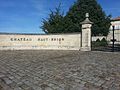 Château du Haut Brion - panoramio.jpg 3,264 × 2,448; 3.2 MB
-
 Château du Lude (Sarthe) - panoramio.jpg 2,804 × 1,783; 1.13 MB
-
 Château Henri IV, Pau - panoramio (1).jpg 2,048 × 1,476; 507 KB
-
 Château Henri IV, Pau - panoramio.jpg 2,048 × 1,536; 538 KB
-
 Château vers Léognan - panoramio.jpg 3,264 × 2,448; 2.41 MB
-
 Châtillon - panoramio.jpg 2,048 × 1,536; 712 KB
-
 Châtillon... en Bretagne^ - panoramio.jpg 2,048 × 1,536; 745 KB
-
 Ciel menaçant à 2km du col du Pourtalet - panoramio.jpg 3,264 × 2,448; 3.19 MB
-
 Cirque de Lescun - panoramio.jpg 3,264 × 2,448; 1.61 MB
-
 Clairière de l'Armistice - panoramio.jpg 2,048 × 1,536; 686 KB
-
 Clairière, dans la forêt de Sivens - panoramio.jpg 2,171 × 1,456; 717 KB
-
 Clocher bourguignon de Savigny sous Malain - panoramio.jpg 2,758 × 1,140; 913 KB
-
 Clocher d'Azet - panoramio.jpg 5,312 × 2,988; 6.61 MB
-
 Collines du Tarn, vers Gaillac (81) - panoramio.jpg 2,085 × 1,477; 702 KB
-
 Collonges-la-Rouge dans son cadre verdoyant - panoramio.jpg 2,448 × 1,464; 2.09 MB
-
 Collonges-la-Rouge, rue de la Barrière - panoramio (1).jpg 3,264 × 2,448; 3.2 MB
-
 Collonges-la-Rouge, rue de la Barrière - panoramio.jpg 2,717 × 1,682; 2.76 MB
-
 Collonges-la-Rouge, sous la pluie - panoramio.jpg 2,426 × 1,626; 1.87 MB
-
 Cordes sur Ciel, Tarn - panoramio.jpg 1,447 × 2,048; 355 KB
-
 Coucher de soleil dans le col Bagargui - panoramio.jpg 3,264 × 2,124; 763 KB
-
 Couleurs automnales à Gavarnie - panoramio.jpg 2,577 × 1,940; 3.4 MB
-
 Couleurs automnales, dans les Landes - panoramio.jpg 2,991 × 1,646; 3.44 MB
-
 Couleurs d'automne, en amont de Gavarnie - panoramio.jpg 2,448 × 3,264; 2.99 MB
-
 Couleurs de Brive-la-Gaillarde - panoramio.jpg 3,264 × 2,448; 2.69 MB
-
 Couleurs de Chalosse, vers Castel-Sarrazin. - panoramio.jpg 5,312 × 2,988; 5.87 MB
-
 Couleurs froides de Canfranc, en Espagne - panoramio.jpg 3,264 × 2,448; 2.6 MB
-
 Couleurs pittoresque de la campagne landaise, vers Orist - panoramio.jpg 2,619 × 1,452; 1.87 MB
-
 Couleurs saturées vers Mauléon, aux confins du Béarn et du Pays Basque - panoramio.jpg 3,251 × 1,139; 721 KB
-
 Couleurs vives vers Saint-Caprais (82) - panoramio.jpg 2,574 × 1,038; 540 KB
-
 Cremona - panoramio (1).jpg 2,048 × 1,536; 503 KB
-
 Cremona - panoramio (2).jpg 1,536 × 2,048; 585 KB
-
 Cremona - panoramio.jpg 2,048 × 1,536; 491 KB
-
 Crémieu (Isère) - panoramio.jpg 2,048 × 1,536; 763 KB
.jpg)
.jpg)
.jpg)
.jpg)
.jpg)
.jpg)
.jpg)
.jpg)
.jpg)
.jpg)
.jpg)


_-_panoramio.jpg)
,_en_Navarre._Un_village_typiquement_basque_pos%C3%A9e_au_beau_milieu_d%27une_montagne_verdoyante,_aux_cr%C3%AAtes_%C3%A0_la_v%C3%A9g%C3%A9tation_rase._Avec_ses_moutons._-_panoramio.jpg)

.jpg)
.jpg)
.jpg)
.jpg)
.jpg)


_-_panoramio.jpg)


,_avec_son_ch%C3%A2teau_et_hippodrome_-_panoramio.jpg)

_-_panoramio.jpg)


_-_panoramio.jpg)


_-_panoramio.jpg)


.jpg)


.jpg)
.jpg)


_-_panoramio.jpg)
.jpg)
.jpg)
.jpg)
.jpg)

_-_panoramio.jpg)


.jpg)
.jpg)
.jpg)


.jpg)


.jpg)

_-_panoramio.jpg)


_-_panoramio.jpg)
.jpg)


_-_panoramio.jpg)
.jpg)


_-_panoramio.jpg)

.jpg)


.jpg)
.jpg)

_-_panoramio.jpg)
_-_panoramio.jpg)