Category:Palmgracht 55, Amsterdam
Jump to navigation
Jump to search
| Object location | | View all coordinates using: OpenStreetMap |
|---|
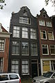
house in Amsterdam, Netherlands  | |||||
| Upload media | |||||
| Instance of | |||||
|---|---|---|---|---|---|
| Location | Amsterdam, North Holland, Netherlands | ||||
| Street address |
| ||||
| Located on street | |||||
| Heritage designation |
| ||||
 | |||||
|
This is a category about rijksmonument number 4064
|
| Address |
|
Media in category "Palmgracht 55, Amsterdam"
The following 5 files are in this category, out of 5 total.
-
 Amsterdam - Palmgracht 53.JPG 3,056 × 4,592; 4.37 MB
-
 Amsterdam - Palmgracht 55.JPG 3,056 × 4,592; 5.09 MB
-
 Amsterdam Palmgracht 55 - 4064.jpg 2,448 × 3,264; 1.95 MB
-
 Gebroeders Douwes, Afb B00000031433.jpg 6,864 × 4,974; 3.71 MB
-
 Voorgevels - Amsterdam - 20019855 - RCE.jpg 1,200 × 1,190; 336 KB


