Category:Old maps of Veneto
Jump to navigation
Jump to search
- Regions of Italy: Abruzzo · Aosta Valley · Apulia · Basilicata · Calabria · Campania · Emilia-Romagna · Friuli-Venezia Giulia · Lazio · Liguria · Lombardy · Marche · Molise · Piedmont · Sardinia · Sicily · Trentino-South Tyrol · Tuscany · Umbria · Veneto
Use the appropriate category for maps showing all or a large part of Veneto. See subcategories for smaller areas:
| If the map shows | Category to use |
|---|---|
| Veneto on a recently created map | Category:Maps of Veneto or its subcategories |
| Veneto on a map created more than 70 years ago | Category:Old maps of Veneto or its subcategories |
| the history of Veneto on a recently created map | Category:Maps of the history of Veneto or its subcategories |
| the history of Veneto on a map created more than 70 years ago | Category:Old maps of the history of Veneto or its subcategories |
Subcategories
This category has the following 14 subcategories, out of 14 total.
Media in category "Old maps of Veneto"
The following 66 files are in this category, out of 66 total.
-
 'Vignesie Julie' pal 'Congresso Geografico Italiano' (1921-1943).jpg 2,494 × 3,070; 3.66 MB
-
 Atlas Ortelius KB PPN369376781-064av-064br.jpg 3,000 × 2,194; 4.67 MB
-
 Wiki Venezia mappa Brenta XV sec.gif 1,275 × 1,280; 198 KB
-
 Oostr1477.png 800 × 600; 1.38 MB
-

-
 1561 mappa Zerpa cipriotto.jpg 3,432 × 2,443; 3.76 MB
-
 Lagune-de-venise-1603.jpg 647 × 781; 157 KB
-
 Wiki 1610 Taglio Nuovissimo Brenta.jpg 691 × 494; 226 KB
-

-

-
 "Dominio Veneto nell Italia". (22254597585).jpg 4,044 × 3,168; 2.7 MB
-

-

-

-
 1799 Cary Map of Mantua, Venice and Tyrol, Italy - Geographicus - Venice-cary-1799.jpg 5,000 × 4,513; 8.31 MB
-
 1801 Cary Map of Austria - Geographicus - Austria-cary-1801.jpg 5,000 × 4,488; 7.86 MB
-

-

-
 1945 Venzia Giulia Italy (30249113773).jpg 4,198 × 6,433; 3.25 MB
-
 407 of 'L'Italia geografica illustrata, etc' (11213141696).jpg 2,204 × 3,260; 1.81 MB
-

-

-
 Antichi confini parrocchia S Marco Vicenza.png 1,516 × 2,960; 6.78 MB
-

-
 Atti del Reale Istituto veneto di scienze, lettere ed arti (1885-1886) (19727861343).jpg 2,348 × 3,184; 1.43 MB
-
 AustroPrussianWar SouthernBattlefield.png 1,508 × 1,131; 643 KB
-

-
 Castagnaro.jpg 2,976 × 3,968; 1.85 MB
-
 Chiesa di San Silvestro catasto napoleonico.png 718 × 569; 688 KB
-
 Como - Collegio Gallio 1045.JPG 4,000 × 6,000; 10.43 MB
-
 D041 - N° 322. Venise et le littoral. - liv3-ch07.png 1,455 × 1,992; 300 KB
-
 Der Oesterreichische Kreis 1806.jpg 2,503 × 1,862; 1.38 MB
-

-

-
 Italia - di Matteo Greuter... - btv1b525056959 (03 of 24).jpg 10,152 × 7,628; 9.93 MB
-
 Italia - di Matteo Greuter... - btv1b525056959 (09 of 24).jpg 10,294 × 7,734; 10.77 MB
-

-
 Italienska fronten 1916-17, Nordisk familjebok.png 1,197 × 698; 105 KB
-
 John Cary 1799 map of the territory of Bergamo.jpg 740 × 1,353; 420 KB
-
 La vita del popolo su s.paolo di lanzago 3.jpg 1,800 × 1,598; 89 KB
-

-
 Map - Special Collections University of Amsterdam - OTM- HB-KZL 33.03.38.tiff 7,108 × 6,262; 127.35 MB
-
 Map of the port of Chioggia in Veneto, Italy - Roux Joseph - 1804.jpg 1,500 × 1,067; 715 KB
-
 Mappa antica di Costabissara, proprietà dei signori Bissari.jpg 2,780 × 2,403; 1.36 MB
-
 Mappa Pontemanco XIV secolo.jpg 1,024 × 683; 391 KB
-
 Mappa storica catasto napoleonico 1811 Saletto.png 1,099 × 1,040; 1.71 MB
-
 Mappa Vajont IGM 1934.jpg 1,600 × 845; 579 KB
-
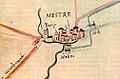 Mestre antica.jpg 503 × 331; 55 KB
-
 Dominii Veneti cum vicinis Parmae Mutinae Mantuae et Mirandol .. (NYPL b13967336-5206893).tiff 10,326 × 7,758, 2 pages; 229.46 MB
-
 Palude1603.jpg 716 × 658; 141 KB
-
 Paludes1570.jpg 1,082 × 754; 184 KB
-
 Pianta di Botestagno.jpg 230 × 253; 31 KB
-

-

-
 Plain-towns of Italy - the cities of old Venetia (1911) (14581914310).jpg 1,674 × 2,804; 713 KB
-
 Regio X Venetia et Istria.jpg 720 × 609; 127 KB
-
 RomanVenetia.png 2,534 × 1,593; 647 KB
-
 Roncade1536.jpg 891 × 748; 289 KB
-
 Sanson - Partie du cercle d'Autriche (1681).jpg 10,417 × 6,754; 79.74 MB
-
 Stielers Handatlas 1891 17.jpg 5,100 × 4,250; 7.39 MB
-
 Stielers Handatlas 1891 20.jpg 5,050 × 4,200; 7.28 MB
-
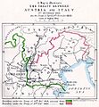 The map of Europe by treaty - Austria Italy 1866.jpg 1,000 × 1,079; 260 KB
-
 1625MappaValpolicella.jpg 1,074 × 1,517; 974 KB
-
 Verona - 29-45.jpg 3,595 × 4,991; 3.86 MB
-
 Map Noventa Padovana, Piovego.jpg 699 × 969; 427 KB
-
 États Italie Trente Brixen 1702.jpg 8,576 × 5,712; 27 MB
.jpg)


.jpg)
.jpg)
.jpg)

_Les_Forces_de_l%27Europe,_Asie,_Afrique_et_Amerique_Comme_aussi_les_Cartes_des_C%C3%B4tes_de_,_RP-P-OB-83.036-135.jpg)
_-_Geographicus_-_Germaniae-covensmortier-1720.jpg)


,_Italy_-_Geographicus_-_VenetianStates-t-1814.jpg)
.jpg)
.jpg)
.jpg)
.jpg)


_(19727861343).jpg)

.png)


.jpg)
.jpg)


.jpg)


_(14581914310).jpg)


.jpg)


.jpg)