Category:Old maps of Alagoas
Jump to navigation
Jump to search
Media in category "Old maps of Alagoas"
The following 12 files are in this category, out of 12 total.
-
-

-
 Admiralty Chart No 3286 Rio de S. Francisco do Norte to R. Tariri, Published 1902.jpg 11,087 × 16,246; 51.39 MB
-
 Admiralty Chart No 891 Pernambuco to Maceio, Published 1864, New Edition 1910.jpg 12,498 × 16,215; 25.28 MB
-
 Admiralty Chart No 892 Maceio to Rio de S. Francisco do Norte, Published 1864, New Edition 1930.jpg 16,270 × 11,075; 18.65 MB
-
 Alagoas e Pernambuco 1871.jpg 5,708 × 5,241; 9.99 MB
-
 Capitaniæ de Cirii, et Parnambuco. R 2= 22. Pièce 77.jpg 8,968 × 7,176; 10.49 MB
-
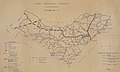
 Estrada de Ferro das Alagoas 1882-1.jpg 7,353 × 4,017; 17.13 MB
-
 Estrada de Ferro das Alagoas 1882-2.jpg 7,344 × 4,039; 16.18 MB
-
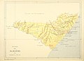
 Mapa de Alagoas, c.1903.jpg 3,496 × 2,143; 914 KB
-
 Rio São Francisco entre Sergipe e Alagoas 1873.jpg 4,379 × 6,701; 12.84 MB
-
 Rodovias de Alagoas 1961.jpg 11,418 × 6,807; 11 MB
.jpg)


