Category:Oil wells in California
Jump to navigation
Jump to search
States of the United States: California · Colorado · Indiana · Louisiana · Michigan · Mississippi · Nevada · New Mexico · North Dakota · Ohio · Oklahoma · Pennsylvania · Texas · Utah · Wyoming
Media in category "Oil wells in California"
The following 41 files are in this category, out of 41 total.
-
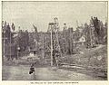 McLaurin(1902) pic.185 Oil-Wells at Los Angeles, CA.jpg 1,037 × 814; 390 KB
-
 August 2012 - panoramio (121).jpg 4,000 × 3,000; 4.7 MB
-
 August 2012 - panoramio (123).jpg 4,000 × 3,000; 4.56 MB
-
 August 2012 - panoramio (125).jpg 4,000 × 3,000; 4.58 MB
-
 LaBrea-tarpits-1910.jpg 720 × 500; 120 KB
-
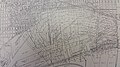
 BeverlyHillsOilFieIdStructureMap.png 760 × 560; 247 KB
-
 Burning Gas - Oil Field - panoramio.jpg 3,456 × 5,184; 502 KB
-
 California - Oil Pumps 4889462844.jpg 2,811 × 1,614; 3.78 MB
-
 California Limited Oil field LCCN2007661669.tif 4,291 × 714; 8.77 MB
-
 CoaingaGusher.jpg 421 × 800; 46 KB
-
 DabneyOil.jpg 320 × 202; 6 KB
-
 DEEP STEAM GENERATOR, BAKERFIELD, CA - DPLA - 9e98fd0b66037a738524030231ec0d28.jpg 3,009 × 2,410; 5.57 MB
-
 Huntington A-1 oil well Huntington Beach California 1920.png 1,160 × 870; 1.38 MB
-
 Huntington Beach, 1956.jpg 3,119 × 3,115; 8.41 MB
-
 KernFrontWells1.jpg 1,441 × 1,008; 397 KB
-
 Know Your City No.82 Abandoned oil well in Elysian Park.jpg 4,290 × 5,469; 15.26 MB
-
 Ladera Heights, CA, USA - panoramio.jpg 2,048 × 649; 798 KB
-
 LakeviewGusher.jpg 405 × 700; 170 KB
-
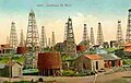
 NIE 1905 Petroleum - oil wells at Los Angeles.jpg 1,484 × 1,186; 291 KB
-
 OccidentalOilWellsElkHills.JPG 1,600 × 1,200; 427 KB
-
 Oil and gas yielding formations of California (1900) (14579586788).jpg 1,530 × 910; 224 KB
-
 Oil and gas yielding formations of California (1900) (14763061531).jpg 3,961 × 1,690; 1.09 MB
-
 Oil Fire, 1928.jpg 6,408 × 4,824; 14.63 MB
-
 Oil wells just offshore at Summerland, California, c.1915.jpg 1,512 × 872; 278 KB
-
 Oil Wells, Along Ocean, Southern Calif (65138).jpg 3,354 × 2,172; 2.87 MB
-
 Pico Canyon Oil Field Well No. 4, Chevron.jpg 2,256 × 1,496; 924 KB
-
 Picocanyon.jpg 700 × 540; 128 KB
-
Pumpjack at the Kern River Oil Field.webm 31 s, 1,080 × 1,080; 12.18 MB
-
 Pumpjacks, San Joaquin Valley, California.jpg 4,416 × 2,183; 2.65 MB
-
 Signal Hill California 1923.jpg 4,685 × 640; 1.64 MB
-
 Signal Hill California 1923.tif 4,685 × 640; 8.61 MB
-
 Signal Hill California Panorama.jpg 4,792 × 696; 1.05 MB
-
 Signal Hill pumpjack, 2011.jpg 4,000 × 3,000; 4.67 MB
-
 Signal Hill.jpg 400 × 452; 40 KB
-
 Taft oil well blow-out in Kern County, ca. 1920 (CHS-2498).jpg 3,240 × 5,062; 1.97 MB
-
 Taft, Calif. and "25" Hill, Kern Co., Oct. 7th, 1911 LCCN2007660592.tif 3,526 × 735; 7.42 MB
-
 Union Oil wells, Orange County, 1928.jpg 5,655 × 3,670; 12.58 MB
-
 Well No. 4, Pico Canyon Oil Field.jpg 3,264 × 2,448; 1.77 MB
-
 Well2-6-Kern+1909.jpg 362 × 629; 25 KB
-
 WilmingtonOilFieldStructureMap.jpg 5,312 × 2,988; 4.94 MB
-
 Y0011 (10221357624).jpg 1,536 × 1,024; 375 KB
_pic.185_Oil-Wells_at_Los_Angeles,_CA.jpg)
.jpg)
.jpg)
.jpg)


_(14579586788).jpg)
_(14763061531).jpg)


.jpg)


.jpg)


.jpg)