Category:Norderneyer Seegatt
Jump to navigation
Jump to search
| Object location | | View all coordinates using: OpenStreetMap |
|---|
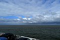
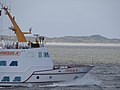
English: The Norderneyer Seegatt is a nautical channel between the East Frisian islands Juist and Norderney.
Strait in the southern North Sea | |||||
| Upload media | |||||
| Instance of |
| ||||
|---|---|---|---|---|---|
| Location | Wadden Sea, East Frisia, Lower Saxony, Germany | ||||
 | |||||
Media in category "Norderneyer Seegatt"
The following 18 files are in this category, out of 18 total.
-
 Am Weststrand 10, 26548 Norderney, Germany - panoramio (1).jpg 4,803 × 3,202; 1.26 MB
-
 Am Weststrand 10, 26548 Norderney, Germany - panoramio (10).jpg 5,056 × 2,844; 1.99 MB
-
 Am Weststrand 10, 26548 Norderney, Germany - panoramio (2).jpg 4,930 × 3,287; 1.68 MB
-
 Am Weststrand 10, 26548 Norderney, Germany - panoramio (9).jpg 5,181 × 3,454; 2.23 MB
-
 Norderney Promenade - panoramio.jpg 1,272 × 954; 319 KB
-
 Norderney Tonne D24.jpg 2,000 × 3,008; 2.23 MB
-
 Norderney, Germany - panoramio (10).jpg 5,184 × 3,888; 5.83 MB
-
 Norderney, Germany - panoramio (12).jpg 5,184 × 3,888; 5.71 MB
-
 Norderney, Germany - panoramio (13).jpg 5,184 × 3,888; 5.87 MB
-
 Norderney, Germany - panoramio (14).jpg 5,184 × 3,888; 6.01 MB
-
 Norderney, Germany - panoramio (15).jpg 5,184 × 3,888; 5.91 MB
-
 Norderney, Germany - panoramio (16).jpg 5,184 × 3,888; 5.91 MB
-
 Norderney, Germany - panoramio (17).jpg 5,184 × 3,888; 5.63 MB
-
 Norderney, Germany - panoramio (19).jpg 5,184 × 3,888; 5.69 MB
-
 Norderney, Germany - panoramio (25).jpg 5,184 × 3,888; 5.85 MB
-
 Norderney, Germany - panoramio (36).jpg 4,930 × 3,287; 1.77 MB
-
 Norderney, Germany - panoramio (475).jpg 5,184 × 3,888; 2.51 MB
-
 Norderneyer Seegatt im Gegenlicht, Nationalpark Niedersächsisches Wattenmeer.jpg 5,472 × 3,648; 18.75 MB
.jpg)
.jpg)
.jpg)
.jpg)


.jpg)
.jpg)
.jpg)
.jpg)
.jpg)
.jpg)
.jpg)
.jpg)
.jpg)
.jpg)
.jpg)
