Category:Newsham, Richmondshire
Jump to navigation
Jump to search
village and civil parish in Richmondshire, North Yorkshire, England  | |||||
| Upload media | |||||
| Instance of | |||||
|---|---|---|---|---|---|
| Location | Richmondshire, North Yorkshire, Yorkshire and the Humber, England | ||||
| Population |
| ||||
 | |||||
English: Newsham is a village and civil parish in the Richmondshire district of North Yorkshire, England.A friendly working village with a good community spirit. A large well used village hall , pretty village green, on which the annual carnival takes place in May/June
Media in category "Newsham, Richmondshire"
The following 112 files are in this category, out of 112 total.
-
 A fairly large bull on Silver Hill - geograph.org.uk - 4982633.jpg 4,000 × 3,000; 5.63 MB
-
 A house of local stone in Newsham - geograph.org.uk - 2391251.jpg 3,648 × 2,736; 1.98 MB
-
 A long descent to Newsham - geograph.org.uk - 4607514.jpg 4,320 × 3,240; 2.95 MB
-
 A public house on the A66 at Smallways - geograph.org.uk - 2253837.jpg 800 × 600; 206 KB
-
 A66 at Newsham Grange - geograph.org.uk - 3078925.jpg 640 × 357; 51 KB
-
 A66 at Newsham Grange - geograph.org.uk - 3114518.jpg 640 × 430; 33 KB
-
 A66 intersect at Smallways - geograph.org.uk - 2389907.jpg 1,521 × 1,108; 396 KB
-
 A66 Motel and Smallways Country Inn - geograph.org.uk - 3955726.jpg 640 × 480; 125 KB
-
 A66 Motel, Smallways - geograph.org.uk - 2391186.jpg 1,824 × 1,368; 839 KB
-
 A66 Motel, Smallways - geograph.org.uk - 3114513.jpg 640 × 430; 37 KB
-
 A66 near Greenbrough - geograph.org.uk - 3114522.jpg 640 × 430; 38 KB
-
 A66 westbound toward Smallways - geograph.org.uk - 5742245.jpg 4,219 × 3,184; 5.45 MB
-

-
 Badger Way Stoop (BS) - geograph.org.uk - 1810378.jpg 2,472 × 3,296; 2.06 MB
-
 Badger Way Stoop - geograph.org.uk - 2664611.jpg 640 × 480; 69 KB
-
 Barn at Long Green Farm - geograph.org.uk - 4004511.jpg 640 × 480; 135 KB
-
 Barn at Long Green Farm - geograph.org.uk - 5242706.jpg 640 × 480; 80 KB
-
 Barningham Moor - geograph.org.uk - 6132192.jpg 2,048 × 1,536; 1.1 MB
-
 Barningham Moor - geograph.org.uk - 871923.jpg 640 × 427; 106 KB
-
 Barningham Moor - geograph.org.uk - 871932.jpg 640 × 427; 103 KB
-
 Blooming heather beside dry stone wall on Cocker Hill - geograph.org.uk - 2186555.jpg 2,000 × 1,500; 2.6 MB
-
 Boundary on Barningham Moor - geograph.org.uk - 871921.jpg 640 × 427; 83 KB
-
 Boundary stone on Barningham Moor - geograph.org.uk - 871960.jpg 427 × 640; 94 KB
-
 Bridleway across Barningham Moor - geograph.org.uk - 871914.jpg 640 × 427; 61 KB
-
 Bridleway approaching gate in wall - geograph.org.uk - 2262987.jpg 1,600 × 899; 1.21 MB
-
 Bridleway by Byers Hill - geograph.org.uk - 5242672.jpg 640 × 480; 66 KB
-
 Bridleway Gate east of Long Green - geograph.org.uk - 2124881.jpg 4,320 × 3,240; 5.68 MB
-
 Bridleway on Newsham Moor - geograph.org.uk - 4004535.jpg 640 × 480; 150 KB
-
 Bridleway track to the Stang from Newsham Moor - geograph.org.uk - 2124861.jpg 4,320 × 3,240; 5.39 MB
-
 Buildings in Newsham - geograph.org.uk - 4698432.jpg 1,600 × 1,065; 562 KB
-
 Byers Hill - geograph.org.uk - 2561231.jpg 3,888 × 2,592; 1.34 MB
-
 Byers Hill - geograph.org.uk - 6132178.jpg 2,048 × 1,536; 955 KB
-
 Byers Hill Farm - geograph.org.uk - 2262983.jpg 1,600 × 899; 1.14 MB
-
 Carter Allotment - geograph.org.uk - 6132195.jpg 2,048 × 1,536; 1.1 MB
-
 Carter House - geograph.org.uk - 4004546.jpg 640 × 480; 140 KB
-
 Cathaw Stoop - geograph.org.uk - 1810193.jpg 2,472 × 3,296; 2.01 MB
-
 Cautious descent, Moor Lane - geograph.org.uk - 1691542.jpg 640 × 640; 122 KB
-
 Chapel Gill - geograph.org.uk - 4005281.jpg 640 × 480; 181 KB
-
 Corner of Barningham Moor - geograph.org.uk - 1810294.jpg 2,459 × 1,584; 1.12 MB
-
 Cottage , Newsham Village. - geograph.org.uk - 145483.jpg 640 × 479; 111 KB
-
 Cottage seen along narrow lane - geograph.org.uk - 6095116.jpg 1,600 × 1,124; 1.02 MB
-
 Crop beyond uncultivated strip - geograph.org.uk - 6551549.jpg 2,000 × 1,233; 2.23 MB
-

-
 Dry stone wall, Newsham - geograph.org.uk - 2391222.jpg 1,824 × 1,368; 973 KB
-
 Dyson Lane - geograph.org.uk - 241144.jpg 640 × 479; 102 KB
-
 Eastern entrance to Newsham - geograph.org.uk - 2391234.jpg 3,648 × 2,736; 1.48 MB
-
 Enclosure east of Cathaw Stoop - geograph.org.uk - 3152729.jpg 1,500 × 1,037; 1.33 MB
-
 Farm Track beside Whinny Gill - geograph.org.uk - 4005284.jpg 640 × 480; 141 KB
-
 Farmland east of Low Lane - geograph.org.uk - 5286683.jpg 1,024 × 768; 143 KB
-
 Fence and hawthorns - geograph.org.uk - 1691763.jpg 512 × 640; 112 KB
-
 Fields near Newsham Grange - geograph.org.uk - 1868412.jpg 640 × 480; 55 KB
-
 Gate and field of oilseed rape - geograph.org.uk - 5773366.jpg 1,024 × 768; 245 KB
-
 Gate and field off Moor Lane - geograph.org.uk - 4004715.jpg 640 × 480; 136 KB
-
 Gate at How Tallon - geograph.org.uk - 6132186.jpg 2,048 × 1,536; 862 KB
-
 Gates at entry to Barningham Park - geograph.org.uk - 3493895.jpg 1,500 × 996; 1.61 MB
-
 Glacial Meltwater Channel - geograph.org.uk - 1810390.jpg 2,097 × 1,123; 550 KB
-
 Grain crop in field north of A66 - geograph.org.uk - 6550938.jpg 2,000 × 1,335; 2.39 MB
-
 Grass field alongside Low Lane - geograph.org.uk - 5773369.jpg 1,024 × 768; 244 KB
-
 Grass field off Low Lane - geograph.org.uk - 5762389.jpg 1,024 × 768; 270 KB
-
 Grouse butt near bridleway - geograph.org.uk - 2262363.jpg 1,600 × 899; 1.16 MB
-
 High Lane, Newsham - geograph.org.uk - 3955659.jpg 640 × 480; 168 KB
-
 High Moor - geograph.org.uk - 2664477.jpg 640 × 480; 66 KB
-
 Hill road passing Carter House - geograph.org.uk - 5917407.jpg 2,000 × 1,152; 1.82 MB
-
 Hill walker beside wall heading for How Tallon - geograph.org.uk - 6527101.jpg 2,000 × 1,164; 1.65 MB
-
 Inn on A66, Smallways - geograph.org.uk - 5143067.jpg 2,592 × 1,936; 1.61 MB
-
 Intake boundaries on Newsham Moor - geograph.org.uk - 1691495.jpg 640 × 440; 109 KB
-
 Lands Lodge - geograph.org.uk - 4993968.jpg 4,000 × 3,000; 3.5 MB
-
 Limestone Pasture - geograph.org.uk - 1810486.jpg 3,296 × 2,472; 1.97 MB
-
 Long Green - geograph.org.uk - 871907.jpg 640 × 427; 70 KB
-
 Long Green Farm - geograph.org.uk - 2262843.jpg 1,600 × 933; 1.25 MB
-
 Long Green Farm - geograph.org.uk - 2561621.jpg 3,537 × 1,981; 804 KB
-
 Long Green Gate - geograph.org.uk - 4003448.jpg 640 × 480; 131 KB
-
 Meltwater channel near Byers Hill Farm - geograph.org.uk - 4607506.jpg 3,240 × 4,320; 5.38 MB
-
 Minor road near Carter House - geograph.org.uk - 3494069.jpg 1,500 × 1,007; 1.51 MB
-
 Moor Lane - geograph.org.uk - 6132155.jpg 2,048 × 1,536; 1.17 MB
-
 Moor Lane - geograph.org.uk - 6132180.jpg 2,048 × 1,536; 926 KB
-
 Moor Lane on Newsham Moor - geograph.org.uk - 4004526.jpg 640 × 480; 137 KB
-
 Newsham , A66 - geograph.org.uk - 6691288.jpg 6,000 × 4,000; 7.38 MB
-
 Newsham , A66 - geograph.org.uk - 6691289.jpg 6,000 × 4,000; 7.25 MB
-
 Newsham , A66 - geograph.org.uk - 6691293.jpg 6,000 × 4,000; 7.31 MB
-
 Newsham , Lanehead Lane - geograph.org.uk - 6691306.jpg 6,000 × 4,000; 7.73 MB
-
 Newsham Moor - geograph.org.uk - 6132183.jpg 2,048 × 1,536; 789 KB
-
 Newsham village green - geograph.org.uk - 3955664.jpg 640 × 480; 137 KB
-
 Newsham village green - geograph.org.uk - 3955668.jpg 640 × 480; 163 KB
-
 Newsham, Richmondshire (2008).jpg 3,072 × 2,304; 1.23 MB
-
 Old petrol pumps , Newsham - geograph.org.uk - 2391302.jpg 1,824 × 1,368; 986 KB
-
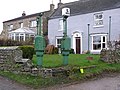 Old Petrol Pumps , Newsham. - geograph.org.uk - 145648.jpg 640 × 479; 119 KB
-
 Ordnance Survey Bench Mark S4320 - geograph.org.uk - 1810446.jpg 2,472 × 3,296; 1.76 MB
-
 Pond and shelter belt at Long Green Farm - geograph.org.uk - 4003446.jpg 640 × 480; 176 KB
-
 Rotting stile onto Barningham Moor - geograph.org.uk - 1691357.jpg 640 × 512; 119 KB
-
 Ruined Wall on How Tallon Ridge - geograph.org.uk - 1810466.jpg 2,363 × 2,328; 1.69 MB
-

-
 Shooting hut beside Carter House - geograph.org.uk - 2496214.jpg 1,500 × 967; 1.54 MB
-
 Smallways Country Inn - geograph.org.uk - 2391202.jpg 1,824 × 1,368; 966 KB
-
 Smallways Garage - geograph.org.uk - 3114510.jpg 640 × 430; 38 KB
-
 Smallways Lake - geograph.org.uk - 3955695.jpg 640 × 480; 99 KB
-
 Smallways Lake - geograph.org.uk - 3955700.jpg 640 × 480; 137 KB
-
 Smallways Lake - geograph.org.uk - 67631.jpg 640 × 480; 57 KB
-
 Smira Wood - geograph.org.uk - 556501.jpg 640 × 480; 80 KB
-
 Stephen Bank - geograph.org.uk - 3955704.jpg 640 × 480; 135 KB
-
 Tall grass in field adjacent to farm access road - geograph.org.uk - 6551533.jpg 2,000 × 1,335; 2.21 MB
-

-
 Tractor, mowing, near to Byers Hill - geograph.org.uk - 6528172.jpg 2,000 × 1,335; 1.92 MB
-
 Trees along a drain, off Low Lane - geograph.org.uk - 5286686.jpg 1,024 × 768; 162 KB
-
 Trig point at How Tallon - geograph.org.uk - 2186548.jpg 2,000 × 1,500; 2.26 MB
-
 Two trees on a knoll - geograph.org.uk - 5652145.jpg 1,499 × 943; 1.21 MB
-
 Uncultivated field margin, off Low Lane - geograph.org.uk - 5286680.jpg 1,024 × 768; 158 KB
-
 War memorial at Newsham - geograph.org.uk - 4698427.jpg 1,065 × 1,600; 507 KB
-
 West end of Newsham - geograph.org.uk - 2391373.jpg 1,779 × 1,171; 750 KB
-
 Winter tree alongside Low Lane - geograph.org.uk - 5286675.jpg 1,024 × 768; 144 KB
-

-
 Isolated Tree, Cabin Hill - geograph.org.uk - 145617.jpg 640 × 480; 34 KB


_-_geograph.org.uk_-_1810378.jpg)


.jpg)


