Category:Nebraska Highway 5
Jump to navigation
Jump to search
 | number: | (five) |
|---|---|---|
| State highways in Nebraska: | 1 · 2 · 4 · 5 · 8 · 9 · 11 · 12 · 13 · 14 · 15 · 19 · 21 · 22 · 23 |
state highway in Thayer County, Nebraska, United States  | |||||
| Upload media | |||||
| Instance of | |||||
|---|---|---|---|---|---|
| Location | Thayer County, Nebraska | ||||
| Located in or next to body of water |
| ||||
| Transport network | |||||
| Owned by | |||||
| Maintained by | |||||
| Inception |
| ||||
| Length |
| ||||
| Terminus | |||||
| |||||
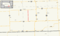
English: Media related to Nebraska Highway 5, a 11.04-mile (17.77 km) state highway in Nebraska, United States, that connects U.S. Route 136 (immediately north of Deshler} with Nebraska Highway 4 (west of Carleton).
Subcategories
This category has only the following subcategory.
Media in category "Nebraska Highway 5"
The following 3 files are in this category, out of 3 total.
-
 N-5 1926.svg 601 × 601; 110 KB
-
 N-5.svg 600 × 600; 124 KB
-
 Nebraska Highway 5.png 3,425 × 2,031; 453 KB
