Category:Mumbles
Jump to navigation
Jump to search
Brezhoneg: Y Mwmbwls (Mumbles e saozneg, diwar ar ger gallek mammelles) zo anv ur c'harter bras eus Abertawe, e Kembre.
Cymraeg: Mae'r Mwmbwls ( Saesneg: (The) Mumbles) yn bentref mawr ger Abertawe, yn sir Abertawe yn ne Cymru. Credir fod yr enw yn tarddu o'r gair Ffrangeg mamelles ("bronnau"), enw a roddwyd ar y llecyn gan y Normaniaid ar ddiwedd yr 11eg ganrif.
Deutsch: Mumbles ist ein großes Dorf auf der Gower-Halbinsel, das an die Swansea Bay grenzt. Es ist Teil der Verwaltung der Stadt und Grafschaft Swansea. Historisch war es ein Teil der Grafschaft Glamorgan.
English: Mumbles or The Mumbles is a headland sited on the western edge of Swansea Bay.
Gaeilge: Baile i Abertawe, an Bhreatain Bheag, is ea Y Mwmbwls, 57.9 km ó Caerdydd agus 268 ó Londain. Tá daonra 16,147 ann, agus tá 1,571 (9.7%) in ann Breatnais a labhairt.
Gàidhlig: Tha am baile Y Mwmbwls ann an Abertawe, a' Chuimrigh. Tha e 35.9 mi (57.9 cilemeatair) bho Caerdydd, agus 166.4 mi (267.7 cilemeatair) bho Lunnainn. A rèir a' chunntais-shluaigh ann an 2011 bha 16147 daoine a' fuireach ann, agus bha Cuimris aig 1571 (9.7%); rugadh 74% den t-sluagh anns a' Chuimrigh fhèin.
Italiano: Mumbles o The Mumbles (in gallese: Y Mwmbwls; 4.000 ab. ca.) è una popolare località balneare del Galles sud-orientale, situata nella Penisola di Gower ed affacciata sulla Baia di Swansea (Canale di Bristol, Oceano Atlantico) ed appartenente - dal punto di vista amministrativo - alla contea di Swansea (contea tradizionale: Glamorgan).
Kernowek: Y Mwmbwls yw tre yn Abertawe, Kembra; (SS68NW36). Yma hi 35.9 mildir (57.9 km) dhiworth Kardydh ha 166.4 m (267.7 km) dhiworth Loundres. 16147 o braster an poblans yn 2011, ha 1571 (9.7%) a wodhya kewsel Kembrek.
Nederlands: Mumbles (ook The Mumbles, Welsh:Y Mwmbwls) is een plaats in Wales, in het bestuurlijke graafschap Swansea en in het ceremoniële behouden graafschap West Glamorgan.
Norsk bokmål: Mumbles ( walisisk Y Mwmxwls) er en landsby og en odde som strekker seg ut i Swanseabukten i Wales. Landsbyen er en del av Swansea, og administreres derfor som en del av byen.

headland sited on the western edge of Swansea Bay .jpg) | |||||
| Upload media | |||||
| Pronunciation audio | |||||
|---|---|---|---|---|---|
| Instance of | |||||
| Location | Mumbles, Swansea, Wales | ||||
 | |||||
Subcategories
This category has the following 10 subcategories, out of 10 total.
B
- Bracelet Bay (23 F)
C
- Clyne Castle (2 F)
L
- Mumbles Lighthouse (65 F)
N
- Newton, Swansea (17 F)
O
P
Media in category "Mumbles"
The following 200 files are in this category, out of 988 total.
(previous page) (next page)-
 17th tee, Clyne Golf Club - geograph.org.uk - 4920777.jpg 5,577 × 3,718; 3.6 MB
-
 18 of 'History of Oystermouth, etc' (11249499974).jpg 1,728 × 1,343; 459 KB
-
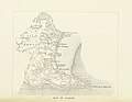
 2010 Wales Swansea Community Mumbles map.svg 512 × 472; 632 KB
-
 20140828 S40 Mumbles (15178918081).jpg 3,648 × 2,736; 5.25 MB
-
 2024 Wales Swansea Community Mumbles map.svg 512 × 472; 651 KB
-
 3rd tee, Clyne Golf Club - geograph.org.uk - 4920954.jpg 6,000 × 4,000; 3.21 MB
-
 A dazzling day at Caswell Bay - geograph.org.uk - 5800406.jpg 3,323 × 2,209; 1.43 MB
-
 A good walk - and a good view - spoiled^ - geograph.org.uk - 5865898.jpg 3,264 × 2,448; 3.2 MB
-
 A moment in time - seaspray (geograph 6703546).jpg 2,100 × 1,574; 1.31 MB
-
 A new bench on the coast path - geograph.org.uk - 4897518.jpg 6,000 × 4,000; 3.72 MB
-
 A seal at The Knab , Mumbles - geograph.org.uk - 2065280.jpg 1,944 × 2,592; 606 KB
-

-

-
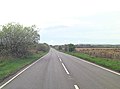
 A4067 at Norton - geograph.org.uk - 4136312.jpg 640 × 481; 73 KB
-
 A4067 at West Cross - geograph.org.uk - 4136305.jpg 640 × 480; 94 KB
-
 A4067 east of Black Pill - geograph.org.uk - 3956718.jpg 3,563 × 2,656; 1.4 MB
-
 Admiralty Chart No 1076 St Govens Head to The Mumbles, Published 1888.jpg 19,307 × 10,770; 76.23 MB
-

-
 Algae in Mumbles.jpg 4,742 × 2,460; 4.11 MB
-
 Amy Dillwyn Memorial Tree - geograph.org.uk - 6181007.jpg 3,000 × 4,000; 2.52 MB
-

-
 An occasional perch for seabirds - geograph.org.uk - 4903464.jpg 6,000 × 4,000; 3.44 MB
-
 Anglers at The Knab - geograph.org.uk - 5805392.jpg 3,384 × 2,169; 1.91 MB
-

-

-

-
 B4436 crosses Clyne Common - geograph.org.uk - 3957110.jpg 3,522 × 2,599; 1.32 MB
-
 B4436 south of Clyne Golf Course - geograph.org.uk - 3957102.jpg 3,547 × 2,583; 1,013 KB
-
 B4593 descends to Caswell Bay - geograph.org.uk - 4136320.jpg 640 × 480; 101 KB
-
 Bae Langland Bay - geograph.org.uk - 4223869.jpg 640 × 433; 71 KB
-
 Band concert in Clyne Gardens - geograph.org.uk - 3477383.jpg 1,729 × 1,161; 1.44 MB
-
 Barbeque bin at Rotherslade Bay - geograph.org.uk - 6211298.jpg 4,000 × 3,000; 3 MB
-
 Basstastic, Mumbles - geograph.org.uk - 3698098.jpg 800 × 745; 94 KB
-
 Beach at Caswell Bay - geograph.org.uk - 4099207.jpg 1,333 × 1,000; 841 KB
-
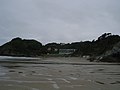
 Beach at Mumbles Head - geograph.org.uk - 4897820.jpg 6,000 × 4,000; 7.15 MB
-
 Beach defences, Black Pill - geograph.org.uk - 6181001.jpg 4,000 × 3,000; 2.73 MB
-
 Beach Huts at Langland Bay - geograph.org.uk - 2990739.jpg 1,681 × 1,161; 1.05 MB
-
 Beach huts, Rotherslade Bay - geograph.org.uk - 6211294.jpg 4,000 × 3,000; 2.58 MB
-
 Bench on the coast path below Rams Tor - geograph.org.uk - 4897512.jpg 6,000 × 4,000; 7.09 MB
-

-
 Black Pill - geograph.org.uk - 4994836.jpg 1,024 × 683; 104 KB
-
 Black Pill post office - geograph.org.uk - 5832459.jpg 1,600 × 1,200; 719 KB
-
 Blackpill lido - geograph.org.uk - 6580614.jpg 3,651 × 2,391; 2 MB
-
 Blackpill post office, Swansea - geograph.org.uk - 3693311.jpg 554 × 800; 98 KB
-
 Boat parking at Village Lane, Mumbles - geograph.org.uk - 6192123.jpg 4,000 × 3,000; 2.66 MB
-
 Boats in Swansea Bay at low tide - geograph.org.uk - 4994753.jpg 2,592 × 1,456; 1.07 MB
-

-
 Bracelet Bay - geograph.org.uk - 4897809.jpg 6,000 × 4,000; 4.85 MB
-
 Bracelet Bay - geograph.org.uk - 6580480.jpg 4,032 × 3,024; 5.03 MB
-
 Bracelet Bay - geograph.org.uk - 6672539.jpg 1,200 × 805; 982 KB
-
 Bracelet Bay and Coastguard station - geograph.org.uk - 1974850.jpg 2,000 × 1,328; 1.8 MB
-
 Bracelet Bay rock pool - geograph.org.uk - 4808276.jpg 2,404 × 3,754; 3.44 MB
-

-
 Breathing at Sea Sculpture, Mumbles, Swansea.JPG 5,184 × 3,456; 4.78 MB
-

-

-
 Brynfield Road houses, Langland, Swansea - geograph.org.uk - 4165065.jpg 800 × 720; 183 KB
-
 Building with RNLI plaques - Mumbles - geograph.org.uk - 1974747.jpg 2,000 × 1,328; 1.77 MB
-
 Buildings by the Slipway, the Knab - geograph.org.uk - 1495893.jpg 640 × 455; 73 KB
-
 Bus stop by Mumbles Road, West Cross - geograph.org.uk - 5832455.jpg 1,600 × 1,200; 793 KB
-

-

-
 Car Park and Beach, The Mumbles - geograph.org.uk - 3130186.jpg 640 × 480; 383 KB
-

-
 Car park by Mumbles Road - geograph.org.uk - 5832443.jpg 1,600 × 1,200; 806 KB
-
 Carlton Hotel, Mumbles, Swansea - geograph.org.uk - 2846144.jpg 601 × 640; 68 KB
-

-
 Castellmare - geograph.org.uk - 3129942.jpg 640 × 481; 437 KB
-
 Castle Avenue, Mumbles - geograph.org.uk - 3663301.jpg 2,012 × 1,382; 1.97 MB
-
 Castle Square, Mumbles, Swansea - geograph.org.uk - 4162911.jpg 800 × 679; 128 KB
-
 Caswell - geograph.org.uk - 3842799.jpg 640 × 480; 90 KB
-
 Caswell Bay - geograph.org.uk - 3866699.jpg 640 × 480; 108 KB
-
 Caswell Bay - geograph.org.uk - 4478374.jpg 2,592 × 1,456; 1.05 MB
-
 Caswell Bay - geograph.org.uk - 5800433.jpg 3,323 × 2,209; 2.11 MB
-
 Caswell Bay - geograph.org.uk - 5805694.jpg 3,254 × 1,928; 1.24 MB
-
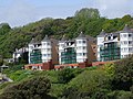 Caswell Bay Court - geograph.org.uk - 2110059.jpg 1,600 × 1,200; 573 KB
-

-
 Caswell Bay with a rising tide - geograph.org.uk - 5806069.jpg 3,323 × 2,209; 2.42 MB
-
 Caswell Bay, Gower - geograph.org.uk - 6459925.jpg 1,799 × 1,199; 398 KB
-

-
 Cave on Middle Head - Mumbles - geograph.org.uk - 1974624.jpg 2,000 × 1,328; 2.75 MB
-
 Chestnut Avenue, West Cross - geograph.org.uk - 1045045.jpg 640 × 480; 126 KB
-
 Chimes of Mumbles, Swansea - geograph.org.uk - 4162865.jpg 800 × 636; 121 KB
-
 Chipping from the rough - geograph.org.uk - 5865894.jpg 3,161 × 2,372; 1.92 MB
-
 Christadelphian Hall, Mumbles - 2022-08-21.jpg 2,654 × 2,654; 1.46 MB
-
 Cliff on north side of the Inner Sound - Mumbles - geograph.org.uk - 1974680.jpg 2,000 × 1,328; 2.38 MB
-
 Clock near Mumbles Pier - geograph.org.uk - 3695970.jpg 800 × 597; 79 KB
-
 Clyne Golf Club 15th tee - geograph.org.uk - 3956742.jpg 3,648 × 2,736; 2.03 MB
-
 Clyne Golf Club clubhouse - geograph.org.uk - 3956729.jpg 3,546 × 2,597; 1.3 MB
-
 Clyne Golf Course - geograph.org.uk - 4920939.jpg 6,000 × 4,000; 4.47 MB
-
 Clyne outflow - geograph.org.uk - 3867384.jpg 640 × 480; 128 KB
-
 Clyne River - geograph.org.uk - 5694264.jpg 3,264 × 2,448; 2.72 MB
-
 Clyne river - geograph.org.uk - 6276043.jpg 5,379 × 3,067; 3.77 MB
-
 Clyne river - geograph.org.uk - 6585142.jpg 4,032 × 3,024; 4.99 MB
-
 Clyne River flows into Swansea Bay - geograph.org.uk - 3693250.jpg 800 × 600; 159 KB
-
 Clyne Woods in Winter - geograph.org.uk - 1169882.jpg 640 × 480; 136 KB
-
 Coast at Newton Cliff - geograph.org.uk - 1480665.jpg 640 × 480; 99 KB
-
 Coast at the Mumbles (5512).jpg 4,288 × 2,848; 5.29 MB
-
 Coast at the Mumbles (5522).jpg 4,288 × 2,848; 6.73 MB
-
 Coast Below Rams Tor - geograph.org.uk - 1481452.jpg 640 × 480; 148 KB
-
 Coast path below Newton Cliff - geograph.org.uk - 4910901.jpg 6,000 × 4,000; 3.55 MB
-
 Coast path from Mumbles to Langland Bay - geograph.org.uk - 461032.jpg 640 × 480; 148 KB
-
 Coast West of Rams Tor - geograph.org.uk - 1481437.jpg 640 × 480; 140 KB
-
 Coastal chalets, Langland Bay, Swansea - geograph.org.uk - 4164713.jpg 800 × 497; 158 KB
-
 Coastal footpath at Ram Tor, near Mumbles, Gower - geograph.org.uk - 2719381.jpg 4,000 × 3,000; 4.24 MB
-
 Coastal footpath near Mumbles, Gower - geograph.org.uk - 2719361.jpg 4,000 × 3,000; 3.83 MB
-
 Coastal houses, Langland Bay, Swansea - geograph.org.uk - 4164847.jpg 800 × 421; 151 KB
-
 Coastal path at the eastern end of Langland Bay - geograph.org.uk - 4897483.jpg 6,000 × 4,000; 3.53 MB
-
 Coastal Path near Rams Tor - geograph.org.uk - 5453777.jpg 4,128 × 2,322; 4.13 MB
-
 Coastguard Station on Mumbles Head - geograph.org.uk - 6211111.jpg 4,000 × 3,000; 2.74 MB
-
 Comin Clun - Clyne Common - geograph.org.uk - 4302970.jpg 640 × 480; 102 KB
-
 Comin Clun - Clyne Common - geograph.org.uk - 4302982.jpg 640 × 480; 83 KB
-
 Command Post Bunker on Mumbles Hill - geograph.org.uk - 3064574.jpg 1,280 × 800; 264 KB
-
 Communications mast by the main road through Newton - geograph.org.uk - 5831223.jpg 1,600 × 1,277; 631 KB
-
 Comon Clun - Clyne Common - geograph.org.uk - 4302977.jpg 640 × 480; 78 KB
-
 Compass on Mumbles promenade - geograph.org.uk - 6192227.jpg 4,000 × 3,000; 2.95 MB
-
 Cornwall Place, Mumbles - geograph.org.uk - 1493435.jpg 640 × 455; 89 KB
-
 Cornwall Place, Mumbles - geograph.org.uk - 3619973.jpg 2,025 × 1,382; 1.32 MB
-
 Cornwall Place, Mumbles, Swansea - geograph.org.uk - 4162484.jpg 800 × 706; 173 KB
-
 Crawshay Court, Langland, Swansea - geograph.org.uk - 4165042.jpg 736 × 800; 176 KB
-
 Crazy Golf, Southend Gardens - geograph.org.uk - 1493401.jpg 640 × 455; 140 KB
-
 Crepidula fornicata - a beast with three backs - geograph.org.uk - 6585177.jpg 2,690 × 2,018; 1.96 MB
-
 Cycling Santas on a charity ride to Mumbles - geograph.org.uk - 2719427.jpg 3,108 × 2,055; 2.49 MB
-
 Cysgod Rotherslade - Rotherslade Shelter - geograph.org.uk - 4223880.jpg 640 × 429; 102 KB
-
 Dan-y-Coed House, Swansea - geograph.org.uk - 3693378.jpg 800 × 736; 127 KB
-
 Devon Place and the Catholic church in Mumbles - geograph.org.uk - 4897468.jpg 6,000 × 4,000; 6.66 MB
-
 Devon Place, Mumbles, Swansea - geograph.org.uk - 2845947.jpg 640 × 385; 56 KB
-
 Dunns Close, Mumbles, Swansea - geograph.org.uk - 4162647.jpg 800 × 539; 111 KB
-
 Dunns Lane houses, Mumbles, Swansea - geograph.org.uk - 4162669.jpg 800 × 644; 124 KB
-
 Early morning view across Swansea Bay - geograph.org.uk - 1974325.jpg 2,000 × 1,229; 1.58 MB
-

-
 Eden and Cheers, Mumbles, Swansea - geograph.org.uk - 2844725.jpg 640 × 539; 84 KB
-
-
 Emergency telephone.jpg 3,022 × 3,648; 2.34 MB
-
 Enjoying the view - geograph.org.uk - 6703110.jpg 3,364 × 2,523; 3.18 MB
-
 Entrance gates to Langland Bay Manor - geograph.org.uk - 4164222.jpg 800 × 660; 238 KB
-

-
 Exit road from the Pier - Mumbles - geograph.org.uk - 1974833.jpg 2,000 × 1,328; 1.74 MB
-
 Exmoor from Mumbles Head (5489).jpg 4,288 × 2,848; 4.53 MB
-
 Exmoor from Mumbles Head (5493).jpg 4,288 × 2,848; 4.86 MB
-
 Exmoor from Mumbles Head (5494).jpg 4,288 × 2,848; 4.55 MB
-
 Exmoor from Mumbles Head (5533).jpg 4,288 × 2,848; 4.47 MB
-
 Exmoor from Mumbles Head (5534).jpg 4,288 × 2,848; 4.67 MB
-
 Exposed rock strata near Limeslade Bay - geograph.org.uk - 4897788.jpg 5,702 × 3,801; 4.1 MB
-
 Fairwood Road-Mumbles Road - geograph.org.uk - 3129905.jpg 640 × 480; 446 KB
-
 Fenced-off Langland Road site in Swansea - geograph.org.uk - 4163150.jpg 800 × 582; 152 KB
-
 Field Near Newton - geograph.org.uk - 1480327.jpg 640 × 480; 124 KB
-
 Fishermen, the Knab - geograph.org.uk - 1495900.jpg 640 × 455; 73 KB
-
 Fishing boats looking towards Swansea from Mumbles (1294787).jpg 1,000 × 760; 48 KB
-
 Fishing The Mumbles - geograph.org.uk - 847141.jpg 640 × 415; 54 KB
-
 Fishy sculpture pointing the way to Langland Beach - geograph.org.uk - 6211251.jpg 3,463 × 2,597; 1.85 MB
-

-
 Flat water - geograph.org.uk - 6276037.jpg 2,048 × 1,536; 681 KB
-
 Footbridge over the Clyne River, Swansea - geograph.org.uk - 3693238.jpg 800 × 600; 129 KB
-
 Footpath and Cycleway, Mumbles - geograph.org.uk - 1493443.jpg 640 × 455; 82 KB
-
 Footpath from Langland Bay - geograph.org.uk - 5453782.jpg 4,128 × 2,322; 5.27 MB
-
 Footpath marker - geograph.org.uk - 6277911.jpg 3,264 × 2,448; 2.6 MB
-
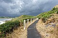
 Footpath signpost on the Wales Coast Path - geograph.org.uk - 6211266.jpg 4,000 × 3,000; 2.85 MB
-
 Footpath, Mumbles - geograph.org.uk - 4208893.jpg 1,600 × 1,067; 398 KB
-
 Footprints in the sand - geograph.org.uk - 6276045.jpg 1,536 × 2,048; 1.25 MB
-
 Foreshore and beach - Mumbles - geograph.org.uk - 1974799.jpg 2,000 × 1,328; 2.24 MB
-
 Former lifeboat station on Mumbles Head - geograph.org.uk - 4897824.jpg 6,000 × 4,000; 3.94 MB
-

-
 Forte's Ice Cream in three tubs.jpg 3,264 × 2,448; 1.67 MB
-
 Forte's Ice Cream Parlour, Limeslade Bay - geograph.org.uk - 6211115.jpg 4,000 × 3,000; 2.75 MB
-

-
 Gas governor, Westcross Lane - geograph.org.uk - 2814089.jpg 640 × 480; 107 KB
-
 Gatehouse of Oystermouth Castle - geograph.org.uk - 4903471.jpg 6,000 × 4,000; 3.79 MB
-
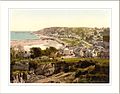 General view Mumbles Wales.jpg 1,069 × 837; 171 KB
-
 General view, Mumbles, Wales LOC 3752422440.jpg 1,024 × 766; 231 KB
-
 General view, Mumbles, Wales-LCCN2001703523.jpg 3,674 × 2,747; 3 MB
-

-
 Gilbertscliffe, Langland, Swansea - geograph.org.uk - 4163204.jpg 791 × 800; 194 KB
-
 Glenview Guest House, Mumbles, Swansea - geograph.org.uk - 4163187.jpg 800 × 799; 201 KB
-
 Gloucester Place, Mumbles, Swansea - geograph.org.uk - 4162657.jpg 800 × 782; 148 KB
-
 Goose Island, Mumbles, Swansea - geograph.org.uk - 4162907.jpg 800 × 600; 110 KB
-
 Gorse and bracken on the slopes of Rams Tor (geograph 6278270).jpg 2,048 × 1,536; 1.17 MB
-
 Gower - path 2.jpg 5,472 × 3,648; 7.09 MB
-
 Gower - path 3.jpg 5,472 × 3,648; 5.78 MB
-
 Gower - path.jpg 5,472 × 3,648; 7.35 MB
-
 Gower boundary sign, Mumbles, Swansea - geograph.org.uk - 3698222.jpg 777 × 800; 145 KB
-
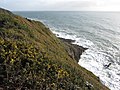 Gower cliffs and coast line - geograph.org.uk - 2719373.jpg 4,000 × 3,000; 4.17 MB
-
 Gower Coastal Cliffs - geograph.org.uk - 2037847.jpg 800 × 516; 178 KB
-
 Gower Getaways, Newton, Swansea - geograph.org.uk - 4163368.jpg 800 × 596; 143 KB
-
 Gower moorland - geograph.org.uk - 1045043.jpg 640 × 480; 118 KB
-
 Green sea front at West Cross - geograph.org.uk - 4984257.jpg 6,000 × 4,000; 4.12 MB
-

-
 Gun emplacement on Mumbles Hill - geograph.org.uk - 3064579.jpg 1,440 × 960; 250 KB
-

-
 Hair salon, Cornwall Place, The Mumbles - geograph.org.uk - 5832453.jpg 1,600 × 960; 640 KB
-
 Hairpin Cottage, Langland, Swansea - geograph.org.uk - 4164157.jpg 800 × 570; 144 KB
-
 Half tide at Mumbles - geograph.org.uk - 460960.jpg 640 × 480; 149 KB
-
 Heading towards Langland Bay on the Wales Coast Path - geograph.org.uk - 6211292.jpg 4,000 × 3,000; 2.86 MB
-
 Headland between the Bays - geograph.org.uk - 2330757.jpg 640 × 360; 39 KB
-
 Headland near Rotherslade Bay - geograph.org.uk - 5692504.jpg 3,264 × 2,448; 2.81 MB
-
 Headlands of the Gower peninsula - geograph.org.uk - 2719364.jpg 4,000 × 3,000; 3.28 MB
-
 Hennebont Gardens, Mumbles - geograph.org.uk - 6283336.jpg 2,592 × 1,944; 1.35 MB
-
 High Tide at Caswell Bay - 1 - geograph.org.uk - 3626374.jpg 3,456 × 2,592; 3.88 MB
-
 High Tide at Caswell Bay - 2 - geograph.org.uk - 3626397.jpg 3,289 × 2,240; 1.71 MB
-
 Higher Lane, Langland, Newton - geograph.org.uk - 5831229.jpg 1,600 × 1,200; 846 KB

.jpg)

.jpg)


.jpg)


.jpg)
.jpg)


.jpg)
.jpg)
.jpg)
.jpg)
.jpg)


.jpg)


.jpg)


