Category:Mill End
Jump to navigation
Jump to search
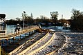
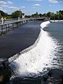
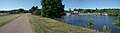
English: Mill End is a small hamlet in the parish of Hambleden in the south of Buckinghamshire, England, on the main A4155 road between Henley-on-Thames and Marlow. It is on the River Thames. Mill End consists of about 30-50 houses, some on the river bank and others on the northern side of the main road. The name clearly comes from the mill that is situated near the lock. Hambledeners do not get on with the population of Mill End, who have to depend on Hambleden for the doctor's surgery, a shop and a pub, (the Stag and Huntsman). The scenery of both places is nice, the rolling hills of Hambleden compared to the peaceful waters of the River Thames alongside the lock. This part of the Thames is idyllic with willow trees and a large biodiversity of wildlife including swans, grebes, ducks, herons, terns and kingfishers. The footpath next to Hambleden Lock is the main attraction for Mill End. People come from many places to feed bread to the ducks, cycle, or walk their dogs and on a sunny day the area can get very busy. Mill End is definitely a beautiful but slow-paced part of Great Britain.
village in Buckinghamshire | |||||
| Upload media | |||||
| Instance of | |||||
|---|---|---|---|---|---|
| Location | Hambleden, Buckinghamshire, South East England, England | ||||
 | |||||
Subcategories
This category has the following 2 subcategories, out of 2 total.
H
- Hambleden Mill (17 F)
- Hambleden Place, Buckinghamshire (14 F)
Media in category "Mill End"
The following 31 files are in this category, out of 31 total.
-
 Approaching Hambleden Lock - geograph.org.uk - 380038.jpg 640 × 487; 81 KB
-
 Approaching Hambleden Lock - geograph.org.uk - 536819.jpg 640 × 480; 117 KB
-
 Buildings at Yewden Manor (geograph 4422496).jpg 4,320 × 3,240; 4.75 MB
-
 Burrow Farm driveway - geograph.org.uk - 722102.jpg 640 × 480; 176 KB
-
 Duck On A Bird Table - panoramio.jpg 4,000 × 3,000; 3.41 MB
-
 Hambleden Lock House - geograph.org.uk - 947992.jpg 640 × 427; 188 KB
-
 Hambleden Valley at Mill End - geograph.org.uk - 722086.jpg 640 × 480; 150 KB
-
 Hambleden Weir - geograph.org.uk - 22721.jpg 640 × 426; 333 KB
-
 Hambleden Weir - geograph.org.uk - 505696.jpg 640 × 480; 77 KB
-
 Hambleden Weir - geograph.org.uk - 536828.jpg 480 × 640; 96 KB
-
 Hambleden Weir - geograph.org.uk - 771417.jpg 640 × 480; 83 KB
-
 Hambleden Weir - geograph.org.uk - 8318.jpg 640 × 480; 117 KB
-
 Houses near Mill End - geograph.org.uk - 947971.jpg 640 × 427; 179 KB
-

-
 Mill End (5771224540).jpg 2,640 × 1,980; 1.37 MB
-
 Mill End Car Park, Hambleden Valley - geograph.org.uk - 692169.jpg 640 × 480; 86 KB
-
 Rickmansworth Sunset - panoramio.jpg 2,688 × 1,008; 1.35 MB
-
 Thames at Hambleden Weir - geograph.org.uk - 536835.jpg 640 × 480; 131 KB
-
 Thames Downstream from Mill End - geograph.org.uk - 536844.jpg 640 × 480; 172 KB
-
 Thames Near Mill End - geograph.org.uk - 536847.jpg 640 × 480; 145 KB
-
 Thames Path in Hambleden Lock.JPG 4,928 × 1,344; 2.88 MB
-
 The River Thames, Mill End - geograph.org.uk - 510770.jpg 640 × 480; 152 KB
-
 The weir at Mill End - geograph.org.uk - 510774.jpg 640 × 480; 161 KB
-
 Hambleden Valley - geograph.org.uk - 722181.jpg 640 × 480; 129 KB
-
 Lane above Mill End - geograph.org.uk - 604594.jpg 640 × 480; 80 KB
-
 Lane above Mill End - geograph.org.uk - 605032.jpg 640 × 480; 203 KB
-
 Lane above Mill End - geograph.org.uk - 605035.jpg 480 × 640; 198 KB
-
 Moorings at Mill End - geograph.org.uk - 536841.jpg 640 × 480; 141 KB
-
 Near Burrow Farm - geograph.org.uk - 89616.jpg 597 × 370; 41 KB
-
 River Thames from Greenlands - geograph.org.uk - 212357.jpg 640 × 437; 39 KB
-
 The Road to Rotten Row - geograph.org.uk - 36322.jpg 640 × 481; 49 KB


.jpg)


.jpg)


