Category:Meols
Jump to navigation
Jump to search
village in England, United Kingdom  | |||||
| Upload media | |||||
| Instance of | |||||
|---|---|---|---|---|---|
| Location | Wirral, Merseyside, North West England, England | ||||
 | |||||

Meols, Wirral, Merseyside, England.
Subcategories
This category has the following 17 subcategories, out of 17 total.
- Benchmarks in Meols (10 F)
- Post boxes in Meols (10 F)
- Meols signs (2 F)
!
- Valued images of Meols (2 F)
A
- St Andrew's Church, Meols (2 F)
B
D
- Dove Point, Meols (5 F)
F
- Fornall bridge (7 F)
J
K
M
- Meols Post Office (2 F)
P
- Parade Gardens, Meols (16 F)
R
- Railway Inn, Meols (4 F)
- Redstone Farm, Meols (3 F)
T
- The Elms, Meols (3 F)
Media in category "Meols"
The following 49 files are in this category, out of 49 total.
-
 Boat at Meols-by-Peter-Craine.jpg 640 × 480; 55 KB
-
 Carr Hall, Meols - geograph.org.uk - 280208.jpg 640 × 480; 132 KB
-
 Dog obstacle course, Meols, Wirral - IMG 0807.JPG 4,320 × 3,240; 4.8 MB
-
 Esso petrol station, Hoylake.jpg 4,760 × 3,094; 11.81 MB
-
 Farmland near Meols - geograph.org.uk - 1411784.jpg 640 × 480; 73 KB
-
 Fingerpost at Dovepoint Road, Meols.jpg 3,292 × 5,169; 19.78 MB
-
 Fingerpost at Heron Road, Meols.jpg 5,120 × 3,459; 20.23 MB
-
 Fingerpost to Greasby, Meols - geograph.org.uk - 78085.jpg 640 × 480; 59 KB
-
 Fishing Pond, Meols - geograph.org.uk - 155012.jpg 640 × 480; 61 KB
-
 Fishing pond, Meols.JPG 3,648 × 2,736; 3.55 MB
-
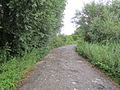
 Footpath near Meols - geograph.org.uk - 1411796.jpg 640 × 480; 71 KB
-
 Footpath to Saughall Massie Road - geograph.org.uk - 1411781.jpg 480 × 640; 89 KB
-
 Hardy & Padmore feeder pillar, 1921.jpg 3,153 × 5,138; 18.39 MB
-
 Heron Road, Meols (1).JPG 4,320 × 3,240; 2.96 MB
-
 HM Coastguard Hoylake.JPG 4,608 × 3,456; 3.52 MB
-
 Horse, A553, Meols.JPG 3,648 × 2,736; 3.53 MB
-

-
 Hoylake Promenade Meols - geograph.org.uk - 77043.jpg 640 × 480; 60 KB
-
 Jet Star boat on Meols beach, Wirral.JPG 3,984 × 2,976; 2.78 MB
-
 Meols Front-by-Rob-Hadfield.jpg 640 × 480; 30 KB
-
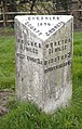
 Milepost at 66 Birkenhead Road, Meols.jpg 3,264 × 5,114; 20.4 MB
-
 Milepost at Heron Road, Meols.jpg 3,243 × 5,083; 21.41 MB
-
 Opera racing off Meols-by-John-Hughes.jpg 640 × 480; 40 KB
-
 Oystercatchers at Meols-by-Peter-Craine.jpg 640 × 454; 40 KB
-
 Park Lane, Meols (0).JPG 4,320 × 3,240; 2.92 MB
-
 Park Lane, Meols (1).JPG 4,320 × 3,240; 4.44 MB
-
 Park Lane, Meols (2).JPG 4,320 × 3,240; 3 MB
-
 Park Lane, Meols (3).JPG 4,320 × 3,240; 3.58 MB
-
 Park Lane, Meols (4).JPG 4,320 × 3,240; 3.95 MB
-
 Park Lane, Meols (5).JPG 4,320 × 3,240; 3.06 MB
-
 Park Lane, Meols (6).JPG 4,320 × 3,240; 3.15 MB
-
 Park Lane, Meols (7).JPG 4,320 × 3,240; 5.38 MB
-
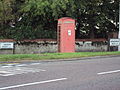 Phone box, A553, Meols.JPG 3,648 × 2,736; 3.59 MB
-
 Promenade at Meols-by-Mike-Wallis.jpg 640 × 403; 44 KB
-
 Promenade at Meols-by-Sue-Adair.jpg 640 × 480; 59 KB
-
 Public Footpath, Roman Road, Meols.JPG 2,736 × 3,648; 3.54 MB
-
 Rear view of Oldfield Manor Farm - geograph.org.uk - 49184.jpg 640 × 480; 48 KB
-
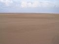 Sand, sea and sky-by-Peter-Craine.jpg 640 × 480; 14 KB
-
 Shaws Drive, Meols (1).jpg 5,152 × 3,864; 7.78 MB
-
 Shops near Meols railway station - geograph.org.uk - 1044882.jpg 640 × 479; 64 KB
-
 Signpost on Birkenhead Road Meols - geograph.org.uk - 1044877.jpg 640 × 479; 60 KB
-
 Starboard lateral post, Meols-by-Peter-Craine.jpg 480 × 640; 19 KB
-

-
 The New Meols Park Play Area-by-Roy-James-Shuttleworth.jpg 640 × 480; 56 KB
-
 The slipway at Dove Point, Meols-by-Tom-Pennington.jpg 640 × 480; 50 KB
-
 Thimble Inn House, Meols - geograph.org.uk - 155015.jpg 640 × 480; 61 KB
-
 Things Are Not What They Seem (198183283).jpeg 2,048 × 1,142; 123 KB
-
 View of Footpath to Meols - geograph.org.uk - 1411775.jpg 480 × 640; 105 KB
-
 Wirral Farmland and Footpath - geograph.org.uk - 1411778.jpg 640 × 480; 70 KB


.JPG)


.JPG)
.JPG)
.JPG)
.JPG)
.JPG)
.JPG)
.JPG)
.JPG)


.jpg)


.jpeg)

