Category:Meierhof Liemberg
Jump to navigation
Jump to search
| Object location | | View all coordinates using: OpenStreetMap |
|---|
 | |||||
| Upload media | |||||
| Instance of | |||||
|---|---|---|---|---|---|
| Part of | |||||
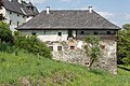
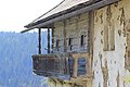
| Location | Liebenfels, Sankt Veit an der Glan District, Carinthia, Austria | ||||
| Street address |
| ||||
| Heritage designation | |||||
 | |||||
Media in category "Meierhof Liemberg"
The following 11 files are in this category, out of 11 total.
-
 Liebenfels Liemberg 12 ehem. Meierhof O-Ansicht 15032019 6095.jpg 7,360 × 4,912; 25.19 MB
-
 Liebenfels Liemberg 12 ehem. Meierhof W-Ansicht 17052015 3775.jpg 7,360 × 4,912; 28.79 MB
-
 Liemberg - Meiereihof.JPG 5,184 × 3,456; 4.98 MB
-
 Liemberg mit Meierhof.jpg 4,608 × 3,456; 4.33 MB
-
 Meierhof Liemberg Osten Detail.jpg 4,608 × 3,456; 3.26 MB
-
 Meierhof Liemberg von Osten 01.jpg 4,608 × 2,949; 2.48 MB
-
 Meierhof Liemberg von Westen.jpg 4,608 × 3,456; 4.11 MB
-
 Meierhof Liemberg Westseite von Norden.jpg 4,555 × 3,416; 2.72 MB
-
 Meierhof Liemberg.JPG 5,184 × 3,456; 8.57 MB
-
 Meierhof u Schloss Liemberg von Westen.jpg 4,572 × 3,429; 3.22 MB
-
 Schloss und Meierhof Liemberg.jpg 4,608 × 3,456; 4.05 MB


