Category:Maps of the Sunda Strait
Jump to navigation
Jump to search
Subcategories
This category has only the following subcategory.
O
- Old maps of the Sunda Strait (26 F)
Media in category "Maps of the Sunda Strait"
The following 18 files are in this category, out of 18 total.
-

-

-

-
 Admiralty Chart No 2056 Straat Sunda and Approaches, Published 1956.jpg 17,632 × 11,223; 25.36 MB
-
 Chilleurs-aux-Bois - château de Chamerolles, promenade des parfums 41.jpg 3,648 × 5,472; 7.87 MB
-
 Combined Range of 9 Tarsier Species.jpg 1,920 × 1,080; 1.39 MB
-
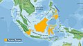
 Java and Sumatra.png 301 × 191; 17 KB
-
 July 19 2006 Sunda strait Earthquake location.jpg 473 × 456; 48 KB
-
 March 2010 indonesian seism.gif 411 × 387; 108 KB
-
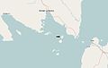
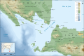
 Pulau sangiang map.png 751 × 615; 56 KB
-
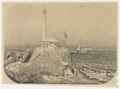 Schets van Java 's 1ste punt, door aardbeving vernield, KITLV 37C72.tiff 3,222 × 2,380; 21.97 MB
-
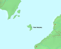
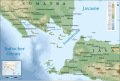
 Sebuku Island Location.jpg 631 × 401; 12 KB
-
 Sunda strait map v3.png 489 × 600; 310 KB
-
 Sunda strait map v4.png 487 × 351; 176 KB
-
 Sunda Strait map-de.svg 3,579 × 2,395; 2.05 MB
-
 Sunda Strait map-fr.svg 3,579 × 2,395; 2.08 MB
-
 Sunda Strait map-he.svg 3,112 × 2,388; 1.78 MB
-
 Sunda Strait.png 615 × 254; 18 KB
.jpg)
.jpg)
.jpg)


