Category:Maps of the Piccadilly line
Jump to navigation
Jump to search
Media in category "Maps of the Piccadilly line"
The following 25 files are in this category, out of 25 total.
-
 Aldwych branch (de).svg 300 × 468; 15 KB
-
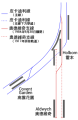
 Aldwych branch (en).svg 300 × 460; 17 KB
-
 Aldwych branch (hu).svg 300 × 460; 16 KB
-
 Aldwych branch (it).svg 300 × 460; 19 KB
-
 Aldwych branch (zh-hans).svg 300 × 460; 29 KB
-
 Aldwych branch (zh-tw).svg 300 × 460; 29 KB
-
 Aldwych branch (zh-yue).svg 300 × 460; 29 KB
-
 Aldwychbranch.png 296 × 450; 22 KB
-
 Brompton road map 1912.png 226 × 174; 19 KB
-
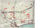 CharingCrossStrandStations.png 1,077 × 871; 1.26 MB
-
 Cockfosters extension.png 229 × 364; 14 KB
-
 Down street map 1912.png 213 × 129; 17 KB
-
 Heathrow Airport tube and rail stations.png 1,058 × 1,129; 771 KB
-
 Heathrow Airport tube rail lines 2019.png 1,385 × 795; 793 KB
-
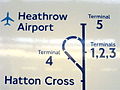
 Heathrow rail links.png 542 × 569; 50 KB
-
 LHR Transport 01.png 600 × 291; 39 KB
-
 London airports rail.png 965 × 1,051; 1.53 MB
-
 Piccadilly line flag box.png 521 × 91; 7 KB
-
 Piccadilly line flag box.svg 512 × 64; 4 KB
-
 Piccadilly Line.png 1,000 × 800; 77 KB
-
 Piccadilly Line.svg 1,000 × 800; 27 KB
-
 Piccadilly T5 Extension.JPG 639 × 479; 139 KB
-
 Piccadilly.gif 454 × 1,420; 37 KB
-
 Pos Station Aldwych.png 823 × 652; 253 KB
-
 Western Rail Approach to Heathrow.png 1,748 × 1,129; 1.16 MB
.svg)
.svg)
.svg)
.svg)
.svg)
.svg)
.svg)


