Category:Maps of the Metropolitan Borough of South Tyneside
Jump to navigation
Jump to search
Media in category "Maps of the Metropolitan Borough of South Tyneside"
The following 13 files are in this category, out of 13 total.
-
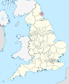
 EnglandSouthTyneside.png 200 × 247; 27 KB
-
 Jarrow and District Electric Tramways.jpg 600 × 600; 124 KB
-
 South Shields Corporation Tramways.jpg 600 × 600; 120 KB
-
 SOUTH TYNESIDE (49910219753).png 2,160 × 1,080; 275 KB
-
 South Tyneside in England (special marker).svg 816 × 991; 1.32 MB
-
 South Tyneside in England (zoom).svg 816 × 991; 817 KB
-
 South Tyneside in England.svg 816 × 991; 1.32 MB
-
 South Tyneside UK local election 2012 map.svg 1,367 × 1,346; 245 KB
-
 South Tyneside UK local election 2018 map.svg 1,367 × 1,346; 246 KB
-
 South Tyneside UK local election 2021 map.svg 1,367 × 1,346; 246 KB
-
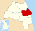 South Tyneside UK locator map.svg 1,425 × 1,252; 683 KB
-
 South Tyneside UK ward map 2010 (blank).svg 1,367 × 1,346; 245 KB
-
 South Tyneside UK ward map 2024.svg 1,367 × 1,346; 246 KB


.png)
.svg)
.svg)


.svg)