Category:Maps of the London Borough of Southwark
Jump to navigation
Jump to search
Subcategories
This category has the following 2 subcategories, out of 2 total.
E
- Election maps of Southwark (7 F)
Media in category "Maps of the London Borough of Southwark"
The following 12 files are in this category, out of 12 total.
-
 Bermondsey Met. B Ward Map 1916.svg 1,222 × 819; 75 KB
-
 Burgess-park-1-27500.svg 560 × 349; 1.05 MB
-
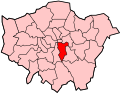
 LondonSouthwark.png 200 × 155; 23 KB
-
 LondonSouthwark.svg 962 × 744; 19 KB
-
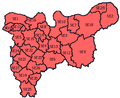 SELondon.PNG 360 × 293; 14 KB
-
 Southwark areas.png 400 × 569; 54 KB
-
 Southwark Civil Parish Map 1870.png 7,982 × 6,869; 2.63 MB
-
 Southwark London UK blank ward map.svg 950 × 1,266; 382 KB
-
 Southwark London UK labelled ward map 2002.svg 684 × 1,290; 99 KB
-
 Southwark London UK location map.svg 950 × 1,266; 4.03 MB
-
 Southwark London UK map Surrey Quays.png 950 × 1,266; 235 KB
-
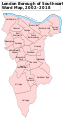
 Southwark Met. B Ward Map 1916.svg 780 × 1,123; 49 KB


