Category:Maps of districts of Kazakhstan
Jump to navigation
Jump to search
Subcategories
This category has the following 18 subcategories, out of 18 total.
*
A
E
J
K
M
N
P
T
U
W
Z
Media in category "Maps of districts of Kazakhstan"
The following 21 files are in this category, out of 21 total.
-
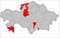 Distritos de Kazajistán trabajados.jpg 1,601 × 1,025; 136 KB
-
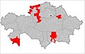 Distritos de Kazajistán trabajados2.jpg 1,601 × 1,025; 137 KB
-
 Kazakhstan district location map.svg 512 × 293; 931 KB
-
 Kazakhstan districts 1996.png 1,598 × 1,022; 62 KB
-
 Kazakhstan rayons.png 1,598 × 1,022; 351 KB
-
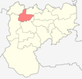
 Makanshy District Kazakhstan.png 1,598 × 1,022; 351 KB
-
 Markakol District Kazakhstan.png 1,598 × 1,022; 351 KB
-
 Ulken Naryn District Kazakhstan.png 1,598 × 1,022; 351 KB
-
 Zhanasemey District Kazakhstan.png 1,598 × 1,022; 350 KB
-
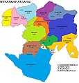
 Ауданның әкімшілік бөлінісі.jpg 2,717 × 2,856; 674 KB
-
 Ақкемер ауылдық округі.jpg 2,717 × 2,856; 432 KB
-
 Ембі.jpg 2,717 × 2,856; 462 KB
-
 Еңбек ауылдық округі.jpg 2,717 × 2,856; 430 KB
-
 Жанадалинский район (1988).png 2,168 × 2,316; 64 KB
-
 Жұрын ауылдық округі.jpg 2,717 × 2,856; 429 KB
-
 Кийминский район (1988).png 2,168 × 2,316; 64 KB
-
 Мариновский район (1982).png 3,923 × 3,772; 163 KB
-
 Мұғалжар ауданының әкімшілік бөлінісі.jpg 2,717 × 2,856; 679 KB
-
 Селетинский район (1982).png 3,923 × 3,772; 163 KB
-
 Талдысай ауылдық округі.jpg 2,717 × 2,856; 436 KB
-
 Тенгизский район (1982).png 3,923 × 3,772; 163 KB


.png)

.png)
.png)

.png)

.png)