Category:Maps of Thégra
Jump to navigation
Jump to search
Wikimedia category | |||||
| Upload media | |||||
| Instance of | |||||
|---|---|---|---|---|---|
| Category combines topics | |||||
| Thégra | |||||
commune in Lot, France   | |||||
| Instance of | |||||
| Location |
| ||||
| Population |
| ||||
| Area |
| ||||
| Elevation above sea level |
| ||||
| official website | |||||
 | |||||
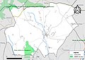
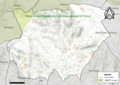
Media in category "Maps of Thégra"
The following 4 files are in this category, out of 4 total.
-
 46317-Thégra-argile.png 3,057 × 2,480; 3.3 MB
-
 46317-Thégra-Natura2000b.png 5,846 × 4,133; 6.05 MB
-
 46317-Thégra-ZNIEFF1.jpg 3,519 × 2,480; 605 KB
-
 46317-Thégra-ZNIEFF2.png 3,519 × 2,480; 4.21 MB


