Category:Maps of Stanley Park, Vancouver
Jump to navigation
Jump to search
Media in category "Maps of Stanley Park, Vancouver"
The following 11 files are in this category, out of 11 total.
-
 An Indian Map of Vancouver 1936.jpg 5,592 × 3,263; 2.01 MB
-
 Burrard-Inlet-map-en 2.svg 728 × 519; 268 KB
-
 City of Vancouver Canadian Pacific town site 1887.jpg 5,302 × 5,661; 3.95 MB
-
 Damage in SP.jpg 1,804 × 2,160; 723 KB
-
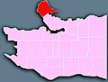
 Location of Stanley Park.jpg 524 × 304; 85 KB
-
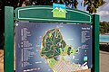 Map of Vancouver Stanley Park (43813562945).jpg 6,240 × 4,160; 11.01 MB
-
 Stanley Park (99841627).jpg 3,072 × 2,048; 2.45 MB
-
 Stanley Park - Vancouver - OpenStreetMaps.png 1,008 × 844; 484 KB
-
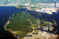 Stanley Park Labeled Aerial Map.png 1,047 × 699; 1.13 MB
-
 Stanley Park Location.png 524 × 304; 41 KB
-
 Vancouver Stanley Park-map.jpg 450 × 342; 20 KB


.jpg)
.jpg)


