Category:Maps of European glaciations
Jump to navigation
Jump to search
Media in category "Maps of European glaciations"
The following 19 files are in this category, out of 19 total.
-
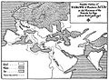 A Short History of the World, p0067.jpg 1,371 × 1,000; 389 KB
-
 Archaeological Sites of Horse Remains, UK.jpg 2,866 × 2,274; 4.24 MB
-
 Archaeological Sites of Horse Remains-ar.png 2,866 × 2,274; 15.65 MB
-
 EisrandlagenNorddeutschland.jpg 474 × 405; 45 KB
-
 EisrandlagenNorddeutschland.png 474 × 405; 349 KB
-
 Europa lgm vegan 3.svg 829 × 871; 119 KB
-
 Europa vegan3.png 829 × 871; 86 KB
-
 Europe during last glaciation maximum.svg 1,900 × 1,264; 183 KB
-
 Ice Age Europe map.png 2,100 × 1,525; 182 KB
-
 Last Glacial Maximum topo contours of Europe 1.svg 953 × 451; 3.21 MB
-
 Lob European Russia Glacier map.svg 780 × 859; 3.76 MB
-
 Meyers b17 s0285a.jpg 3,217 × 2,470; 4.4 MB
-
 Pleistocene glaciations in Poland.png 2,000 × 1,660; 652 KB
-
 Rheingletscher.jpg 633 × 609; 286 KB
-
 Valun-sedergolm-1911.png 903 × 704; 245 KB
-
 Weichsel ice age europe.png 2,100 × 1,525; 162 KB
-
 Weichsel ice age europe.svg 2,100 × 1,525; 220 KB
-
 Weichsel-Würm-Glaciation.png 1,475 × 1,200; 539 KB
-
 Www.wesleyjohnston.com-users-ireland-maps-historical-ice age.gif 466 × 581; 18 KB


