Category:Maps of Distrikt Bielefeld
Jump to navigation
Jump to search
Media in category "Maps of Distrikt Bielefeld"
The following 23 files are in this category, out of 23 total.
-
-
 Bielefeld im Fuldadepartment ab 1811.svg 581 × 734; 7 KB
-
 Bielefeld in Kgr Westphalen 1811.svg 560 × 638; 21 KB
-
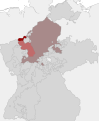 Distrikt Bielefeld im Rheinbund.svg 688 × 835; 505 KB
-
 Kreis BI 10. Aug. 1952 - 1956.svg 574 × 532; 39 KB
-
 Kreis BI 1930-10. Aug. 1952.svg 574 × 532; 39 KB
-
 Kreis BI 1956-31.12.1964.svg 574 × 532; 39 KB
-
 Kreis BI 1965-1969.svg 575 × 532; 39 KB
-
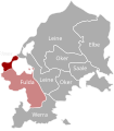
 Kreis Bielefeld in NRW 31 12 1972.svg 584 × 583; 79 KB
-
 Lage des Kreises Bielefeld in Deutschland 1972.png 176 × 235; 6 KB
-
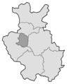
 Landkreis Bielefeld 1970-1972.svg 589 × 608; 33 KB
-
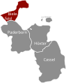
 RB Detmold 1947-1968 Kreiseinteilung Bielefeld.png 311 × 386; 6 KB
-
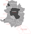
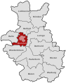 RB Detmold 1949-1968 beschriftet Bielefeld.svg 570 × 724; 102 KB
-
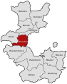
 RB Detmold 1975 beschriftet Bielefeld.svg 575 × 724; 39 KB
-
 RB Detmold 1975 Kreiseinteilung Bielefeld.png 309 × 388; 3 KB
-
 RB Minden 1817-1831 beschriftet Bielefeld.svg 570 × 724; 93 KB
-
 RB Minden 1832-1878 beschriftet Bielefeld.svg 570 × 724; 83 KB
-
 RB Minden 1832-1878 Kreiseinteilung Bielefeld.png 310 × 386; 6 KB
-
 RB Minden 1878-1911 (Bielefeld ab 1878) beschriftet Bielefeld.svg 570 × 724; 85 KB
-
 RB Minden 1878-1911 Kreiseinteilung Bielefeld.png 310 × 386; 6 KB
-
 RB Minden 1911-1947 (Bielefeld ab 1907) beschriftet Bielefeld.svg 570 × 724; 88 KB
-
 RB Minden 1911-1947 (Bielefeld ab 1930) beschriftet Bielefeld.svg 570 × 724; 88 KB
-
 RB Minden 1911-1947 Kreiseinteilung Bielefeld.png 310 × 386; 6 KB


_beschriftet_Bielefeld.svg)

_beschriftet_Bielefeld.svg)
_beschriftet_Bielefeld.svg)
