Category:Maps of Danube Delta
Jump to navigation
Jump to search
Media in category "Maps of Danube Delta"
The following 49 files are in this category, out of 49 total.
-
 151 of 'Les Artères du globe ... Illustré de ... gravures et cartes' (11194994736).jpg 1,761 × 1,817; 698 KB
-

-

-
 Karte des Donaudeltas mit den Jagdstreifzügen.jpg 5,525 × 2,672; 2.94 MB
-

-

-

-

-
 Admiralty Chart No 2231 Cape Kaliakra to Odessa, Published 1854, New Edition 1919.jpg 10,954 × 16,343; 55.75 MB
-
 Admiralty Chart No 2231 Cape Kaliakra to Odessa, Published 1854, New Edition 1927.jpg 11,075 × 16,258; 46.42 MB
-
 Areas polderised under Ceausescu.png 727 × 674; 436 KB
-

-
 Brațul Chilia-1771.jpg 800 × 649; 323 KB
-
 Bystroe canal.png 1,294 × 756; 403 KB
-
 Canale Danubio-Mar Nero.jpg 315 × 291; 91 KB
-

-
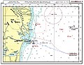
 Danube delta chart.png 1,000 × 540; 848 KB
-
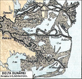
 Danube Delta evolution.gif 642 × 449; 277 KB
-
 Danube delta scheme-hu.png 295 × 291; 7 KB
-
 Danube mouths 1867.JPG 4,064 × 3,088; 3.7 MB
-
 Danube-Black Sea Canal.png 315 × 291; 12 KB
-
 Danube1940-1948-hu.svg 1,500 × 800; 270 KB
-
 Danube19401948.svg 1,500 × 800; 405 KB
-
 Delta inundabilă.png 702 × 670; 1.04 MB
-
 DeltaPaleogeo.jpg 339 × 383; 166 KB
-
 DeltaPierderi.jpg 339 × 371; 172 KB
-
 DeltaRBDD.jpg 339 × 383; 153 KB
-
 Dobrogea-Bugeac harta etnica (1861).JPG 1,722 × 1,516; 505 KB
-
 Dobroger.png 657 × 565; 71 KB
-
 Dobrudscha-1895.jpg 503 × 457; 180 KB
-
 ETH-BIB-Chilia-Arm der Donau (Valcov)-Dia 247-Z-00329.tif 2,884 × 3,380; 27.99 MB
-
 ETH-BIB-Donau-Delta, Karte-Dia 247-11170.tif 3,700 × 2,696; 9.63 MB
-
 Ethnic map of Ismail and Tulcea Counties 1930.png 3,026 × 2,988; 1.98 MB
-
 FrontLaMusura.jpg 3,258 × 2,528; 2.89 MB
-
 Kanäle im Donaudelta.png 935 × 1,014; 482 KB
-
 LocMap WH Danube Delta.png 275 × 250; 4 KB
-
 Ongal battle.png 1,311 × 1,372; 610 KB
-
 Paläografische Evolution des Donaudeltas.png 876 × 990; 1.03 MB
-

-
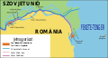
 Rumaenisch-Russischer Streit um Donauinseln am Chiliaarm, 1940, 1948.JPG 1,041 × 612; 64 KB
-
 Rumänien BV042517039.jpg 6,367 × 2,560; 1.6 MB
-
 Rumänien BV042773339.jpg 6,630 × 6,460; 4.01 MB
-
 Russian map of Sulina in 1911.jpg 1,859 × 1,754; 278 KB
-
 Scythia Minor in Late Antiquity.jpg 2,500 × 2,289; 803 KB
-
 Sulina - 47-45.jpg 3,579 × 4,989; 2.05 MB
-
 Trophic state of water in the Danube Delta.jpg 5,669 × 8,071; 6.13 MB
-
 USSR map NL 35-9 Tulcea.jpg 5,924 × 4,361; 8.25 MB
-
 William Faden. Composite Mediterranean. 1785.QA.jpg 796 × 703; 151 KB
-
 Дельта Дунаю.png 960 × 685; 251 KB
.jpg)

_With_numerous_maps_and_notes%27_(11108499893).jpg)

.jpg)
.jpg)
_With_numerous_maps_and_notes%27_(11109083974).jpg)
_With_numerous_maps_and_notes%27_(11111342845).jpg)


.jpg)


.JPG)


