Category:Maps of Agder
Jump to navigation
Jump to search
Subcategories
This category has the following 7 subcategories, out of 7 total.
L
O
R
T
Media in category "Maps of Agder"
The following 10 files are in this category, out of 10 total.
-
 Admiralty Chart No 2328 Kristiansand to Sandoen, Published 1854, New Edition 1917.jpg 10,920 × 13,637; 45.86 MB
-
 Agder in Norway 2020.svg 1,361 × 1,501; 1.58 MB
-
 Agder in Norway 2024.svg 1,361 × 1,501; 1.63 MB
-
 Norway Agder adm location map.svg 794 × 813; 240 KB
-
 Norway Agder rel location map.svg 794 × 813; 880 KB
-
 Norway Counties Agder Position.svg 740 × 790; 54 KB
-
 Prostier i Agder og Telemark.svg 885 × 1,025; 442 KB
-
 Prostier i Vest-Agder.svg 710 × 862; 344 KB
-
 Rutebok for Norge - Rutebokens Norgeskart - utsnitt Agder.jpg 3,648 × 2,736; 5.43 MB
-
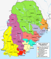
 Sørlandets regioner.jpg 480 × 506; 45 KB


