Category:Long Load
Jump to navigation
Jump to search
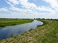
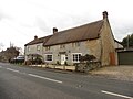
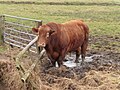
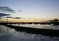
English: Long Load is a village and parish in Somerset, England, situated on the River Yeo south of Somerton in the South Somerset district. The village has a population of 361.
human settlement in United Kingdom  | |||||
| Upload media | |||||
| Instance of | |||||
|---|---|---|---|---|---|
| Location | South Somerset, Somerset, South West England, England | ||||
| Population |
| ||||
| Said to be the same as | Long Load (Wikimedia duplicated page, civil parish) | ||||
 | |||||
Media in category "Long Load"
The following 88 files are in this category, out of 88 total.
-
 'The Council houses' Long Load - geograph.org.uk - 5277109.jpg 1,024 × 673; 148 KB
-
 A dense hedgerow - geograph.org.uk - 2479751.jpg 640 × 359; 62 KB
-
 B3165, Long Load - geograph.org.uk - 2479755.jpg 640 × 480; 110 KB
-

-
 Benchmark on Christ Church, Long Load - geograph.org.uk - 4520616.jpg 640 × 480; 119 KB
-
 Benchmark on Village Hall, Long Load - geograph.org.uk - 4520587.jpg 640 × 600; 148 KB
-
 Bend on Church Lane - geograph.org.uk - 5276309.jpg 1,024 × 768; 253 KB
-
 Bull on the Levels - geograph.org.uk - 5265179.jpg 640 × 427; 62 KB
-
 Bull on Wetmoor Lane - geograph.org.uk - 5276295.jpg 1,024 × 768; 263 KB
-
 By Wetmoor Lane - geograph.org.uk - 5026600.jpg 3,072 × 2,048; 1.19 MB
-
 Carey Drove - geograph.org.uk - 5367073.jpg 1,024 × 768; 196 KB
-
 Cattle by Mare Grove - geograph.org.uk - 2479747.jpg 640 × 359; 64 KB
-
 Cattle Feeding near Long Load - geograph.org.uk - 5265344.jpg 640 × 480; 88 KB
-
 Cattle Sheds on Church Lane - geograph.org.uk - 1278894.jpg 640 × 428; 103 KB
-
 Chinese Puzzle Inlet - geograph.org.uk - 2251616.jpg 800 × 600; 616 KB
-
 Christ Church, Long Load - geograph.org.uk - 4520613.jpg 640 × 480; 70 KB
-
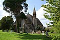 Christs Church Long Load - geograph.org.uk - 1278909.jpg 640 × 428; 111 KB
-
 Cottages, Long Load - geograph.org.uk - 5276767.jpg 1,024 × 752; 174 KB
-
 Direction Sign – Signpost - geograph.org.uk - 6537668.jpg 720 × 960; 155 KB
-
 Farm buildings on Church Lane - geograph.org.uk - 5276756.jpg 1,024 × 833; 238 KB
-
 Farmland by Wetmoor Lane - geograph.org.uk - 5026642.jpg 3,072 × 2,048; 1.48 MB
-
 Field by Wetmoor Lane - geograph.org.uk - 5026672.jpg 3,072 × 2,048; 1.39 MB
-
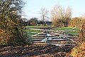 Gateway into Rotten Ham - geograph.org.uk - 5251805.jpg 640 × 427; 120 KB
-
 Houses at the southern end of Long Load - geograph.org.uk - 5277102.jpg 1,024 × 768; 147 KB
-
 Junction on Long Load Road - geograph.org.uk - 1278919.jpg 640 × 428; 74 KB
-
 Junction on Wetmoor Lane - geograph.org.uk - 1278876.jpg 640 × 428; 57 KB
-
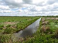
 Lane and rhyne - geograph.org.uk - 1575506.jpg 640 × 480; 97 KB
-
 Lane near Muchelney Ham - geograph.org.uk - 1575511.jpg 640 × 480; 108 KB
-
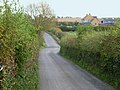
 Lane to Long Load - geograph.org.uk - 1575508.jpg 640 × 480; 114 KB
-
 Long Load - geograph.org.uk - 5251683.jpg 640 × 427; 67 KB
-
 Long load sluice gates - geograph.org.uk - 450460.jpg 640 × 427; 70 KB
-
 Long Load, Minor road closed to Muchelney - geograph.org.uk - 3810848.jpg 794 × 1,200; 1.12 MB
-
 Looking over Wet moor, Longload - geograph.org.uk - 1318426.jpg 640 × 480; 109 KB
-
 Mistletoe by Wetmoor Lane - geograph.org.uk - 5026570.jpg 3,029 × 1,809; 1.18 MB
-
 Muchelney Ham Wetmoor Lane - geograph.org.uk - 2236735.jpg 1,600 × 1,071; 1.96 MB
-
 New Mead Drove - geograph.org.uk - 1278854.jpg 640 × 428; 74 KB
-
 New Mead Drove - geograph.org.uk - 5278158.jpg 1,024 × 798; 246 KB
-
 Old school building, Long Load - geograph.org.uk - 2479754.jpg 640 × 480; 86 KB
-
 On the banks of the River Yeo near Long Sutton - geograph.org.uk - 2260109.jpg 1,024 × 681; 105 KB
-
 Orchard Laver Farm - geograph.org.uk - 5265345.jpg 640 × 427; 122 KB
-
 Overspill pond and sluice, Long Load - geograph.org.uk - 5367527.jpg 1,024 × 768; 204 KB
-
 Pumping Station on River Yeo - geograph.org.uk - 5367513.jpg 1,024 × 768; 180 KB
-
 Rhyne by Wetmoor Lane - geograph.org.uk - 5026689.jpg 3,072 × 2,048; 1.23 MB
-
 Rhyne on Wet Moor - geograph.org.uk - 5367050.jpg 1,024 × 768; 210 KB
-
 Rhyne on Wet Moor - geograph.org.uk - 5367076.jpg 1,024 × 768; 244 KB
-
 Rhyne on Wet Moor - geograph.org.uk - 5367082.jpg 1,024 × 768; 233 KB
-
 Rhyne on Wetmoor Lane - geograph.org.uk - 5251823.jpg 640 × 481; 106 KB
-
 Rhyne with swans on Wet Moor - geograph.org.uk - 5367098.jpg 1,024 × 768; 205 KB
-
 River Yeo - geograph.org.uk - 220969.jpg 640 × 480; 51 KB
-
 River Yeo - geograph.org.uk - 220970.jpg 640 × 480; 41 KB
-
 River Yeo - geograph.org.uk - 220975.jpg 480 × 640; 57 KB
-
 River Yeo - geograph.org.uk - 5276790.jpg 1,024 × 768; 159 KB
-
 River Yeo at Long Load, in the floods - geograph.org.uk - 658871.jpg 640 × 480; 53 KB
-
 River Yeo near Muchelney - geograph.org.uk - 4520610.jpg 640 × 480; 68 KB
-
 Stone cottages, Long Load - geograph.org.uk - 5277104.jpg 1,024 × 768; 153 KB
-
 Sunrise over flooded fields and River Yeo - geograph.org.uk - 3245756.jpg 4,592 × 3,056; 1.96 MB
-
 Swan on the river in Long Load - geograph.org.uk - 450467.jpg 640 × 427; 42 KB
-
 Thatched cottage on Church Lane - geograph.org.uk - 5276762.jpg 1,024 × 768; 164 KB
-
 Thatched house, Long Load - geograph.org.uk - 5277093.jpg 1,024 × 768; 141 KB
-
 The bull on Wetmoor Lane - a closer look - geograph.org.uk - 5276302.jpg 1,024 × 768; 287 KB
-
 The Rhyne Beside Wetmoor Lane - geograph.org.uk - 5251821.jpg 640 × 427; 97 KB
-
 The River Yeo overflowing into fields at Long Load - geograph.org.uk - 3245732.jpg 3,506 × 2,442; 1.7 MB
-
 The River Yeo overflowing into fields at Long Load - geograph.org.uk - 3245748.jpg 4,592 × 3,056; 2.47 MB
-
 Track, north of Wetmoor Lane - geograph.org.uk - 5278173.jpg 1,024 × 799; 275 KB
-
 Village Hall, Long Load - geograph.org.uk - 4520588.jpg 640 × 480; 75 KB
-
 Village Hall, Long Load - geograph.org.uk - 5276776.jpg 1,024 × 782; 190 KB
-
 Wet Moor - geograph.org.uk - 5367103.jpg 1,024 × 768; 188 KB
-
 Wet Moor near Muchelney Ham - geograph.org.uk - 2236743.jpg 1,600 × 1,071; 1.49 MB
-
 Wetmoor Lane - geograph.org.uk - 1278841.jpg 640 × 428; 80 KB
-
 Wetmoor Lane - geograph.org.uk - 5026586.jpg 3,072 × 1,806; 1.21 MB
-
 Wetmoor Lane - geograph.org.uk - 5026649.jpg 3,072 × 2,048; 1.42 MB
-
 Wetmoor Lane - geograph.org.uk - 5253164.jpg 640 × 427; 58 KB
-
 Wetmoor Lane - geograph.org.uk - 5277110.jpg 1,024 × 793; 191 KB
-
 Wetmoor Lane - geograph.org.uk - 5278185.jpg 1,024 × 845; 276 KB
-
 Wetmoor Lane Bridge, Long Load - geograph.org.uk - 4520573.jpg 640 × 480; 95 KB
-
 Willow by Wetmoor Lane - geograph.org.uk - 4921847.jpg 1,920 × 1,436; 755 KB
-
 A Stormy Evening On Whit Moor - geograph.org.uk - 627647.jpg 640 × 426; 42 KB
-
 Arable land on the Levels - geograph.org.uk - 622837.jpg 640 × 480; 86 KB
-
 Ash Lakes - geograph.org.uk - 635946.jpg 640 × 480; 88 KB
-
 Ash Lakes - geograph.org.uk - 637691.jpg 480 × 640; 52 KB
-
 Barn near Witcombe - geograph.org.uk - 637696.jpg 640 × 472; 98 KB
-
 Barns at Orchard Laver Farm - geograph.org.uk - 524971.jpg 640 × 388; 70 KB
-
 Bearley Farm - geograph.org.uk - 636058.jpg 640 × 480; 68 KB
-
 Field - geograph.org.uk - 228253.jpg 640 × 480; 54 KB
-
 Lower Witcombe Farm - Witcombe - geograph.org.uk - 457644.jpg 477 × 640; 188 KB
-
 Manor Farm House - geograph.org.uk - 526081.jpg 640 × 463; 98 KB
-
 Rhyne and Road - geograph.org.uk - 228256.jpg 640 × 480; 69 KB
-


