Category:Long Duckmanton
Jump to navigation
Jump to search
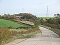
English: Long Duckmanton is a village in the civil parish of Sutton-cum-Duckmanton, in North East Derbyshire, located between Bolsover and Chesterfield. It is located 3km west of Bolsover and about 18km south-east of the city of Sheffield.
village in Derbyshire, United Kingdom | |||||
| Upload media | |||||
| Instance of | |||||
|---|---|---|---|---|---|
| Location | Sutton cum Duckmanton, North East Derbyshire, Derbyshire, East Midlands, England | ||||
 | |||||
Subcategories
This category has only the following subcategory.
S
Media in category "Long Duckmanton"
The following 16 files are in this category, out of 16 total.
-
 Buttermilk Lane Ahead - geograph.org.uk - 839602.jpg 640 × 480; 70 KB
-
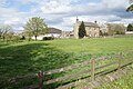 Cherry Tree Farm, Long Duckmanton.jpg 6,000 × 4,000; 5.7 MB
-
 Duckmanton Workshops 132419.jpg 616 × 296; 39 KB
-

-
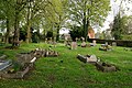 St Peter & St Paul's Church graveyard - geograph.org.uk - 3957698.jpg 800 × 533; 175 KB
-
 St Peter and St Paul's Church, Long Duckmanton - geograph.org.uk - 3895605.jpg 2,522 × 1,892; 1.77 MB
-

-
 Bridge over M1used by farm traffic. - geograph.org.uk - 272907.jpg 640 × 480; 59 KB
-
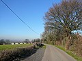
 Longcourse Lane - and a 'Pile' - geograph.org.uk - 687859.jpg 640 × 480; 65 KB
-
 Longcourse Lane - View towards A632 - geograph.org.uk - 687831.jpg 640 × 480; 90 KB
-
 Longcourse Lane View - geograph.org.uk - 687866.jpg 640 × 480; 65 KB
-
 Markham House, Nr Duckmanton - geograph.org.uk - 320865.jpg 640 × 480; 131 KB
-
 Site clearance adjacent to the M1 - geograph.org.uk - 634476.jpg 640 × 338; 52 KB
-

-

-


_-_geograph.org.uk_-_703306.jpg)
_-_geograph.org.uk_-_702485.jpg)
