Category:Locator maps of neighborhoods in Wierden
Jump to navigation
Jump to search
Media in category "Locator maps of neighborhoods in Wierden"
The following 34 files are in this category, out of 34 total.
-

-

-

-
 Map - NL - Wierden - Wijk 00 Wierden (kern) - Buurt 03 De Maaten.svg 375 × 375; 27 KB
-

-
 Map - NL - Wierden - Wijk 00 Wierden (kern) - Buurt 05 De Stouwe.svg 375 × 375; 27 KB
-
 Map - NL - Wierden - Wijk 00 Wierden (kern) - Buurt 06 't Loo.svg 375 × 375; 27 KB
-

-
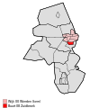 Map - NL - Wierden - Wijk 00 Wierden (kern) - Buurt 08 Zuidbroek.svg 375 × 375; 27 KB
-
 Map - NL - Wierden - Wijk 00 Wierden (kern).svg 625 × 575; 12 KB
-
-

-

-

-

-
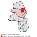
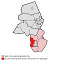
 Map - NL - Wierden - Wijk 01 Landelijk gebied Wierden.svg 625 × 575; 12 KB
-

-

-
 Map - NL - Wierden - Wijk 02 Hooge-Hexel.svg 625 × 575; 12 KB
-

-

-
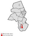 Map - NL - Wierden - Wijk 03 Enter (kern) - Buurt 02 Enter-Oost.svg 375 × 375; 27 KB
-
 Map - NL - Wierden - Wijk 03 Enter (kern) - Buurt 03 Enter-West.svg 375 × 375; 27 KB
-
 Map - NL - Wierden - Wijk 03 Enter (kern).svg 625 × 575; 12 KB
-
-

-
-

-

-
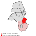
 Map - NL - Wierden - Wijk 04 Landelijk gebied Enter.svg 625 × 575; 12 KB
-

-

-

-
 Map - NL - Wierden - Wijk 05 Rectum - Notter - Zuna.svg 625 × 575; 12 KB
_-_Buurt_00_Wierden-Centrum.svg)
_-_Buurt_01_Wierden-Noord.svg)
_-_Buurt_02_Wierden-West.svg)
_-_Buurt_03_De_Maaten.svg)
_-_Buurt_04_Wierden-Oost.svg)
_-_Buurt_05_De_Stouwe.svg)
_-_Buurt_06_%27t_Loo.svg)
_-_Buurt_07_De_Hooilanden.svg)
_-_Buurt_08_Zuidbroek.svg)
.svg)


_-_Buurt_00_Enter-Zuidwest.svg)
_-_Buurt_01_Enter-Noordwest.svg)
_-_Buurt_02_Enter-Oost.svg)
_-_Buurt_03_Enter-West.svg)
.svg)


