Category:Locator maps of municipalities of Mallorca
Jump to navigation
Jump to search
Subcategories
This category has the following 3 subcategories, out of 3 total.
C
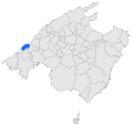
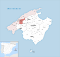
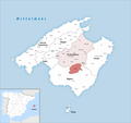
- Maps of Calvià (5 F)
P
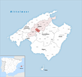
- Maps of Pollença (6 F)
Media in category "Locator maps of municipalities of Mallorca"
The following 152 files are in this category, out of 152 total.
-
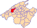
 Localització d'Alaró respecte de Mallorca.svg 440 × 413; 528 KB
-
 Localització d'Alaró.png 231 × 179; 4 KB
-
 Karte Gemeinde Alaró 2022.png 3,000 × 2,820; 822 KB
-
 Localització d'Alcúdia respecte de Mallorca.svg 440 × 413; 528 KB
-
 Localització d'Alcúdia.png 231 × 179; 4 KB
-
 Karte Gemeinde Alcúdia 2022.png 3,000 × 2,820; 821 KB
-
 Karte Gemeinde Algaida 2022.png 3,000 × 2,820; 825 KB
-
 Localització d'Algaida respecte de Mallorca.svg 440 × 413; 528 KB
-
 Localització d'Algaida.png 231 × 179; 4 KB
-
 Karte Gemeinde Andratx 2022.png 3,000 × 2,820; 822 KB
-
 Localització d'Andratx respecte de Mallorca.svg 440 × 413; 528 KB
-
 Localització d'Andratx.png 231 × 179; 4 KB
-
 Karte Gemeinde Ariany 2022.png 3,000 × 2,820; 825 KB
-
 Localització d'Ariany respecte de Mallorca.svg 440 × 413; 528 KB
-
 Localització d'Ariany.png 231 × 179; 4 KB
-
 Localització d'Artà respecte de Mallorca.svg 440 × 413; 528 KB
-
 Localització d'Artà.png 231 × 179; 4 KB
-
 Karte Gemeinde Artà 2022.png 3,000 × 2,820; 821 KB
-
 Karte Gemeinde Banyalbufar 2022.png 3,000 × 2,820; 823 KB
-
 Localització de Banyalbufar respecte de Mallorca.svg 440 × 413; 528 KB
-
 Localització de Banyalbufar.png 231 × 179; 4 KB
-
 Karte Gemeinde Binissalem 2022.png 3,000 × 2,820; 822 KB
-
 Localització de Binissalem respecte de Mallorca.svg 440 × 413; 528 KB
-
 Localització de Binissalem.png 231 × 179; 4 KB
-
 Localització de Búger respecte de Mallorca.svg 440 × 413; 528 KB
-
 Localització de Búger.png 231 × 179; 4 KB
-
 Karte Gemeinde Bunyola 2022.png 3,000 × 2,820; 823 KB
-
 Localització de Bunyola respecte de Mallorca.svg 440 × 413; 528 KB
-
 Localització de Bunyola.png 231 × 179; 4 KB
-
 Karte Gemeinde Búger 2022.png 3,000 × 2,820; 822 KB
-
 Karte Gemeinde Calvià 2022.png 3,000 × 2,820; 823 KB
-
 Karte Gemeinde Campanet 2022.png 3,000 × 2,820; 822 KB
-
 Localització de Campanet respecte de Mallorca.svg 440 × 413; 528 KB
-
 Localització de Campanet.png 231 × 179; 4 KB
-
 Karte Gemeinde Campos 2022.png 3,000 × 2,820; 818 KB
-
 Localització de Campos respecte de Mallorca.svg 440 × 413; 528 KB
-
 Localització de Campos.png 231 × 179; 4 KB
-
 Karte Gemeinde Capdepera 2022.png 3,000 × 2,820; 821 KB
-
 Localització de Capdepera respecte de Mallorca.svg 440 × 413; 528 KB
-
 Localització de Capdepera.png 231 × 179; 4 KB
-
 Karte Gemeinde Consell 2022.png 3,000 × 2,820; 822 KB
-
 Localització de Consell respecte de Mallorca.svg 440 × 413; 528 KB
-
 Localització de Consell.png 231 × 179; 4 KB
-
 Karte Gemeinde Costitx 2022.png 3,000 × 2,820; 825 KB
-
 Localització de Costitx respecte de Mallorca.svg 440 × 413; 528 KB
-
 Localització de Costitx.png 231 × 179; 4 KB
-
 Localització de Deià respecte de Mallorca.svg 440 × 413; 528 KB
-
 Localització de Deià.png 231 × 179; 4 KB
-
 Karte Gemeinde Deià 2022.png 3,000 × 2,820; 822 KB
-
 Karte Gemeinde Escorca 2022.png 3,000 × 2,820; 822 KB
-
 Localització d'Escorca respecte de Mallorca.svg 440 × 413; 528 KB
-
 Localització d'Escorca.png 231 × 179; 4 KB
-
 Karte Gemeinde Esporles 2022.png 3,000 × 2,820; 823 KB
-
 Localització d'Esporles respecte de Mallorca.svg 440 × 413; 528 KB
-
 Localització d'Esporles.png 231 × 179; 4 KB
-
 Karte Gemeinde Estellencs 2022.png 3,000 × 2,820; 823 KB
-
 Localització d'Estellencs respecte de Mallorca.svg 440 × 413; 528 KB
-
 Localització d'Estellencs.png 231 × 179; 4 KB
-
 Karte Gemeinde Felanitx 2022.png 3,000 × 2,820; 818 KB
-
 Localització de Felanitx respecte de Mallorca.svg 440 × 413; 528 KB
-
 Localització de Felanitx.png 231 × 179; 4 KB
-
 Karte Gemeinde Fornalutx 2022.png 3,000 × 2,820; 823 KB
-
 Localització de Fornalutx respecte de Mallorca.svg 440 × 413; 528 KB
-
 Localització de Fornalutx.png 231 × 179; 4 KB
-
 Karte Gemeinde Inca 2022.png 3,000 × 2,820; 822 KB
-
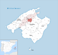
 Localització d'Inca respecte de Mallorca.svg 440 × 413; 528 KB
-
 Localització d'Inca.png 231 × 179; 4 KB
-
 Karte Gemeinde Lloret de Vistalegre 2022.png 3,000 × 2,820; 825 KB
-
 Localització de Lloret de Vistalegre respecte de Mallorca.svg 440 × 413; 528 KB
-
 Localització de Lloret de Vistalegre.png 231 × 179; 4 KB
-
 Karte Gemeinde Lloseta 2022.png 3,000 × 2,820; 822 KB
-
 Localització de Lloseta respecte de Mallorca.svg 440 × 413; 528 KB
-
 Localització de Lloseta.png 231 × 179; 4 KB
-
 Localització de Llubí respecte de Mallorca.svg 440 × 413; 528 KB
-
 Localització de Llubí.png 231 × 179; 4 KB
-
 Karte Gemeinde Llubí 2022.png 3,000 × 2,820; 825 KB
-
 Karte Gemeinde Llucmajor 2022.png 3,000 × 2,820; 817 KB
-
 Localització de Llucmajor respecte de Mallorca.svg 440 × 413; 528 KB
-
 Localització de Llucmajor.png 231 × 179; 4 KB
-
 Karte Gemeinde Manacor 2022.png 3,000 × 2,820; 820 KB
-
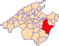
 Localització de Manacor respecte de Mallorca.svg 440 × 413; 528 KB
-
 Localització de Manacor.png 231 × 179; 4 KB
-
 Karte Gemeinde Mancor de la Vall 2022.png 3,000 × 2,820; 822 KB
-
 Localització de Mancor de la Vall respecte de Mallorca.svg 440 × 413; 528 KB
-
 Localització de Mancor de la Vall.png 231 × 179; 4 KB
-
 Karte Gemeinde Maria de la Salut 2022.png 3,000 × 2,820; 825 KB
-
 Localització de Maria de la Salut respecte de Mallorca.svg 440 × 413; 528 KB
-
 Localització de Maria de la Salut.png 231 × 179; 4 KB
-
 Localització de Marratxí respecte de Mallorca.svg 440 × 413; 528 KB
-
 Localització de Marratxí.png 231 × 179; 4 KB
-
 Karte Gemeinde Marratxí 2022.png 3,000 × 2,820; 822 KB
-
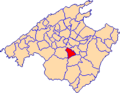
 Localització de Montuïri respecte de Mallorca.svg 440 × 413; 528 KB
-
 Localització de Montuïri.png 231 × 179; 4 KB
-
 Karte Gemeinde Montuïri 2022.png 3,000 × 2,820; 825 KB
-
 Karte Gemeinde Muro 2022.png 3,000 × 2,820; 824 KB
-
 Localització de Muro respecte de Mallorca.svg 440 × 413; 528 KB
-
 Localització de Muro.png 231 × 179; 4 KB
-
 Karte Gemeinde Petra 2022.png 3,000 × 2,820; 825 KB
-
 Localització de Petra respecte de Mallorca.svg 440 × 413; 528 KB
-
 Localització de Petra.png 231 × 179; 4 KB
-
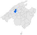
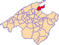
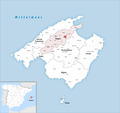
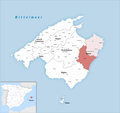
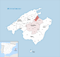
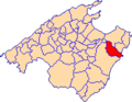
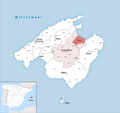
 Localització de Pollença respecte de Mallorca.svg 440 × 413; 528 KB
-
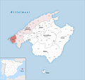
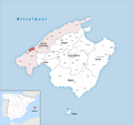
 Localització de Pollença.png 231 × 179; 4 KB
-
 Karte Gemeinde Porreres 2022.png 3,000 × 2,820; 824 KB
-
 Localització de Porreres respecte de Mallorca.svg 440 × 413; 528 KB
-
 Localització de Porreres.png 231 × 179; 4 KB
-
 Karte Gemeinde Puigpunyent 2022.png 3,000 × 2,820; 823 KB
-
 Localització de Puigpunyent respecte de Mallorca.svg 440 × 413; 528 KB
-
 Localització de Puigpunyent.png 231 × 179; 4 KB
-
 Karte Gemeinde Sa Pobla 2022.png 3,000 × 2,820; 822 KB
-
 Localització de sa Pobla respecte de Mallorca.svg 440 × 413; 528 KB
-
 Localització de sa Pobla.png 231 × 179; 4 KB
-
 Karte Gemeinde Sant Joan 2022.png 3,000 × 2,820; 825 KB
-
 Localització de Sant Joan respecte de Mallorca.svg 440 × 413; 528 KB
-
 Localització de Sant Joan.png 231 × 179; 4 KB
-
 Localització de Sant Llorenç des Cardassar respecte de Mallorca.svg 440 × 413; 528 KB
-
 Localització de Sant Llorenç des Cardassar.png 231 × 179; 4 KB
-
 Karte Gemeinde Sant Llorenç des Cardassar 2022.png 3,000 × 2,820; 821 KB
-
 Localització de Santa Eugènia respecte de Mallorca.svg 440 × 413; 528 KB
-
 Localització de Santa Eugènia.png 231 × 179; 4 KB
-
 Karte Gemeinde Santa Eugènia 2022.png 3,000 × 2,820; 825 KB
-
 Karte Gemeinde Santa Margalida 2022.png 3,000 × 2,820; 825 KB
-
 Localització de Santa Margalida respecte de Mallorca.svg 440 × 413; 528 KB
-
 Localització de Santa Margalida.png 231 × 179; 4 KB
-
 Localització de Santa Maria del Camí respecte de Mallorca.svg 440 × 413; 528 KB
-
 Localització de Santa Maria del Camí.png 231 × 179; 4 KB
-
 Karte Gemeinde Santa Maria del Camí 2022.png 3,000 × 2,820; 822 KB
-
 Localització de Santanyí respecte de Mallorca.svg 440 × 413; 528 KB
-
 Localització de Santanyí.png 231 × 179; 4 KB
-
 Karte Gemeinde Santanyí 2022.png 3,000 × 2,820; 818 KB
-
 Karte Gemeinde Selva 2022.png 3,000 × 2,820; 822 KB
-
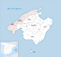
 Localització de Selva respecte de Mallorca.svg 440 × 413; 528 KB
-
 Localització de Selva.png 231 × 179; 4 KB
-
 Karte Gemeinde Sencelles 2022.png 3,000 × 2,820; 825 KB
-
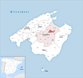
 Localització de Sencelles respecte de Mallorca.svg 440 × 413; 528 KB
-
 Localització de Sencelles.png 231 × 179; 4 KB
-
 Karte Gemeinde Ses Salines 2022.png 3,000 × 2,820; 818 KB
-
 Localització de ses Salines respecte de Mallorca.svg 440 × 413; 528 KB
-
 Localització de Ses Salines.png 231 × 179; 4 KB
-
 Karte Gemeinde Sineu 2022.png 3,000 × 2,820; 825 KB
-
 Localització de Sineu respecte de Mallorca.svg 440 × 413; 528 KB
-
 Localització de Sineu.png 231 × 179; 4 KB
-
 Localització de Sóller respecte de Mallorca.svg 440 × 413; 528 KB
-
 Localització de Sóller.png 231 × 179; 4 KB
-
 Karte Gemeinde Son Servera 2022.png 3,000 × 2,820; 821 KB
-
 Localització de Son Servera respecte de Mallorca.svg 440 × 413; 528 KB
-
 Localització de Son Servera.png 231 × 179; 4 KB
-
 Karte Gemeinde Valldemossa 2022.png 3,000 × 2,820; 823 KB
-
 Localització de Valldemossa respecte de Mallorca.svg 440 × 413; 528 KB
-
 Localització de Valldemossa.png 231 × 179; 4 KB
-
 Karte Gemeinde Vilafranca de Bonany 2022.png 3,000 × 2,820; 825 KB
-
 Localització de Vilafranca de Bonany respecte de Mallorca.svg 440 × 413; 528 KB
-
 Localització de Vilafranca de Bonany.png 231 × 179; 4 KB


