Category:Locator maps of districts of Sulawesi
Jump to navigation
Jump to search
Subcategories
This category has only the following subcategory.
Media in category "Locator maps of districts of Sulawesi"
The following 18 files are in this category, out of 18 total.
-
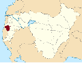 Bajeng Barat District location Map.svg 6,888 × 5,227; 2.75 MB
-
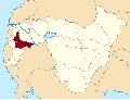 Bajeng District location Map.svg 6,888 × 5,227; 2.74 MB
-
 Barombong District location Map.svg 6,888 × 5,227; 2.74 MB
-
 Biringbulu District location Map.svg 6,888 × 5,227; 2.73 MB
-
 Bontolempangan District location Map.svg 6,888 × 5,227; 2.74 MB
-
 Bontomarannu District location Map.svg 6,888 × 5,227; 2.74 MB
-
 Bontonompo District location Map.svg 6,888 × 5,227; 2.74 MB
-
 Bontonompo Selatan District location Map.svg 6,888 × 5,227; 2.74 MB
-
 Bungaya District location Map.svg 6,888 × 5,227; 2.73 MB
-
 Manuju District location Map.svg 6,888 × 5,227; 2.74 MB
-
 Parangloe District location Map.svg 6,888 × 5,227; 2.73 MB
-
 Parigi District location Map.svg 6,888 × 5,227; 2.74 MB
-
 Pattallassang District location Map.svg 6,888 × 5,227; 2.74 MB
-
 Somba Opu District location Map.svg 1,602 × 1,216; 4.65 MB
-
 Tinggimoncong District location Map.svg 6,888 × 5,227; 2.74 MB
-
 Tombolo Pao District location Map.png 6,888 × 5,227; 2.02 MB
-
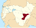
 Tombolo Pao District location Map.svg 6,888 × 5,227; 2.73 MB
-
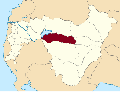
 Tompobulu District location Map.svg 6,888 × 5,227; 2.73 MB


