Category:Lemington
Jump to navigation
Jump to search
area in Newcastle upon Tyne, UK  | |||||
| Upload media | |||||
| Instance of | |||||
|---|---|---|---|---|---|
| Location | Newcastle upon Tyne, Tyne and Wear, North East England, England | ||||
| Different from | |||||
 | |||||
Subcategories
This category has the following 3 subcategories, out of 3 total.
H
L
- Lemington Power Station (7 F)
Media in category "Lemington"
The following 41 files are in this category, out of 41 total.
-

-
 Caroline Terrace - geograph.org.uk - 3372873.jpg 4,752 × 3,168; 5.7 MB
-
 Church of St George, Lemington - geograph.org.uk - 1985848.jpg 1,024 × 768; 143 KB
-
 Construction site, South Stella, Blaydon - geograph.org.uk - 3343428.jpg 1,024 × 641; 218 KB
-
 Cromwell Ford Way, South Stella, Blaydon - geograph.org.uk - 3343346.jpg 1,024 × 768; 194 KB
-
 Cromwell Ford Way, South Stella, Blaydon - geograph.org.uk - 3397142.jpg 1,024 × 768; 182 KB
-
 Cycle track beside Lemington Road - geograph.org.uk - 3442291.jpg 640 × 480; 107 KB
-
 Footbridge over the A1 - geograph.org.uk - 1038640.jpg 640 × 480; 98 KB
-
 Haugh Lane - geograph.org.uk - 3434537.jpg 800 × 620; 79 KB
-
 King Oswald Drive, Stella South, Blaydon - geograph.org.uk - 3343317.jpg 1,024 × 768; 221 KB
-
 Lemingon Glassworks Cone - geograph.org.uk - 3372895.jpg 4,752 × 3,168; 5.66 MB
-
 Lemington Methodist Church - geograph.org.uk - 1989046.jpg 862 × 1,024; 208 KB
-
 Lemington Methodist Church - geograph.org.uk - 613653.jpg 640 × 480; 63 KB
-
 Lemington Road (A6085) - geograph.org.uk - 3442289.jpg 640 × 480; 82 KB
-
 New houses at Addison - geograph.org.uk - 3372885.jpg 4,752 × 3,168; 4.72 MB
-
 Newburn Riverside - geograph.org.uk - 3372863.jpg 4,752 × 3,168; 7.19 MB
-
 Newburn Riverside - geograph.org.uk - 3372892.jpg 4,752 × 3,168; 6.32 MB
-
 Newburn Riverside Path and Cycleway - geograph.org.uk - 3340459.jpg 4,000 × 3,000; 4.96 MB
-
 Newcastle By-pass - geograph.org.uk - 1038636.jpg 640 × 480; 79 KB
-
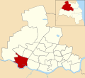 Newcastle upon Tyne UK ward map highlighting Lemington.svg 1,425 × 1,305; 245 KB
-
 Outfall into the River Tyne at Stella - geograph.org.uk - 3340626.jpg 3,889 × 2,847; 3.51 MB
-
 Path Head Watermill - geograph.org.uk - 3356787.jpg 3,072 × 2,304; 2.85 MB
-
 Path Head Watermill - geograph.org.uk - 3356791.jpg 3,072 × 2,304; 2.46 MB
-
 River Tyne, Cromwell - geograph.org.uk - 3340634.jpg 4,000 × 3,000; 4.93 MB
-
 Route of Towneley Main Waggonway - geograph.org.uk - 3445628.jpg 640 × 480; 155 KB
-
 Ryton Haugh - geograph.org.uk - 3343436.jpg 1,024 × 768; 288 KB
-
 Sailing Club, Lemington - geograph.org.uk - 362587.jpg 640 × 480; 106 KB
-
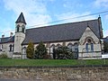 St. George's R.C. Church, Bells Close. - geograph.org.uk - 359857.jpg 640 × 480; 103 KB
-
 Stella - new housing on the Riverside - geograph.org.uk - 3372890.jpg 4,752 × 3,168; 4.55 MB
-
 Stella Hall Drive, Stella - geograph.org.uk - 3434535.jpg 640 × 481; 58 KB
-
 Stella Park - geograph.org.uk - 3372875.jpg 4,752 × 3,168; 5.06 MB
-

-
 Stella South housing development, Blaydon - geograph.org.uk - 3343353.jpg 1,024 × 644; 196 KB
-
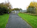
 The Hadrian's Wall Path at Lemington - geograph.org.uk - 3495438.jpg 2,592 × 1,944; 2.06 MB
-
 The Hadrian's Wall Path beside the A6085 - geograph.org.uk - 3495443.jpg 2,592 × 1,944; 1.39 MB
-
 The River Tyne near Blaydon - geograph.org.uk - 3434533.jpg 640 × 554; 62 KB
-
 The Vallum east of Sugley Dene (2) - geograph.org.uk - 1725040.jpg 640 × 480; 77 KB
-
 The Vallum east of Sugley Dene (5) - geograph.org.uk - 1725043.jpg 640 × 480; 70 KB
-
 The Vallum east of Sugley Dene (6) - geograph.org.uk - 1725050.jpg 640 × 480; 84 KB
-
 The Vallum east of Sugley Dene (7) - geograph.org.uk - 1725053.jpg 640 × 480; 84 KB
-
 Winlaton seen from the Tyne riverside - geograph.org.uk - 3372869.jpg 4,752 × 3,168; 5.02 MB


_-_geograph.org.uk_-_3442289.jpg)


_-_geograph.org.uk_-_1725040.jpg)
_-_geograph.org.uk_-_1725043.jpg)
_-_geograph.org.uk_-_1725050.jpg)
_-_geograph.org.uk_-_1725053.jpg)
