Category:Kalverstraat 98, Amsterdam
Jump to navigation
Jump to search
| Object location | | View all coordinates using: OpenStreetMap |
|---|
 | |||||
| Upload media | |||||
| Instance of |
| ||||
|---|---|---|---|---|---|
| Location | Amsterdam, North Holland, Netherlands | ||||
| Street address |
| ||||
| Located on street | |||||
| Heritage designation |
| ||||
 | |||||
|
This is a category about rijksmonument number 2155
|
| Address |
|
Media in category "Kalverstraat 98, Amsterdam"
The following 5 files are in this category, out of 5 total.
-
 George Hendrik Breitner, Afb 010104000119.jpg 3,150 × 4,003; 1.76 MB
-
 Overzicht Kalverstraat 94-108 - Amsterdam - 20014296 - RCE.jpg 950 × 1,200; 179 KB
-
 RM2155 Kalverstraat 98.jpg 2,448 × 3,264; 1.99 MB
-
 RM2157 Kalverstraat 104-106.jpg 2,448 × 3,264; 1.7 MB
-
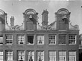 Topgevels - Amsterdam - 20020586 - RCE.jpg 1,200 × 894; 230 KB


