Category:Kaiserstraße 36 (Frankfurt am Main)
Jump to navigation
Jump to search
| Object location | | View all coordinates using: OpenStreetMap |
|---|
Media in category "Kaiserstraße 36 (Frankfurt am Main)"
The following 4 files are in this category, out of 4 total.
-
 Frankfurt Kaiserstraße 36.20130310.jpg 3,600 × 3,219; 5.53 MB
-
 Frankfurt-Bahnhofsviertel, Haus Kaiserstraße 36.jpg 2,655 × 4,193; 4.04 MB
-
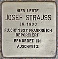
 Stolperstein für Josef Strauss (Frankfurt (Main)).jpg 2,904 × 2,894; 3.24 MB
-
 Stolperstein für Josef Strauss (Frankfurt am Main).jpg 3,353 × 3,403; 3.43 MB


).jpg)
.jpg)
Categories:
- Built in Frankfurt am Main in 1895
- Buildings in Frankfurt am Main
- Buildings in Frankfurt-Bahnhofsviertel
- Gothic Revival architecture in Frankfurt-Bahnhofsviertel
- Neo-Renaissance architecture in Frankfurt-Bahnhofsviertel
- Kaiserstraße, Frankfurt
- Cultural heritage monuments in Frankfurt-Bahnhofsviertel
- Stolpersteinlage in Frankfurt-Bahnhofsviertel