Category:Kaiserbrunnen (Bad Homburg vor der Höhe)
Jump to navigation
Jump to search
| Camera location | | View all coordinates using: OpenStreetMap |
|---|
Media in category "Kaiserbrunnen (Bad Homburg vor der Höhe)"
The following 2 files are in this category, out of 2 total.
-
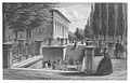 (GASPEY) p45 DER KAISERBRUNNEN.jpg 2,074 × 1,339; 2.04 MB
-
 Kaiserbrunnen Bad Homburg.jpg 4,731 × 2,721; 3.95 MB
_p45_DER_KAISERBRUNNEN.jpg)
