Category:Inchnadamph
Jump to navigation
Jump to search
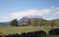
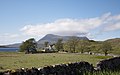
English: Inchnadamph is a hamlet in Assynt, Sutherland, Scotland. The name is an anglicisation of the Gaelic name Innis nan Damh meaning 'meadow of the stags'. Assynt is a remote area with a low population density and Inchnadamph contains a few houses, a lodge and a hotel.
Nederlands: Inchnadamph ( Schots-Gaelisch:Innis nan Damh) is een gehucht in het westen van het traditionele graafschap Sutherland, bestuurlijke regio Highland, Schotland ongeveer 15 kilometer ten oosten van Lochinver. De naam Inchnadamph is afkomstig van het Gaelische Innis nan Damh wat weide van de mannetjes herten betekent.
human settlement in Highland, Scotland, UK   | |||||
| Upload media | |||||
| Instance of | |||||
|---|---|---|---|---|---|
| Location |
| ||||
 | |||||
Subcategories
This category has the following 4 subcategories, out of 4 total.
B
- Bone Caves (12 F)
G
- Glas Bheinn, Assynt (19 F)
I
- Inchnadamph Old Church (8 F)
L
- Loch Awe, Highland (14 F)
Media in category "Inchnadamph"
The following 133 files are in this category, out of 133 total.
-
 19th century crushing stone. - geograph.org.uk - 738860.jpg 640 × 480; 521 KB
-
 2011 Schotland Inchnadamph en Quinag 2-06-2011 17-31-21.png 2,914 × 1,821; 7.62 MB
-
 2011 Sutherland Inchnadamph en Quinag 2-06-2011 17-31-21.jpg 2,914 × 1,821; 889 KB
-
 A rough shelter - geograph.org.uk - 1253070.jpg 640 × 424; 108 KB
-
 Allt nan Uamh and Canisp - geograph.org.uk - 822917.jpg 427 × 640; 83 KB
-
 Assynt Church Info Board Inchnadamph Scotland Jul14 DSC 5271.jpg 4,641 × 3,086; 7.48 MB
-
 Assyntian Unconformity2.jpg 2,736 × 3,648; 2.8 MB
-
 Assyntian Unconformity3.JPG 2,736 × 3,648; 2.34 MB
-
 Beach and bog near Torr an Eilein - geograph.org.uk - 827844.jpg 640 × 480; 107 KB
-
 Bealach na h-Uidhe - geograph.org.uk - 1253305.jpg 640 × 424; 104 KB
-
 Bealach Traligill - geograph.org.uk - 158717.jpg 640 × 447; 99 KB
-
 Ben Peach at Inchnadamph.png 187 × 198; 17 KB
-
 By the A837 - geograph.org.uk - 738589.jpg 640 × 456; 415 KB
-
 Creag nan Uamh - geograph.org.uk - 25740.jpg 640 × 426; 103 KB
-
 Cuil Dubh (The Black Corner) - geograph.org.uk - 523083.jpg 640 × 480; 93 KB
-
 Dubh Loch Mor - geograph.org.uk - 158705.jpg 640 × 474; 141 KB
-
 Eas a'Chual Aluinn - geograph.org.uk - 450466.jpg 640 × 427; 108 KB
-
 Inchnadamph - geograph.org.uk - 1826.jpg 557 × 412; 55 KB
-
 Inchnadamph - geograph.org.uk - 823078.jpg 640 × 427; 244 KB
-
 Inchnadamph - geograph.org.uk - 823281.jpg 640 × 427; 241 KB
-
 Inchnadamph - geograph.org.uk - 825055.jpg 640 × 427; 252 KB
-
 Inchnadamph Hotel - geograph.org.uk - 823069.jpg 640 × 427; 289 KB
-
 Inchnadamph Kirk and Stronchrubie Cliff - geograph.org.uk - 823083.jpg 640 × 427; 265 KB
-
 Inchnadamph Loch Assynt geograph-3199910-by-Ben-Brooksbank.jpg 646 × 419; 308 KB
-
 Inchnadamph Lodge - geograph.org.uk - 823087.jpg 640 × 427; 254 KB
-
 Inchnadamph Lodge - geograph.org.uk - 935212.jpg 640 × 360; 48 KB
-
 Inchnadamph.jpg 2,592 × 1,944; 1.03 MB
-
 Lewisian-Torridonian Unconformity - geograph.org.uk - 9020.jpg 640 × 421; 275 KB
-
 Loch Assynt - geograph.org.uk - 252017.jpg 629 × 408; 22 KB
-
 Loch Assynt from Cnoc an Lochain Fheoir - geograph.org.uk - 546799.jpg 640 × 427; 218 KB
-
 Lower Traligill Cave - geograph.org.uk - 830709.jpg 427 × 640; 296 KB
-
 Moraines - geograph.org.uk - 825043.jpg 640 × 427; 283 KB
-

-
 Old boat at sunset - geograph.org.uk - 2450.jpg 572 × 430; 129 KB
-
 Ordnance Survey One-Inch Sheet 13 Loch Inver & Loch Assynt, Published 1959.jpg 7,750 × 9,218; 10.28 MB
-
 Ordnance Survey One-Inch Sheet 15 Lochinver & Loch Assynt, Published 1947.jpg 12,196 × 9,283; 11.15 MB
-
 Path to Inchnadamph - geograph.org.uk - 820433.jpg 640 × 480; 149 KB
-
 Peach Horne PC.png 784 × 588; 309 KB
-
 Peach-Horne Monument, Inchnadmaph.jpg 1,944 × 2,592; 1.61 MB
-
 Remote Coire - geograph.org.uk - 158712.jpg 640 × 466; 142 KB
-
 River Loanan Crossing - geograph.org.uk - 425194.jpg 640 × 426; 155 KB
-
 Rocky ground beside Loch Assynt - geograph.org.uk - 5996946.jpg 1,600 × 978; 321 KB
-
 Scotland Inchnadamph Assynt Hatchery.jpg 2,125 × 1,700; 3.1 MB
-
 Southern End of Loch Assynt - geograph.org.uk - 157081.jpg 640 × 480; 82 KB
-
 Steep slopes of Beinn an Fhurain - geograph.org.uk - 158671.jpg 640 × 455; 132 KB
-
 The Head of Loch Assynt - geograph.org.uk - 822931.jpg 640 × 427; 245 KB
-
 Track Near Assynt Hatchery - geograph.org.uk - 193502.jpg 640 × 480; 115 KB
-
 Westerly wind, hardy roadside tree Inchnadamph. - panoramio.jpg 3,241 × 4,302; 5.06 MB
-
 A bay on Loch Assynt - geograph.org.uk - 663869.jpg 1,000 × 668; 282 KB
-
 Above Allt nan Uamh - geograph.org.uk - 822865.jpg 427 × 640; 312 KB
-
 Above Loch Mhaolach-coire - geograph.org.uk - 1510399.jpg 640 × 480; 69 KB
-
 Achmore Farm - geograph.org.uk - 568320.jpg 640 × 480; 91 KB
-

-
 Active Erosion - geograph.org.uk - 822867.jpg 427 × 640; 294 KB
-
 Aird Breac - geograph.org.uk - 233914.jpg 640 × 480; 76 KB
-
 Airigh a' Bhealaich - geograph.org.uk - 819485.jpg 640 × 480; 151 KB
-
 Allt an Dubh Loch' Mhoir - geograph.org.uk - 819447.jpg 640 × 480; 147 KB
-
 Allt Mhic Mhurchaidh Gheir - geograph.org.uk - 425203.jpg 640 × 426; 188 KB
-
 Allt nan Uamh - geograph.org.uk - 822859.jpg 640 × 427; 256 KB
-
 Allt nan Uamh - geograph.org.uk - 822870.jpg 640 × 427; 271 KB
-
 Am Bealach - geograph.org.uk - 819460.jpg 640 × 480; 153 KB
-
 An odd shaped mound - geograph.org.uk - 67115.jpg 640 × 480; 109 KB
-
 Approaching Breabag over the moorland - geograph.org.uk - 825430.jpg 640 × 480; 98 KB
-
 Approaching the ridge north of Conival - geograph.org.uk - 755069.jpg 1,000 × 666; 1.08 MB
-
 Assynt Hatchery - geograph.org.uk - 189882.jpg 480 × 640; 90 KB
-
 Assynt Moorland - geograph.org.uk - 847587.jpg 640 × 480; 90 KB
-
 Assynt mountain burn - geograph.org.uk - 187831.jpg 640 × 480; 107 KB
-
 Assynt valley view - geograph.org.uk - 188351.jpg 640 × 480; 97 KB
-
 Bealach Trallgil - geograph.org.uk - 819472.jpg 640 × 480; 170 KB
-
 Beinn an Fhurain from Cnoc nan Uamh - geograph.org.uk - 831038.jpg 640 × 427; 218 KB
-
 Beinn nan Cnaimhseag from Cnoc nan Uamh - geograph.org.uk - 831047.jpg 640 × 427; 202 KB
-
 Ben More Assynt - Conival track - geograph.org.uk - 1509871.jpg 640 × 480; 76 KB
-

-
 Bowl in limestone plateau - geograph.org.uk - 523414.jpg 640 × 480; 84 KB
-
 Bridge over the Ledbeg river. - geograph.org.uk - 228757.jpg 640 × 426; 56 KB
-
 By the A837 - geograph.org.uk - 738558.jpg 640 × 457; 450 KB
-
 Chambered Cairn - geograph.org.uk - 523057.jpg 640 × 480; 110 KB
-
 Cnoc Eilid Mhathain - geograph.org.uk - 523340.jpg 640 × 480; 81 KB
-
 Cnoc Eilid Mhathain - geograph.org.uk - 523358.jpg 640 × 480; 113 KB
-
 Coire a' Mhadaidh - geograph.org.uk - 158685.jpg 640 × 461; 148 KB
-
 Col west of Beinn nan Cnaimhseag - geograph.org.uk - 523386.jpg 640 × 480; 70 KB
-
 Conival approaches - geograph.org.uk - 755062.jpg 640 × 404; 80 KB
-
 Creag Sron Chrùbaidh - geograph.org.uk - 193503.jpg 640 × 480; 91 KB
-
 Down into Gleann Dubh - geograph.org.uk - 158690.jpg 640 × 486; 107 KB
-
 Dry River Bed of the Allt nan Uamh - geograph.org.uk - 722797.jpg 640 × 426; 226 KB
-
 Fuaran Allt nan Uamh - geograph.org.uk - 759515.jpg 640 × 495; 133 KB
-
 Glacial Erratic - geograph.org.uk - 523104.jpg 640 × 480; 109 KB
-
 Gleann Dubh - geograph.org.uk - 158666.jpg 640 × 436; 103 KB
-
 Gleann Dubh - geograph.org.uk - 3013.jpg 503 × 304; 122 KB
-
 Gleann Dubh - geograph.org.uk - 755059.jpg 1,000 × 669; 880 KB
-
 Glencoul - geograph.org.uk - 189615.jpg 640 × 480; 136 KB
-

-
 Heading into Gleann Dubh - geograph.org.uk - 158718.jpg 640 × 474; 128 KB
-

-
 Inchnadamph flats - geograph.org.uk - 196127.jpg 640 × 425; 64 KB
-
 Inchnadamph Lodge - geograph.org.uk - 9034.jpg 640 × 382; 229 KB
-
 Leathad Mhic Mhurchaidh Gheir - geograph.org.uk - 425200.jpg 640 × 426; 156 KB
-
 Leaving the glen - geograph.org.uk - 755065.jpg 1,000 × 665; 1.05 MB
-
 Loch Mhaolach-coire - geograph.org.uk - 523072.jpg 640 × 480; 84 KB
-
 Lochan - geograph.org.uk - 523596.jpg 640 × 480; 71 KB
-
 Lochan Below the Bealach na h-Uidhe - geograph.org.uk - 189900.jpg 640 × 384; 57 KB
-
 Lochan Feoir from Creag Sgiathaig - geograph.org.uk - 549280.jpg 640 × 427; 84 KB
-

-
 Looking towards Achmore Farm - geograph.org.uk - 513331.jpg 640 × 480; 180 KB
-
 Meallan Mhurchaidh - geograph.org.uk - 425284.jpg 640 × 426; 139 KB
-
 Path Bend - geograph.org.uk - 193129.jpg 640 × 480; 107 KB
-
 Path Between Two Lochans - geograph.org.uk - 189917.jpg 640 × 480; 127 KB
-
 Path to the caves - geograph.org.uk - 523064.jpg 640 × 480; 101 KB
-

-
 Pool - geograph.org.uk - 523369.jpg 640 × 480; 100 KB
-
 Pot hole waterfalls by Inchnadamph - geograph.org.uk - 110328.jpg 640 × 480; 293 KB
-

-
 Remote lochain on Conival - geograph.org.uk - 187847.jpg 640 × 469; 77 KB
-
 River Traligill - geograph.org.uk - 158720.jpg 640 × 429; 118 KB
-
 River Traligill - geograph.org.uk - 189891.jpg 640 × 480; 73 KB
-
 Rocks in Assynt - geograph.org.uk - 203235.jpg 640 × 480; 94 KB
-
 SE ridge of Beinn Uidhe - geograph.org.uk - 429433.jpg 640 × 480; 116 KB
-

-
 Sink hole - geograph.org.uk - 33941.jpg 424 × 640; 103 KB
-
 Sink Hole - geograph.org.uk - 523093.jpg 640 × 480; 103 KB
-
 Sink Hole - geograph.org.uk - 523398.jpg 640 × 480; 107 KB
-
 Sink Hole - geograph.org.uk - 523635.jpg 640 × 480; 80 KB
-
 Small Lochan, Beinn Uidhe - geograph.org.uk - 189539.jpg 640 × 480; 131 KB
-
 Stalkers' Track, Glen Coul - geograph.org.uk - 193138.jpg 640 × 480; 112 KB
-
 Stalkers' Track. Glencoul - geograph.org.uk - 189618.jpg 640 × 480; 111 KB
-
 Sunset at Loch nan Caorach - geograph.org.uk - 605084.jpg 640 × 423; 96 KB
-
 The lane to Ledbeg. - geograph.org.uk - 228755.jpg 640 × 426; 65 KB
-
 The road to Inchnadamph - geograph.org.uk - 582862.jpg 640 × 428; 67 KB
-
 Traligill River - geograph.org.uk - 3014.jpg 459 × 327; 149 KB
-
 Tributary of Allt Sgiathaig - geograph.org.uk - 189519.jpg 480 × 640; 88 KB
-

-
-
 West shore of Loch nan Cuaran - geograph.org.uk - 429426.jpg 640 × 480; 112 KB


_-_geograph.org.uk_-_523083.jpg)


