Category:Images by Mike W Hallett
Jump to navigation
Jump to search

Media in category "Images by Mike W Hallett"
The following 160 files are in this category, out of 160 total.
-
 11 Miles to Leicester - geograph.org.uk - 1431447.jpg 480 × 640; 262 KB
-
 12 Miles to Leicester - geograph.org.uk - 1431440.jpg 480 × 640; 261 KB
-
 16 Miles to Leicester - geograph.org.uk - 1431451.jpg 361 × 640; 200 KB
-
 17 Miles to Braunston - geograph.org.uk - 1431491.jpg 480 × 640; 237 KB
-
 17 Miles to Leicester - geograph.org.uk - 1431454.jpg 480 × 640; 241 KB
-
 18 Miles to Braunston - geograph.org.uk - 1431500.jpg 480 × 640; 255 KB
-
 25 Miles to Braunston - geograph.org.uk - 1388028.jpg 480 × 640; 257 KB
-
 26 Miles to Braunston - geograph.org.uk - 1388007.jpg 480 × 640; 267 KB
-
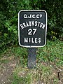 27 Miles to Braunston - geograph.org.uk - 1387979.jpg 480 × 640; 250 KB
-
 28 Miles to Braunston - geograph.org.uk - 1387963.jpg 480 × 640; 278 KB
-
 40 Miles to Braunston - geograph.org.uk - 1354226.jpg 480 × 640; 121 KB
-
 41 Miles to Braunston - geograph.org.uk - 1354578.jpg 480 × 640; 111 KB
-
 43 Miles to Braunston - geograph.org.uk - 1354509.jpg 480 × 640; 144 KB
-
 44 Miles to Braunston - geograph.org.uk - 1354478.jpg 480 × 640; 107 KB
-
 45 Miles to Braunston - geograph.org.uk - 1354454.jpg 480 × 640; 108 KB
-
 47 Miles to Braunston - geograph.org.uk - 1354373.jpg 480 × 640; 113 KB
-
 57 Miles to Braunston - geograph.org.uk - 1448181.jpg 480 × 640; 257 KB
-
 58 Miles to Braunston - geograph.org.uk - 1448174.jpg 480 × 640; 242 KB
-
 59 Miles to Braunston - geograph.org.uk - 1448171.jpg 480 × 640; 236 KB
-
 60 Miles to Braunston - geograph.org.uk - 1448169.jpg 480 × 640; 271 KB
-
 61 Miles to Braunston - geograph.org.uk - 1448164.jpg 480 × 640; 244 KB
-
 62 Miles to Braunston - geograph.org.uk - 1448159.jpg 480 × 640; 255 KB
-
 63 Miles to Braunston - geograph.org.uk - 1448154.jpg 480 × 640; 246 KB
-
 77 Miles to Braunston - geograph.org.uk - 1354723.jpg 480 × 640; 143 KB
-
 78 Miles to Braunston - geograph.org.uk - 1354818.jpg 480 × 640; 139 KB
-
 79 Miles to Braunston - geograph.org.uk - 1354794.jpg 480 × 640; 135 KB
-
 A1198 Ermine Way - geograph.org.uk - 1471247.jpg 640 × 480; 226 KB
-
 St Michael and All Angels Church - geograph.org.uk - 1387939.jpg 640 × 480; 193 KB
-
 Allotments on the Cambridge Road - geograph.org.uk - 1452344.jpg 640 × 480; 241 KB
-
 Barkway village sign and pond - geograph.org.uk - 1380716.jpg 480 × 640; 135 KB
-
 War graves in Bassingbourn Cemetery - geograph.org.uk - 1349359.jpg 640 × 480; 103 KB
-
 Bassingbourn village sign - geograph.org.uk - 1349350.jpg 480 × 640; 99 KB
-
 Beckington Motors - geograph.org.uk - 1528215.jpg 640 × 480; 121 KB
-
 Benchmark on Cambridge 8 milestone (geograph 7088346).jpg 768 × 1,024; 513 KB
-
 Benchmark on milestone 41 (geograph 7086985).jpg 768 × 1,024; 473 KB
-
 Benchmark on Milestone 44 (geograph 7088360).jpg 768 × 1,024; 393 KB
-
 Benchmark on Milestone 46 (geograph 7089001).jpg 768 × 1,024; 527 KB
-
 Benchmark on Milestone 50 (geograph 7088307).jpg 768 × 1,024; 686 KB
-
 Benchmark on Sawston milestone 48 (geograph 7090214).jpg 768 × 1,024; 465 KB
-
 Benchmark on Trinity Milestone 5 (geograph 7088397).jpg 768 × 1,024; 458 KB
-
 Bluebells - geograph.org.uk - 1398861.jpg 640 × 480; 199 KB
-
 Bridge 63 - geograph.org.uk - 1388049.jpg 640 × 480; 213 KB
-
 Building at Bury Farm - geograph.org.uk - 1380736.jpg 480 × 640; 121 KB
-
 Canal Bridge 102 - geograph.org.uk - 1354618.jpg 640 × 480; 101 KB
-
 Canal Milepost on the Ashby Canal - geograph.org.uk - 1344417.jpg 480 × 640; 134 KB
-
 Chain Walk - geograph.org.uk - 1507956.jpg 480 × 640; 268 KB
-
 Chain Walk - geograph.org.uk - 1507979.jpg 480 × 640; 205 KB
-

-
 Congerstone War Memorial - geograph.org.uk - 1344422.jpg 480 × 640; 126 KB
-
 Croxton Aqueduct - geograph.org.uk - 1388172.jpg 640 × 480; 125 KB
-
 Disused chalk pit - geograph.org.uk - 1507994.jpg 640 × 480; 218 KB
-

-
 Disused swing bridge - geograph.org.uk - 1354424.jpg 640 × 480; 101 KB
-

-

-
 George IV - geograph.org.uk - 1387869.jpg 640 × 480; 225 KB
-
 Glasshouses on the Old North Road - geograph.org.uk - 1349338.jpg 640 × 480; 96 KB
-
 Godmanchester Cemetery - geograph.org.uk - 1452355.jpg 640 × 361; 174 KB
-
 Grand Union Canal Milepost (geograph 6934520).jpg 768 × 1,024; 261 KB
-
 Grantham Canal Milestone (geograph 6648759).jpg 1,200 × 1,600; 546 KB
-
 Grantham Canal Milestone (geograph 6648818).jpg 768 × 1,024; 302 KB
-
 Grantham Canal Milestone (geograph 6648913).jpg 768 × 1,024; 300 KB
-
 Grantham Canal Milestone (geograph 6648924).jpg 768 × 1,024; 220 KB
-
 Grantham Canal Milestone (geograph 6652185).jpg 768 × 1,024; 199 KB
-
 Grantham Canal Milestone 15 (geograph 6648766).jpg 1,200 × 1,600; 504 KB
-
 Grantham Canal Milestone 16 (geograph 6648808).jpg 768 × 1,024; 325 KB
-
 Grantham Canal Milestone 18 (geograph 6648830).jpg 768 × 1,024; 252 KB
-
 Grantham Canal Milestone 20 (geograph 6648845).jpg 768 × 1,024; 215 KB
-
 St James's Church, Croxton, Cambs - geograph.org.uk - 1473187.jpg 640 × 480; 262 KB
-
 Keeper's Office at Brookfoot Lock - geograph.org.uk - 1537534.jpg 640 × 480; 215 KB
-
 Kibworth Top Lock - geograph.org.uk - 1416511.jpg 640 × 480; 201 KB
-
 Kings Ride - geograph.org.uk - 1447932.jpg 640 × 480; 229 KB
-
 Leeds and Liverpool Canal Milepost (geograph 6649212).jpg 768 × 1,024; 325 KB
-
 Lifting Bridge at Rothersthorpe Lock 13 - geograph.org.uk - 1430197.jpg 640 × 480; 200 KB
-
-
 Little Chef - geograph.org.uk - 1508005.jpg 640 × 480; 219 KB
-
 Little Venice - geograph.org.uk - 1473158.jpg 640 × 480; 249 KB
-
 Lock Keeper's Cottage - geograph.org.uk - 1398875.jpg 640 × 480; 248 KB
-
 Lockkeeper's cottage at Brick Lock - geograph.org.uk - 1377068.jpg 640 × 480; 130 KB
-
 Lockkeeper's Cottage at Lock 76 - geograph.org.uk - 1477155.jpg 640 × 361; 186 KB
-
 Lockkeeper's Cottage at Newton Top Lock - geograph.org.uk - 1416519.jpg 640 × 480; 236 KB
-
 Lockkeeper's Cottage at North Grove Lock - geograph.org.uk - 1477163.jpg 640 × 361; 194 KB
-
 Macclesfield Canal Milestone (geograph 6648962).jpg 768 × 1,024; 351 KB
-
 Macclesfield Canal Milestone (geograph 6648981).jpg 768 × 1,024; 289 KB
-
 Macclesfield Canal Milestone (geograph 6649004).jpg 768 × 1,024; 339 KB
-
 Milepost 10 on the Ashby Canal - geograph.org.uk - 1431482.jpg 480 × 640; 247 KB
-
 Milepost 14 on the Ashby Canal - geograph.org.uk - 1344443.jpg 480 × 640; 142 KB
-
 Milepost 15 on the Ashby Canal - geograph.org.uk - 1344434.jpg 480 × 640; 139 KB
-
 Milepost 20 on the Grand Union Canal - geograph.org.uk - 1349377.jpg 480 × 640; 133 KB
-
 Milepost 22 on the Grand Union Canal - geograph.org.uk - 1349382.jpg 480 × 640; 132 KB
-
 Milepost 23 on the Grand Union Canal - geograph.org.uk - 1349386.jpg 480 × 640; 128 KB
-
 Milepost 24 on the Grand Union Canal - geograph.org.uk - 1349390.jpg 480 × 640; 146 KB
-
 Milepost 39 on the Grand Union Canal - geograph.org.uk - 1354237.jpg 480 × 640; 118 KB
-
 Milepost 6 on the Ashby Canal - geograph.org.uk - 1431466.jpg 480 × 640; 257 KB
-
 Milepost 7 on the Ashby Canal - geograph.org.uk - 1431470.jpg 480 × 640; 253 KB
-
 Milepost 8 on the Ashby Canal - geograph.org.uk - 1431476.jpg 480 × 640; 265 KB
-
 Milepost on the Trent and Mersey Canal - geograph.org.uk - 1388148.jpg 480 × 640; 120 KB
-
 Milestone 40 miles from London - geograph.org.uk - 1349332.jpg 480 × 640; 114 KB
-
 Missing benchmark on Royston milestone (geograph 7088593).jpg 768 × 1,024; 516 KB
-
 Monkswood Retail Park - geograph.org.uk - 1537917.jpg 640 × 361; 140 KB
-
 New Cambridge House - geograph.org.uk - 1477142.jpg 640 × 480; 242 KB
-
 New canal bridge - geograph.org.uk - 1354352.jpg 640 × 480; 104 KB
-
 Northern Engine House at Marsworth Lock - geograph.org.uk - 1404044.jpg 640 × 361; 186 KB
-
 Northern Engine House at Seabrook Lock - geograph.org.uk - 1404030.jpg 640 × 480; 232 KB
-
 Not the real thing^ - geograph.org.uk - 1354394.jpg 480 × 640; 142 KB
-
 Old Swing Bridge - geograph.org.uk - 1354533.jpg 640 × 480; 103 KB
-
 OS Benchmark 650 - geograph.org.uk - 1349393.jpg 480 × 640; 127 KB
-
 OS Benchmark on Fairfield Bridge - geograph.org.uk - 1344429.jpg 480 × 640; 126 KB
-
 Plinston Retail Park - geograph.org.uk - 1447922.jpg 640 × 361; 159 KB
-
 Reconstruction in Leys Avenue - geograph.org.uk - 1537912.jpg 640 × 480; 245 KB
-
 Reed village sign - geograph.org.uk - 1388081.jpg 480 × 640; 124 KB
-
 Reservoir behind Grange Farm - geograph.org.uk - 1436074.jpg 640 × 361; 174 KB
-
 Royston Leisure Centre - geograph.org.uk - 1430685.jpg 640 × 361; 151 KB
-
 Sandon Village Pond - geograph.org.uk - 1507904.jpg 640 × 480; 236 KB
-
 Sandon Village Sign - geograph.org.uk - 1507918.jpg 480 × 640; 216 KB
-
 St Neots FC football ground - geograph.org.uk - 1473176.jpg 640 × 361; 146 KB
-
 Steeple Morden village sign - geograph.org.uk - 1387891.jpg 480 × 640; 225 KB
-
 Stoke Hammond Lock - geograph.org.uk - 1354558.jpg 640 × 480; 112 KB
-
 Tapps Garden Centre - geograph.org.uk - 1481426.jpg 640 × 361; 168 KB
-
 The A1(M) Motorway - geograph.org.uk - 1349178.jpg 640 × 480; 108 KB
-
 The British Queen - geograph.org.uk - 1404007.jpg 640 × 480; 232 KB
-
 The Brook - geograph.org.uk - 1349369.jpg 640 × 480; 105 KB
-
 The busy A14 trunk road - geograph.org.uk - 1528155.jpg 640 × 480; 221 KB
-
 The busy A14 trunk road - geograph.org.uk - 1528168.jpg 640 × 480; 221 KB
-
 The Cambridge Motel - geograph.org.uk - 1447941.jpg 640 × 361; 152 KB
-
 The Chequers - geograph.org.uk - 1404019.jpg 640 × 480; 210 KB
-
 The Crown - geograph.org.uk - 1387914.jpg 640 × 480; 201 KB
-
 The Dry Ski Run at Bassingbourn Barracks - geograph.org.uk - 1354182.jpg 640 × 480; 106 KB
-
 The Duke of Wellington - geograph.org.uk - 1404040.jpg 640 × 480; 211 KB
-
 The George and Dragon at Graveley - geograph.org.uk - 1349206.jpg 640 × 480; 106 KB
-
 The Hoops - geograph.org.uk - 1349363.jpg 640 × 480; 98 KB
-
 The North Star and Old North Road - geograph.org.uk - 1444759.jpg 640 × 338; 181 KB
-
 The Old White Horse - geograph.org.uk - 1447918.jpg 640 × 480; 237 KB
-
 The Pear Tree, Bassingbourn - geograph.org.uk - 1354201.jpg 640 × 480; 105 KB
-
 The Red Admiral - geograph.org.uk - 1430171.jpg 640 × 480; 224 KB
-
 The Waggon and Horses at Graveley - geograph.org.uk - 1349193.jpg 640 × 480; 106 KB
-
 The White Rose Hotel - geograph.org.uk - 1537527.jpg 640 × 480; 213 KB
-
 Therfield First School - geograph.org.uk - 1507940.jpg 640 × 480; 256 KB
-

-
 Trent and Mersey Canal Milepost - geograph.org.uk - 1388161.jpg 480 × 640; 128 KB
-
 Trent and Mersey Canal Milepost - geograph.org.uk - 1388182.jpg 480 × 640; 140 KB
-
 Trent and Mersey Canal Milepost - geograph.org.uk - 1388189.jpg 480 × 640; 133 KB
-
 Tuddenham St. Mary village sign - geograph.org.uk - 1388101.jpg 480 × 640; 116 KB
-
 Turnover Bridge near to Gayton Junction - geograph.org.uk - 1430214.jpg 640 × 480; 235 KB
-
 Tythorne Bridge - geograph.org.uk - 1416524.jpg 640 × 480; 223 KB
-
 Wallington Village Hall - geograph.org.uk - 1507887.jpg 640 × 480; 244 KB
-
 Weir on the River Great Ouse - geograph.org.uk - 1377086.jpg 640 × 480; 104 KB
-
 Wellhead Springs - geograph.org.uk - 1349344.jpg 480 × 640; 106 KB
-
 Widening the A1 Great North Road - geograph.org.uk - 1537530.jpg 640 × 480; 204 KB
-
 Willmott Recreation Ground and Pavilion - geograph.org.uk - 1406013.jpg 640 × 361; 158 KB
-
 Wireless Station Park - geograph.org.uk - 1443079.jpg 640 × 361; 141 KB
-
 Ashby Canal - geograph.org.uk - 1430184.jpg 640 × 480; 264 KB
-
 Ashwell Road fork - geograph.org.uk - 1494893.jpg 640 × 480; 178 KB
-
 Ashwell Street - geograph.org.uk - 1494872.jpg 480 × 640; 216 KB
-
 Barkway Street - geograph.org.uk - 1444773.jpg 640 × 480; 244 KB
-
 Biggleswade Retail Park - geograph.org.uk - 1447902.jpg 640 × 361; 145 KB
-
 Bridge over the River Cam - geograph.org.uk - 1471251.jpg 640 × 361; 174 KB
-
 Byway 22 - geograph.org.uk - 1436097.jpg 480 × 640; 251 KB
-
 Chalk conveyor - geograph.org.uk - 1477150.jpg 640 × 480; 231 KB
-
 Chalk Pit on the County Boundary - geograph.org.uk - 1406001.jpg 640 × 480; 236 KB


.jpg)
.jpg)
.jpg)
.jpg)
.jpg)
.jpg)
.jpg)


.jpg)
.jpg)
.jpg)
.jpg)
.jpg)
.jpg)
.jpg)
.jpg)
.jpg)
.jpg)


.jpg)


.jpg)
.jpg)
.jpg)


.jpg)


_Motorway_-_geograph.org.uk_-_1349178.jpg)


