Category:Ilôt Bosquet, Grimentz
Jump to navigation
Jump to search
| Object location | | View all coordinates using: OpenStreetMap |
|---|
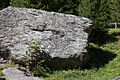
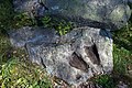
archaeological site in Grimentz in the canton of Valais, Switzerland  | |||||
| Upload media | |||||
| Instance of | |||||
|---|---|---|---|---|---|
| Part of | |||||
| Location | Grimentz, Anniviers, Sierre District, Valais, Switzerland | ||||
| Heritage designation | |||||
 | |||||
Media in category "Ilôt Bosquet, Grimentz"
The following 7 files are in this category, out of 7 total.
-
 Grimentz-pierre-00.jpg 2,000 × 1,333; 3.16 MB
-
 Grimentz-pierre-01.jpg 2,000 × 1,333; 3.6 MB
-
 Grimentz-pierre-02.jpg 2,000 × 1,333; 3.4 MB
-
 Grimentz-pierre-03-BF.jpg 2,000 × 1,333; 3.42 MB
-
 Grimentz-pierre-04-05.jpg 1,333 × 2,000; 3.05 MB
-
 Grimentz-pierre-04.jpg 1,333 × 2,000; 3.27 MB
-
 Grimentz-pierre-06.jpg 2,000 × 1,333; 3.33 MB


