Category:Huish Champflower
Jump to navigation
Jump to search
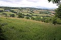
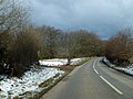
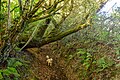
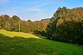
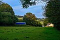
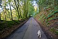
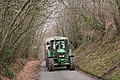
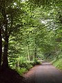
English: Huish Champflower is a village and civil parish in Somerset, England, three miles north-west of Wiveliscombe and ten miles north of Wellington. It has a population of 240 (Census 2001).
village and civil parish in Somerset, England, UK  | |||||
| Upload media | |||||
| Instance of | |||||
|---|---|---|---|---|---|
| Location | Somerset West and Taunton, Somerset, South West England, England | ||||
| Population |
| ||||
 | |||||
Subcategories
This category has only the following subcategory.
Media in category "Huish Champflower"
The following 200 files are in this category, out of 217 total.
(previous page) (next page)-
 A lone fisherman on Clatworthy Reservoir - geograph.org.uk - 4188986.jpg 1,024 × 768; 181 KB
-
 Abandoned glasshouse - geograph.org.uk - 3907621.jpg 1,024 × 768; 273 KB
-
 Barn on the Brendon Hills - geograph.org.uk - 1983305.jpg 480 × 640; 103 KB
-
 Barn, near Foxglove Farm - geograph.org.uk - 3890940.jpg 1,024 × 768; 184 KB
-
 Barn, on the B3190 - geograph.org.uk - 3890888.jpg 1,024 × 768; 204 KB
-
 Beverton Farm - geograph.org.uk - 3891132.jpg 1,024 × 768; 230 KB
-
 Cattle near Coombe Park - geograph.org.uk - 1957557.jpg 640 × 429; 95 KB
-
 Chitcombe Rocks Lane - geograph.org.uk - 4243721.jpg 1,024 × 768; 305 KB
-
 Cleeve Cottage - geograph.org.uk - 3907589.jpg 1,024 × 768; 160 KB
-
 Common Lane, Huish Cleeve - geograph.org.uk - 1956488.jpg 640 × 480; 106 KB
-
 Cottage and church, Huish Champflower - geograph.org.uk - 2143942.jpg 1,024 × 768; 160 KB
-
 Cottages, Huish Champflower - geograph.org.uk - 2143926.jpg 1,024 × 768; 140 KB
-
 Farm buildings, off Brown Lane - geograph.org.uk - 4243691.jpg 1,024 × 768; 254 KB
-
 Field on Potter's Knap - geograph.org.uk - 1957794.jpg 640 × 424; 92 KB
-
 Field with ponds near Winters Cross - geograph.org.uk - 1957742.jpg 640 × 447; 94 KB
-
 Flint Cross - geograph.org.uk - 2286445.jpg 1,024 × 768; 166 KB
-
 Footpath at Beverton Pond - geograph.org.uk - 3369128.jpg 1,024 × 768; 160 KB
-
 Ford and footbridge, below Stolford Wood - geograph.org.uk - 4189014.jpg 1,024 × 758; 251 KB
-
 Gauth House, Huish Champflower, OS Cut Benchmark - geograph.org.uk - 6571039.jpg 768 × 1,024; 275 KB
-
 Gauth House, Huish Champflower, OS Cut Benchmark - geograph.org.uk - 6571043.jpg 768 × 1,024; 231 KB
-
 Grazing sheep, Paddock's Farm - geograph.org.uk - 3716168.jpg 1,024 × 768; 200 KB
-
 Hairpin on Holland's Lane - geograph.org.uk - 1956433.jpg 640 × 480; 106 KB
-
 Holland's Lane - geograph.org.uk - 1956312.jpg 487 × 640; 116 KB
-
 Holland's Lane - geograph.org.uk - 4243765.jpg 1,024 × 750; 307 KB
-
 House on Chitcombe Rocks Lane - geograph.org.uk - 4243697.jpg 1,024 × 768; 187 KB
-
 Huish Champflower , Challick Lane - geograph.org.uk - 6282285.jpg 6,000 × 4,000; 7.89 MB
-
 Huish Champflower , Challick Lane - geograph.org.uk - 6282286.jpg 6,000 × 4,000; 6.18 MB
-
 Huish Champflower , Common Lane - geograph.org.uk - 6282336.jpg 6,000 × 4,000; 7.57 MB
-
 Huish Champflower , Common Lane - geograph.org.uk - 6282338.jpg 6,000 × 4,000; 5.74 MB
-
 Huish Champflower , Common Lane - geograph.org.uk - 6282340.jpg 6,000 × 4,000; 6.69 MB
-
 Huish Champflower , Common Lane - geograph.org.uk - 6282343.jpg 4,000 × 6,000; 6.53 MB
-
 Huish Champflower , Common Lane - geograph.org.uk - 6282347.jpg 6,000 × 4,000; 6.77 MB
-
 Huish Champflower , Common Lane - geograph.org.uk - 6282348.jpg 4,000 × 6,000; 7.86 MB
-
 Huish Champflower , Common Lane - geograph.org.uk - 6282351.jpg 6,000 × 4,000; 5.95 MB
-
 Huish Champflower , Common Lane - geograph.org.uk - 6282352.jpg 4,000 × 6,000; 6.59 MB
-
 Huish Champflower , Country Lane - geograph.org.uk - 6282834.jpg 6,000 × 4,000; 6.79 MB
-
 Huish Champflower , Countryside Scenery - geograph.org.uk - 6282363.jpg 6,000 × 4,000; 6.96 MB
-
 Huish Champflower , Farm Track - geograph.org.uk - 6282766.jpg 6,000 × 4,000; 7.11 MB
-
 Huish Champflower , Farm Track - geograph.org.uk - 6282821.jpg 6,000 × 4,000; 6.37 MB
-
 Huish Champflower , Gate - geograph.org.uk - 6282331.jpg 6,000 × 4,000; 7.55 MB
-
 Huish Champflower , Grassy Field - geograph.org.uk - 6282299.jpg 6,000 × 4,000; 7.12 MB
-
 Huish Champflower , Grassy Field - geograph.org.uk - 6282365.jpg 6,000 × 4,000; 6.98 MB
-
 Huish Champflower , Grassy Field - geograph.org.uk - 6282769.jpg 6,000 × 4,000; 7.77 MB
-
 Huish Champflower , Grassy Field - geograph.org.uk - 6282776.jpg 6,000 × 4,000; 6.05 MB
-
 Huish Champflower , Grassy Field - geograph.org.uk - 6282790.jpg 6,000 × 4,000; 6.16 MB
-
 Huish Champflower , Grassy Field - geograph.org.uk - 6282793.jpg 6,000 × 4,000; 4.79 MB
-
 Huish Champflower , Grassy Field - geograph.org.uk - 6282797.jpg 6,000 × 4,000; 7.07 MB
-
 Huish Champflower , Grassy Field - geograph.org.uk - 6282803.jpg 6,000 × 4,000; 7.42 MB
-
 Huish Champflower , Grassy Field - geograph.org.uk - 6282805.jpg 6,000 × 4,000; 6.26 MB
-
 Huish Champflower , Grassy Field - geograph.org.uk - 6282808.jpg 6,000 × 4,000; 6.6 MB
-
 Huish Champflower , Grassy Field ^ Cattle - geograph.org.uk - 6282786.jpg 6,000 × 4,000; 6.48 MB
-
 Huish Champflower , Grassy Field ^ Sheep - geograph.org.uk - 6282353.jpg 6,000 × 4,000; 5.99 MB
-
 Huish Champflower , Grassy Field ^ Sheep - geograph.org.uk - 6282359.jpg 6,000 × 4,000; 5.82 MB
-
 Huish Champflower , Grassy Field ^ Sheep - geograph.org.uk - 6282770.jpg 6,000 × 4,000; 5.66 MB
-
 Huish Champflower , Grassy Field ^ Stile - geograph.org.uk - 6282350.jpg 6,000 × 4,000; 5.84 MB
-
 Huish Champflower , Grassy Footpath - geograph.org.uk - 6282287.jpg 6,000 × 4,000; 7.35 MB
-
 Huish Champflower , Grassy Track - geograph.org.uk - 6282298.jpg 6,000 × 4,000; 7.06 MB
-
 Huish Champflower , Hart's Path - geograph.org.uk - 6282319.jpg 6,000 × 4,000; 7.12 MB
-
 Huish Champflower , Huish Cleeve - geograph.org.uk - 6282316.jpg 6,000 × 4,000; 7.56 MB
-
 Huish Champflower , Huish Cleeve - geograph.org.uk - 6282317.jpg 6,000 × 4,000; 7.63 MB
-
 Huish Champflower , Huish Cleeve - geograph.org.uk - 6282819.jpg 6,000 × 4,000; 6.67 MB
-
 Huish Champflower , Paddocks Farm - geograph.org.uk - 6282334.jpg 6,000 × 4,000; 7.12 MB
-
 Huish Champflower , Tanner's Hill - geograph.org.uk - 6282811.jpg 6,000 × 4,000; 6.7 MB
-
 Huish Champflower , Tanner's Hill - geograph.org.uk - 6282813.jpg 6,000 × 4,000; 7.57 MB
-
 Huish Champflower , Tanner's Hill - geograph.org.uk - 6282817.jpg 4,000 × 6,000; 7.12 MB
-
 Huish Champflower , Tanner's Hill - geograph.org.uk - 6282825.jpg 6,000 × 4,000; 7.59 MB
-
 Huish Champflower , Washbuttle Mills - geograph.org.uk - 6282833.jpg 6,000 × 4,000; 5.9 MB
-
 Huish Champflower , Woodland - geograph.org.uk - 6282323.jpg 6,000 × 4,000; 6.37 MB
-
 Huish Champflower , Woodland - geograph.org.uk - 6282325.jpg 6,000 × 4,000; 6.85 MB
-
 Huish Champflower , Woodland - geograph.org.uk - 6282328.jpg 6,000 × 4,000; 6.96 MB
-
 Huish Champflower , Woodland Track - geograph.org.uk - 6282308.jpg 6,000 × 4,000; 7.07 MB
-
 Huish Champflower , Woodland Track - geograph.org.uk - 6282313.jpg 6,000 × 4,000; 5.81 MB
-
 Huish Champflower Barrow (geograph 3891125).jpg 1,024 × 768; 236 KB
-
 Huish Champflower Ford - geograph.org.uk - 5136045.jpg 1,440 × 960; 2.23 MB
-
 Huish Champflower, Church of St.Peter - geograph.org.uk - 5825353.jpg 683 × 1,024; 273 KB
-
 Huish Champflower, Flint Cross - geograph.org.uk - 158187.jpg 640 × 427; 150 KB
-

-

-
 Huish Champflower, lane at Huish Cleeve - geograph.org.uk - 158197.jpg 640 × 427; 201 KB
-
 Huish Champflower, near Coombe End - geograph.org.uk - 748392.jpg 640 × 427; 146 KB
-
 Huish Champflower, the village - geograph.org.uk - 181182.jpg 640 × 427; 188 KB
-
 Huish Champflower, wood at Potters Cross - geograph.org.uk - 158173.jpg 640 × 427; 232 KB
-
 Huish Cleeve - geograph.org.uk - 1956752.jpg 480 × 640; 133 KB
-
 Huish Cleeve - geograph.org.uk - 4354148.jpg 1,024 × 768; 247 KB
-
 Junction of Brown Lane and Syndercombe Lane - geograph.org.uk - 3891452.jpg 1,024 × 768; 255 KB
-
 Lane south of Winters Cross - geograph.org.uk - 1957761.jpg 640 × 480; 124 KB
-
 Lower Brown Farmyard - geograph.org.uk - 4243708.jpg 768 × 1,024; 225 KB
-
 Minor road to Huish Champflower - geograph.org.uk - 3716194.jpg 1,024 × 831; 306 KB
-
 Old farm machinery at Huish Champflower - geograph.org.uk - 4762975.jpg 3,456 × 2,304; 2.53 MB
-
 Old post office at Huish Champflower - geograph.org.uk - 4762976.jpg 3,456 × 2,304; 1.47 MB
-
 Potter's Cross - geograph.org.uk - 3543665.jpg 1,024 × 768; 185 KB
-
 Radio mast near Roborough Gate - geograph.org.uk - 3369118.jpg 1,024 × 768; 142 KB
-
 Radio station, on Brendon Hill - geograph.org.uk - 3891114.jpg 768 × 1,024; 222 KB
-

-

-
 St Peter's Church. Huish Champflower - geograph.org.uk - 4763430.jpg 3,456 × 2,304; 1.13 MB
-
 Syndercombe Lane - geograph.org.uk - 4243681.jpg 1,024 × 768; 375 KB
-
 Tanners - geograph.org.uk - 3907627.jpg 1,024 × 776; 260 KB
-
 The Tone Valley - geograph.org.uk - 2143906.jpg 640 × 480; 77 KB
-
 Tone valley - geograph.org.uk - 1956453.jpg 640 × 429; 81 KB
-
 Tone valley - geograph.org.uk - 1957435.jpg 640 × 482; 95 KB
-
 Track and gate near Winters Cross - geograph.org.uk - 1957581.jpg 640 × 410; 89 KB
-
 Track to East Withy Farm - geograph.org.uk - 3890951.jpg 1,024 × 768; 210 KB
-
 Track, Huish Cleeve - geograph.org.uk - 1956810.jpg 640 × 480; 129 KB
-
 Tree-lined lane - geograph.org.uk - 4243728.jpg 1,024 × 768; 312 KB
-
 Turning for Huish Cleeve - geograph.org.uk - 2143921.jpg 640 × 480; 102 KB
-
 Turning for Upton and Brendon Hill - geograph.org.uk - 2143944.jpg 1,024 × 768; 178 KB
-
 Valley below Huish Cleeve - geograph.org.uk - 1956837.jpg 640 × 480; 123 KB
-
 View towards Huish Cleeve - geograph.org.uk - 3716152.jpg 1,024 × 768; 181 KB
-
 View towards Lower and Higher Shute Farms - geograph.org.uk - 4354170.jpg 1,024 × 751; 125 KB
-
 Wellington and the Blackdown Hills - geograph.org.uk - 4295824.jpg 3,264 × 2,448; 3.59 MB
-
 West Somerset , Brendon Hill Radio Mast - geograph.org.uk - 4856186.jpg 4,000 × 6,000; 5.17 MB
-
 West Somerset , Brendon Hill Radio Mast - geograph.org.uk - 4856191.jpg 4,000 × 6,000; 4.97 MB
-
 West Somerset , Brendon Hill Radio Mast - geograph.org.uk - 4856192.jpg 6,000 × 4,000; 6.44 MB
-
 West Somerset , Brendon Hill Radio Mast - geograph.org.uk - 4856193.jpg 3,727 × 5,591; 6.64 MB
-
 West Somerset , Brown Lane - geograph.org.uk - 4856092.jpg 6,000 × 4,000; 6.45 MB
-
 West Somerset , Brown Lane - geograph.org.uk - 4856132.jpg 6,000 × 4,000; 6.87 MB
-
 West Somerset , Brown Lane - geograph.org.uk - 4856133.jpg 6,000 × 4,000; 6.51 MB
-
 West Somerset , Brown Lane - geograph.org.uk - 4856137.jpg 6,000 × 4,000; 6.68 MB
-
 West Somerset , Brown Lane - geograph.org.uk - 4856138.jpg 6,000 × 4,000; 7.34 MB
-
 West Somerset , Brown Lane - geograph.org.uk - 4856146.jpg 6,000 × 4,000; 6.81 MB
-
 West Somerset , Brown Lane - geograph.org.uk - 4856158.jpg 4,000 × 6,000; 7.44 MB
-
 West Somerset , Brown Lane - geograph.org.uk - 4856163.jpg 6,000 × 4,000; 6.69 MB
-
 West Somerset , Catford Farm - geograph.org.uk - 4172971.jpg 4,288 × 2,848; 5.96 MB
-
 West Somerset , Challick Lane - geograph.org.uk - 4172909.jpg 4,288 × 2,848; 6.25 MB
-
 West Somerset , Chitcombe Rocks Lane - geograph.org.uk - 4856164.jpg 6,000 × 4,000; 7.83 MB
-
 West Somerset , Clatworthy Reservoir - geograph.org.uk - 2868245.jpg 4,288 × 2,848; 5.8 MB
-
 West Somerset , Clatworthy Reservoir - geograph.org.uk - 2868274.jpg 4,288 × 2,848; 5.82 MB
-
 West Somerset , Clatworthy Reservoir - geograph.org.uk - 2868275.jpg 4,288 × 2,848; 6.29 MB
-
 West Somerset , Clatworthy Reservoir - geograph.org.uk - 2868277.jpg 4,288 × 2,848; 6.4 MB
-
 West Somerset , Clatworthy Reservoir Path - geograph.org.uk - 2868269.jpg 4,288 × 2,848; 6.15 MB
-
 West Somerset , Country Lane - geograph.org.uk - 4172914.jpg 4,288 × 2,848; 6.47 MB
-
 West Somerset , Country Lane - geograph.org.uk - 4172915.jpg 4,288 × 2,848; 5.61 MB
-
 West Somerset , Country Lane - geograph.org.uk - 4172920.jpg 4,288 × 2,848; 5.64 MB
-
 West Somerset , Country Lane - geograph.org.uk - 4172925.jpg 4,288 × 2,848; 6.23 MB
-
 West Somerset , Country Lane - geograph.org.uk - 4172938.jpg 4,288 × 2,848; 6.3 MB
-
 West Somerset , Country Lane - geograph.org.uk - 4172947.jpg 4,288 × 2,848; 6.4 MB
-
 West Somerset , Country Lane - geograph.org.uk - 4856098.jpg 6,000 × 4,000; 6.19 MB
-
 West Somerset , Countryside Scenery - geograph.org.uk - 4856023.jpg 6,000 × 4,000; 6.38 MB
-
 West Somerset , Countryside Scenery - geograph.org.uk - 4856065.jpg 6,000 × 4,000; 6.12 MB
-
 West Somerset , Countryside Scenery - geograph.org.uk - 4856071.jpg 5,511 × 3,674; 5.98 MB
-
 West Somerset , Countryside Scenery - geograph.org.uk - 4856089.jpg 6,000 × 4,000; 6.58 MB
-
 West Somerset , Countryside Scenery - geograph.org.uk - 4856135.jpg 6,000 × 4,000; 7.35 MB
-
 West Somerset , Countryside Scenery - geograph.org.uk - 4856172.jpg 6,000 × 4,000; 7.55 MB
-
 West Somerset , Countryside Scenery - geograph.org.uk - 4856179.jpg 6,000 × 4,000; 5.69 MB
-
 West Somerset , East Hayes Plantation - geograph.org.uk - 4172990.jpg 4,288 × 2,848; 6.49 MB
-
 West Somerset , East Withy Farm - geograph.org.uk - 4856028.jpg 6,000 × 4,000; 6.13 MB
-
 West Somerset , East Withy Farm - geograph.org.uk - 4856031.jpg 6,000 × 4,000; 6.26 MB
-
 West Somerset , East Withy Farm - geograph.org.uk - 4856125.jpg 6,000 × 4,000; 7.69 MB
-
 West Somerset , East Withy Farm Track - geograph.org.uk - 4856034.jpg 6,000 × 4,000; 5.95 MB
-
 West Somerset , Farm Track - geograph.org.uk - 4172930.jpg 4,288 × 2,848; 6.13 MB
-
 West Somerset , Farm Track - geograph.org.uk - 4172949.jpg 2,848 × 4,288; 7.07 MB
-
 West Somerset , Farm Track - geograph.org.uk - 4172953.jpg 4,288 × 2,848; 6.32 MB
-
 West Somerset , Farm Track - geograph.org.uk - 4172987.jpg 4,288 × 2,848; 6.2 MB
-
 West Somerset , Farm Track - geograph.org.uk - 4856021.jpg 6,000 × 4,000; 7.37 MB
-
 West Somerset , Farm Track - geograph.org.uk - 4856145.jpg 6,000 × 4,000; 6.52 MB
-
 West Somerset , Footpath ^ Gate - geograph.org.uk - 4856061.jpg 6,000 × 4,000; 6.89 MB
-
 West Somerset , Grassy Field - geograph.org.uk - 4856053.jpg 6,000 × 4,000; 7.57 MB
-
 West Somerset , Grassy Field - geograph.org.uk - 4856140.jpg 6,000 × 4,000; 7.11 MB
-
 West Somerset , Grassy Field - geograph.org.uk - 4856154.jpg 5,629 × 3,753; 6.39 MB
-
 West Somerset , Grassy Field - geograph.org.uk - 4856156.jpg 6,000 × 4,000; 5.76 MB
-
 West Somerset , Grassy Field - geograph.org.uk - 4856165.jpg 5,772 × 3,848; 5.82 MB
-
 West Somerset , Grassy Field - geograph.org.uk - 4856167.jpg 6,000 × 4,000; 7.73 MB
-
 West Somerset , Grassy Field - geograph.org.uk - 4856168.jpg 6,000 × 4,000; 6.74 MB
-
 West Somerset , Grassy Field - geograph.org.uk - 4856175.jpg 5,572 × 3,715; 5.94 MB
-
 West Somerset , Grassy Field - geograph.org.uk - 4856176.jpg 6,000 × 4,000; 5.8 MB
-
 West Somerset , Grassy Field - geograph.org.uk - 4856180.jpg 6,000 × 4,000; 6.57 MB
-
 West Somerset , Grassy Field - geograph.org.uk - 4856197.jpg 5,167 × 3,445; 6.79 MB
-
 West Somerset , Grassy Field ^ Gate - geograph.org.uk - 4856161.jpg 6,000 × 4,000; 6.76 MB
-
 West Somerset , Grassy Field ^ Gate - geograph.org.uk - 4856169.jpg 6,000 × 4,000; 7.31 MB
-
 West Somerset , Grassy Field ^ Gate - geograph.org.uk - 4856173.jpg 5,674 × 3,782; 6.32 MB
-
 West Somerset , Grassy Field ^ Path - geograph.org.uk - 4856047.jpg 6,000 × 4,000; 6.97 MB
-
 West Somerset , Grassy Field ^ Radio Mast - geograph.org.uk - 4856187.jpg 6,000 × 4,000; 7.36 MB
-
 West Somerset , Grassy Field ^ Sheep - geograph.org.uk - 4172935.jpg 4,288 × 2,848; 5.67 MB
-
 West Somerset , Grassy Field ^ Sheep - geograph.org.uk - 4856136.jpg 6,000 × 4,000; 7.09 MB
-
 West Somerset , Grassy Field ^ Sheep - geograph.org.uk - 4856159.jpg 5,648 × 3,765; 5.55 MB
-
 West Somerset , Grassy Field ^ Sheep - geograph.org.uk - 4856181.jpg 6,000 × 4,000; 7.35 MB
-
 West Somerset , Grassy Field ^ Sheep - geograph.org.uk - 4856189.jpg 6,000 × 4,000; 6.32 MB
-
 West Somerset , Grassy Field ^ Sheep - geograph.org.uk - 4856190.jpg 6,000 × 4,000; 7.19 MB
-
 West Somerset , Grassy Field ^ Trees - geograph.org.uk - 4856171.jpg 6,000 × 4,000; 6.38 MB
-
 West Somerset , Home Office Radio Station - geograph.org.uk - 4856195.jpg 6,000 × 4,000; 6.99 MB
-
 West Somerset , Middleton Lane - geograph.org.uk - 4856064.jpg 6,000 × 4,000; 7.6 MB
-
 West Somerset , Middleton Lane - geograph.org.uk - 4856067.jpg 6,000 × 4,000; 6.87 MB
-
 West Somerset , Middleton Lane - geograph.org.uk - 4856076.jpg 6,000 × 4,000; 6.88 MB
-
 West Somerset , Middleton Lane - geograph.org.uk - 4856122.jpg 4,000 × 6,000; 7.38 MB
-
 West Somerset , Middleton Lane - geograph.org.uk - 4856123.jpg 6,000 × 4,000; 6.82 MB
-
 West Somerset , Middleton Lane - geograph.org.uk - 4856128.jpg 4,000 × 6,000; 7.4 MB
-
 West Somerset , Middleton Lane - geograph.org.uk - 4856129.jpg 6,000 × 4,000; 7.3 MB
-
 West Somerset , Middleton Lodge - geograph.org.uk - 4856182.jpg 6,000 × 4,000; 6.86 MB
-
 West Somerset , Muddy Track - geograph.org.uk - 4856103.jpg 6,000 × 4,000; 7.21 MB
-
 West Somerset , Old Way - geograph.org.uk - 4172900.jpg 4,288 × 2,848; 6.14 MB
-
 West Somerset , Path around Clatworthy Reservoir - geograph.org.uk - 2868272.jpg 4,288 × 2,848; 6.39 MB
-
 West Somerset , Potters Cross - geograph.org.uk - 4172916.jpg 4,288 × 2,848; 6.72 MB
-
 West Somerset , Riding Paddock - geograph.org.uk - 4856039.jpg 6,000 × 4,000; 6.16 MB
-
 West Somerset , Sheep Grazing - geograph.org.uk - 4856188.jpg 6,000 × 4,000; 7 MB
-
 West Somerset , Small Stream - geograph.org.uk - 2868271.jpg 4,288 × 2,848; 6.34 MB
-
 West Somerset , Small Stream - geograph.org.uk - 4856050.jpg 4,000 × 6,000; 7.15 MB
-
 West Somerset , Small Stream - geograph.org.uk - 4856056.jpg 4,000 × 6,000; 7.29 MB
-
 West Somerset , Small Stream - geograph.org.uk - 4856059.jpg 6,000 × 4,000; 7.54 MB
-
 West Somerset , Small Stream ^ Gate - geograph.org.uk - 4856051.jpg 6,000 × 4,000; 6.93 MB


.jpg)


