Category:Houten Hoofd (Hoorn)
Jump to navigation
Jump to search
| Object location | | View all coordinates using: OpenStreetMap |
|---|
 | |||||
| Upload media | |||||
| Instance of | |||||
|---|---|---|---|---|---|
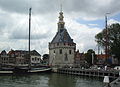
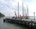
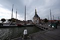
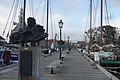
| Location | Hoorn, North Holland, Netherlands | ||||
| Street address |
| ||||
| Heritage designation |
| ||||
| Inception |
| ||||
 | |||||
|
This is a category about rijksmonument number 22413
|
| Address |
|
Media in category "Houten Hoofd (Hoorn)"
The following 21 files are in this category, out of 21 total.
-
 20180719 080 hoorn.jpg 6,000 × 4,000; 12.48 MB
-
 Aanzicht - Hoorn - 20115564 - RCE.jpg 884 × 1,200; 243 KB
-
 Aanzicht - Hoorn - 20115575 - RCE.jpg 797 × 1,200; 131 KB
-
 Achterzijde - Hoorn - 20115570 - RCE.jpg 1,200 × 946; 182 KB
-
 Achterzijde - Hoorn - 20115574 - RCE.jpg 940 × 1,200; 174 KB
-
 De hoofdtoren van hoorn vanaf de waterkant.jpg 1,200 × 1,600; 758 KB
-
 Exterieur - Hoorn - 20115546 - RCE.jpg 890 × 1,200; 164 KB
-
 Haven Hoorn met Hoofdtoren2.jpg 3,672 × 4,896; 1.07 MB
-
 Haven van Hoorn foto 9.JPG 3,456 × 4,608; 6.35 MB
-
 Hoofdtoren Hoorn.JPG 3,028 × 2,196; 1.55 MB
-
 Hoorn, Houten Hoofd.JPG 1,388 × 1,114; 242 KB
-
 Hoorn, Netherlands - panoramio - Ben Bender (1).jpg 4,896 × 3,264; 6.11 MB
-
 Hoorn, Netherlands - panoramio - Ben Bender (3).jpg 4,896 × 3,264; 4.92 MB
-
 Houten Hoofd vanuit Hoofdtoren, Hoorn.jpg 5,472 × 3,648; 4.91 MB
-
 Overzicht Houten Hoofd, Hoorn 01.jpg 5,472 × 3,648; 3.59 MB
-
 Overzicht Houten Hoofd, Hoorn 02.jpg 5,472 × 3,648; 6.13 MB
-
 Overzicht Houten Hoofd, Hoorn 03.jpg 5,472 × 3,648; 6.72 MB
-
 Overzicht Houten Hoofd, Hoorn 04.jpg 5,472 × 3,648; 3.01 MB
-
 Overzicht toren zeezijde - Hoorn - 20329044 - RCE.jpg 803 × 1,200; 158 KB
-
 Rijksmonument - Minke Wagenaar - 08-06-25 Zeildag 004.jpg 2,272 × 1,704; 1.85 MB
-
 Stadsarchief Amsterdam, Afb ANWT00151000001.jpg 5,873 × 4,249; 2.66 MB


.jpg)
.jpg)


