Category:Historical flag maps of the Netherlands
Jump to navigation
Jump to search
Media in category "Historical flag maps of the Netherlands"
The following 6 files are in this category, out of 6 total.
-
 Flag map of Batavian Republic.png 1,373 × 1,386; 39 KB
-
 Flag map of Belgium and the Netherlands (1830).png 464 × 635; 9 KB
-
 Flag map of Belgium and the Netherlands (1831).png 464 × 635; 9 KB
-
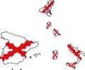 Flag map of Cross of Burgundy (1556).png 2,733 × 2,267; 75 KB
-
 Flag map of the Dutch Republic (1610).png 949 × 886; 12 KB
-
 Flag-map of the Netherlands (1815-1830).png 1,334 × 1,853; 25 KB

.png)
.png)
.png)
.png)
.png)