Category:Heybrook Bay
Jump to navigation
Jump to search
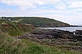
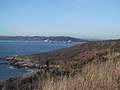
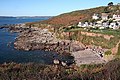
English: Heybrook Bay is a settlement in the civil parish of Wembury, in the South Hams district, in the county of Devon, England.
settlement in Devon, England | |||||
| Upload media | |||||
| Instance of | |||||
|---|---|---|---|---|---|
| Location | Wembury, South Hams, Devon, South West England, England | ||||
 | |||||
Media in category "Heybrook Bay"
The following 37 files are in this category, out of 37 total.
-
 Across Heybrook Bay - geograph.org.uk - 303222.jpg 640 × 428; 86 KB
-
 Bovisand , Crownhill Bay - geograph.org.uk - 3059672.jpg 4,288 × 2,848; 6.41 MB
-
 Coastline, Heybrook Bay - geograph.org.uk - 5610764.jpg 640 × 426; 75 KB
-
 Heybrook Bay , Beach Road - geograph.org.uk - 3055587.jpg 4,288 × 2,848; 6.77 MB
-
 Heybrook Bay , Beach Road - geograph.org.uk - 3055590.jpg 4,240 × 2,776; 5.3 MB
-
 Heybrook Bay , Coastal Settlement - geograph.org.uk - 3055580.jpg 4,288 × 2,848; 7 MB
-
 Heybrook Bay - geograph.org.uk - 1579489.jpg 640 × 480; 103 KB
-
 Heybrook Bay - geograph.org.uk - 2488215.jpg 1,024 × 768; 273 KB
-
 Heybrook Bay - geograph.org.uk - 31338.jpg 640 × 395; 101 KB
-
 Heybrook Bay - geograph.org.uk - 3903636.jpg 640 × 425; 86 KB
-
 Heybrook Bay - geograph.org.uk - 3903647.jpg 640 × 425; 68 KB
-
 Heybrook Bay - geograph.org.uk - 4870387.jpg 640 × 480; 71 KB
-
 Heybrook Bay - geograph.org.uk - 5109745.jpg 3,264 × 2,448; 3.35 MB
-
 Heybrook Bay - geograph.org.uk - 5498611.jpg 1,280 × 851; 379 KB
-
 Heybrook Bay - geograph.org.uk - 5610719.jpg 640 × 426; 80 KB
-
 Heybrook Bay - geograph.org.uk - 5610738.jpg 640 × 426; 84 KB
-
 Heybrook Bay - geograph.org.uk - 8455.jpg 640 × 480; 77 KB
-
 Heybrook Bay and Plymouth Sound.jpg 3,692 × 2,744; 2.52 MB
-
 Heybrook Bay SPS - geograph.org.uk - 5610748.jpg 640 × 426; 91 KB
-

-
-
 Heybrook Bay, out towards the Great Mewstone - geograph.org.uk - 5757412.jpg 1,600 × 1,200; 400 KB
-
 Heybrook Bay, Renney Rocks at high tide - geograph.org.uk - 5757394.jpg 4,128 × 3,096; 3.53 MB
-
 Heybrook Bay, rocky inlet - geograph.org.uk - 5757389.jpg 1,200 × 1,600; 771 KB
-
 Heybrook Bay, to Cornwall and Rame Head - geograph.org.uk - 5757420.jpg 4,128 × 3,096; 3.74 MB
-
 Heybrook Bay, to Renney Rocks - geograph.org.uk - 5757405.jpg 3,096 × 4,128; 4.06 MB
-
 Heybrook Bay, towards Rame Head, a Cornish headland - geograph.org.uk - 5757429.jpg 4,128 × 3,096; 3.74 MB
-
 Heybrook Bay, towards Renney Rocks - geograph.org.uk - 5757391.jpg 1,600 × 1,200; 614 KB
-
 Inlet - geograph.org.uk - 5610791.jpg 640 × 426; 92 KB
-
 Looking towards Heybrook Bay - geograph.org.uk - 3903610.jpg 640 × 425; 75 KB
-
 Offshore rocks - geograph.org.uk - 5611179.jpg 640 × 426; 74 KB
-
 South Hams , Bovisand Bay - geograph.org.uk - 3059736.jpg 4,288 × 2,848; 6.56 MB
-
 The Coast Path into Heybrook Bay - geograph.org.uk - 898672.jpg 640 × 427; 119 KB
-
 Wembury, approaching Heybrook Bay - geograph.org.uk - 613390.jpg 640 × 427; 230 KB
-
 Wembury, coast at Heybrook Bay - geograph.org.uk - 613394.jpg 640 × 427; 231 KB
-
 Wembury, Heybrook Bay - geograph.org.uk - 4077158.jpg 1,600 × 1,200; 667 KB
-
 Wembury, nearing Heybrook Bay - geograph.org.uk - 680446.jpg 640 × 427; 161 KB


