Category:Heriot (civil parish)
Jump to navigation
Jump to search
Scottish parish in Scottish Borders, Scotland, UK | |||||
| Upload media | |||||
| Instance of | |||||
|---|---|---|---|---|---|
| Part of |
| ||||
| Named after | |||||
| Location |
| ||||
| Population |
| ||||
| Area |
| ||||
 | |||||
Subcategories
This category has the following 4 subcategories, out of 4 total.
Media in category "Heriot (civil parish)"
The following 200 files are in this category, out of 554 total.
(previous page) (next page)-

-

-
 A forlorn hope, Heriot - geograph.org.uk - 6315987.jpg 1,600 × 1,060; 808 KB
-
 A house demolition at Stagebank - geograph.org.uk - 3671890.jpg 640 × 450; 159 KB
-
 A rough grazing field at Heriot - geograph.org.uk - 4787366.jpg 640 × 417; 162 KB
-
 A sign to nowhere - geograph.org.uk - 2077052.jpg 640 × 427; 136 KB
-
 A small bridge over the Gala Water - geograph.org.uk - 2077047.jpg 640 × 427; 157 KB
-
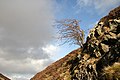 A small hawthorn tree - geograph.org.uk - 2269968.jpg 640 × 427; 162 KB
-

-

-
 A turbine at Carcant Wind Farm - geograph.org.uk - 2269984.jpg 640 × 417; 157 KB
-
 A7 Road Works - geograph.org.uk - 3793034.jpg 3,144 × 1,856; 956 KB
-
 A7, Falahill - geograph.org.uk - 3886018.jpg 640 × 480; 287 KB
-
 A7, Heriot - geograph.org.uk - 6503486.jpg 1,024 × 768; 223 KB
-
 A7, Stagebank - geograph.org.uk - 3716576.jpg 640 × 480; 288 KB
-
 Aerial on Broad Law - geograph.org.uk - 5508694.jpg 1,600 × 1,066; 244 KB
-
 An abandoned house at Falahill - geograph.org.uk - 3236789.jpg 640 × 480; 226 KB
-

-
 Another Moorfoots fank - geograph.org.uk - 1811823.jpg 640 × 480; 90 KB
-
 Ascending to the south of Wooly Law - geograph.org.uk - 1810450.jpg 640 × 480; 88 KB
-
 Autumn colours, Heriot - geograph.org.uk - 6316269.jpg 1,600 × 1,101; 480 KB
-
 B7007 looking south west - geograph.org.uk - 3394042.jpg 3,648 × 2,736; 2.32 MB
-
 B709 - geograph.org.uk - 6530595.jpg 1,024 × 768; 232 KB
-
 B709 - geograph.org.uk - 6530605.jpg 1,024 × 768; 293 KB
-
 B709 from Burntshiel Rig - geograph.org.uk - 1872446.jpg 800 × 530; 219 KB
-
 B709 passing Firbank - geograph.org.uk - 3877813.jpg 640 × 360; 267 KB
-
 B709, Dewar - geograph.org.uk - 3880136.jpg 640 × 480; 256 KB
-
 B709, Dewar - geograph.org.uk - 3880146.jpg 640 × 480; 280 KB
-
 B709, Dewar Gill - geograph.org.uk - 6530612.jpg 1,024 × 768; 269 KB
-
 B709, Heriot - geograph.org.uk - 3877776.jpg 640 × 360; 228 KB
-
 B709, Heriot - geograph.org.uk - 3877783.jpg 640 × 360; 242 KB
-
 B709, Heriot - geograph.org.uk - 6528763.jpg 1,024 × 768; 247 KB
-
 B709, Heriot - geograph.org.uk - 6528767.jpg 1,024 × 768; 232 KB
-
 B709, Heriot Water - geograph.org.uk - 3879030.jpg 640 × 360; 228 KB
-
 Balance pond, Borders Railway - geograph.org.uk - 6503123.jpg 1,024 × 768; 369 KB
-
 Barn at Corsehope House - geograph.org.uk - 2826588.jpg 800 × 530; 117 KB
-
 Bend in the track, Rawburn Head - geograph.org.uk - 4920821.jpg 1,024 × 678; 246 KB
-
 Big grass field on Shoestanes in the Scottish Borders - geograph.org.uk - 6270761.jpg 5,184 × 3,888; 6.19 MB
-
 Blackhope farm buildings - geograph.org.uk - 4686282.jpg 1,024 × 678; 176 KB
-
 Blackhope Scar - geograph.org.uk - 3358173.jpg 1,600 × 1,200; 1.34 MB
-
 Blackhope Water - geograph.org.uk - 3886474.jpg 640 × 480; 288 KB
-
 Blackhope Water - geograph.org.uk - 5688230.jpg 1,600 × 1,060; 399 KB
-
 Borders Railway under construction - geograph.org.uk - 3714971.jpg 640 × 480; 329 KB
-
 Borders Railway under construction - geograph.org.uk - 3714994.jpg 640 × 480; 283 KB
-
 Borders Railway under construction - geograph.org.uk - 3715727.jpg 640 × 480; 252 KB
-
 Borders Railway under construction - geograph.org.uk - 3715735.jpg 640 × 480; 276 KB
-
 Borders Railway under construction - geograph.org.uk - 3717903.jpg 640 × 480; 111 KB
-
 Borders Railway under construction - geograph.org.uk - 3886023.jpg 640 × 480; 349 KB
-
 Borders Railway under construction - geograph.org.uk - 3886186.jpg 640 × 480; 297 KB
-
 Borders railway, Heriot - geograph.org.uk - 5588969.jpg 1,024 × 683; 346 KB
-
 Borders Railway, Heriot - geograph.org.uk - 6513172.jpg 4,148 × 2,765; 3.15 MB
-

-
 Bridge construction, Heriot - geograph.org.uk - 3715715.jpg 640 × 480; 243 KB
-
 Bridge construction, Heriot - geograph.org.uk - 3877745.jpg 640 × 480; 322 KB
-
 Bridge construction, Heriot - geograph.org.uk - 3886191.jpg 640 × 480; 366 KB
-
 Bridge over the Blackhope Water - geograph.org.uk - 4608952.jpg 1,024 × 678; 230 KB
-
 Bridge over the Borders Railway - geograph.org.uk - 3953544.jpg 3,264 × 2,448; 4.61 MB
-
 Bridge over the Waverley Line - geograph.org.uk - 3303016.jpg 640 × 360; 207 KB
-
 Bridging the Corsehope Burn - geograph.org.uk - 1122057.jpg 640 × 394; 86 KB
-
 Broadlaw Burn - geograph.org.uk - 4258874.jpg 3,264 × 2,448; 4.82 MB
-
 Broadlaw Burn - geograph.org.uk - 4258879.jpg 3,264 × 2,448; 4.54 MB
-
 Burn and fields near Heriot - geograph.org.uk - 4379488.jpg 800 × 419; 63 KB
-
 Burn at boundary point on A7 - geograph.org.uk - 4379470.jpg 800 × 410; 61 KB
-

-
 Burning rubbish, Piper's Grave - geograph.org.uk - 6528756.jpg 1,024 × 768; 510 KB
-
 Burntshell Rig - geograph.org.uk - 6140285.jpg 1,600 × 935; 411 KB
-
 Burntshiel Cleuch from above - geograph.org.uk - 1871590.jpg 800 × 530; 279 KB
-
 Burntshiel Cleuch from below - geograph.org.uk - 1871577.jpg 800 × 530; 260 KB
-
 By the Blackhope Water - geograph.org.uk - 1811351.jpg 640 × 480; 106 KB
-
 By the Blackhope Water - geograph.org.uk - 1811440.jpg 640 × 480; 86 KB
-
 Cakemuir Burn - geograph.org.uk - 3877428.jpg 640 × 480; 324 KB
-
 Cakemuir Burn and the Borders Railway - geograph.org.uk - 3954489.jpg 3,264 × 2,448; 5.43 MB
-
 Cakemuir Hill - geograph.org.uk - 3946034.jpg 3,264 × 2,448; 3.98 MB
-
 Cakemuir Hill - geograph.org.uk - 886444.jpg 640 × 480; 59 KB
-
 Cakemuir Hill - geograph.org.uk - 886447.jpg 640 × 480; 80 KB
-
 Caller Cleuch - geograph.org.uk - 6528796.jpg 1,024 × 768; 260 KB
-
 Carcant Wind Farm - geograph.org.uk - 3394036.jpg 3,648 × 2,736; 2.11 MB
-
 Carcant Wind Farm - geograph.org.uk - 4259252.jpg 3,264 × 2,448; 4.14 MB
-
 Carcant Wind Farm - geograph.org.uk - 4260600.jpg 3,264 × 2,448; 4.1 MB
-
 Carcant windfarm - geograph.org.uk - 5508719.jpg 1,600 × 1,066; 238 KB
-
 Cattle at Shoestanes - geograph.org.uk - 3945947.jpg 3,264 × 2,448; 3.79 MB
-
 Cattle grid at Brothershiels - geograph.org.uk - 4204831.jpg 3,264 × 2,448; 3.62 MB
-
 Chapel Bridge, Kilcoulter - geograph.org.uk - 6316109.jpg 1,600 × 1,060; 780 KB
-
 Clearfell on Lammas Board in the Borders - geograph.org.uk - 6270239.jpg 5,184 × 3,888; 5.49 MB
-
 Cleuch by Ladyside Burn - geograph.org.uk - 4920663.jpg 1,024 × 678; 319 KB
-
 Cleugh at the head of the Wooly Burn - geograph.org.uk - 1810175.jpg 640 × 486; 93 KB
-
 Club run, B709 - geograph.org.uk - 3877799.jpg 640 × 360; 205 KB
-
 Club run, B709 - geograph.org.uk - 3879007.jpg 640 × 360; 264 KB
-
 Club run, B709, Midlothian - geograph.org.uk - 3879062.jpg 640 × 480; 283 KB
-
 Col below Mauldslie Hill - geograph.org.uk - 5447433.jpg 1,600 × 1,060; 519 KB
-
 Communication hub at Heriot - geograph.org.uk - 3946214.jpg 3,264 × 2,448; 3.79 MB
-
 Construction compound - geograph.org.uk - 6503516.jpg 1,024 × 768; 226 KB
-
 Construction, Borders Railway - geograph.org.uk - 3777825.jpg 640 × 480; 310 KB
-
 Construction, Borders Railway - geograph.org.uk - 3877758.jpg 640 × 480; 285 KB
-

-
 Corse Hope - geograph.org.uk - 6585022.jpg 1,024 × 683; 251 KB
-
 Corsehope Burn - geograph.org.uk - 2826580.jpg 800 × 530; 165 KB
-
 Corsehope Burn - geograph.org.uk - 4922165.jpg 1,024 × 678; 253 KB
-
 Corsehope Farm - geograph.org.uk - 2827065.jpg 800 × 530; 114 KB
-
 Corsehope glen - geograph.org.uk - 6316028.jpg 1,600 × 1,060; 490 KB
-
 Corsehope Rings hill fort (2) - geograph.org.uk - 2828354.jpg 800 × 530; 170 KB
-
 Corsehope Rings hill fort - geograph.org.uk - 2828346.jpg 800 × 530; 175 KB
-
 Covered reservoir, Heriot - geograph.org.uk - 3869143.jpg 640 × 360; 212 KB
-
 Cowbraehill farm - geograph.org.uk - 3942851.jpg 3,264 × 2,448; 4.97 MB
-
 Creeping Thistles at Falahill Cottages - geograph.org.uk - 5402098.jpg 3,264 × 2,448; 4.64 MB
-
 Crookston Mains Hill - geograph.org.uk - 6503490.jpg 1,024 × 768; 145 KB
-
 Crossing a burn on the way to Heriot - geograph.org.uk - 1121998.jpg 640 × 480; 107 KB
-
 Cul-de-sac at Fala Hill Cottages - geograph.org.uk - 5402085.jpg 3,264 × 2,448; 3.62 MB
-
 Curlew - geograph.org.uk - 5750860.jpg 1,408 × 1,261; 322 KB
-
 Cyclists on the B7007 - geograph.org.uk - 2269987.jpg 640 × 427; 145 KB
-
 Decoy pond, Nether Birchy Law - geograph.org.uk - 4922158.jpg 1,024 × 678; 281 KB
-
 Deer on Fala Hill - geograph.org.uk - 4712543.jpg 1,024 × 697; 170 KB
-
 Demolition, Falahill - geograph.org.uk - 3655339.jpg 640 × 480; 347 KB
-
 Descending to Corsehope House - geograph.org.uk - 2826573.jpg 800 × 530; 159 KB
-
 Dewar Gill - geograph.org.uk - 3880132.jpg 640 × 480; 265 KB
-
 Dewar Hill - geograph.org.uk - 3880141.jpg 640 × 480; 279 KB
-
 Dewar Straight - geograph.org.uk - 1691643.jpg 640 × 359; 98 KB
-
 Diggers at work above Dewar - geograph.org.uk - 6530591.jpg 1,024 × 768; 163 KB
-
 Disused quarry, Fala Hill - geograph.org.uk - 4713058.jpg 1,024 × 678; 292 KB
-
 Dod Law - geograph.org.uk - 4651747.jpg 800 × 600; 496 KB
-
 Dod Law - geograph.org.uk - 4651972.jpg 800 × 450; 174 KB
-
 Double-gated track above Shoestanes - geograph.org.uk - 6270794.jpg 5,184 × 3,888; 6.71 MB
-
 Dyke end, above Dewar - geograph.org.uk - 1690775.jpg 640 × 359; 81 KB
-
 Elm tree on Shoestanes near Heriot - geograph.org.uk - 6270819.jpg 3,128 × 2,346; 2.9 MB
-
 Embankment, Middleton Moor - geograph.org.uk - 3303005.jpg 640 × 360; 187 KB
-
 Entrance to Blackhope - geograph.org.uk - 1358807.jpg 640 × 480; 46 KB
-
 Entrance to Carcant windfarm - geograph.org.uk - 5508705.jpg 1,600 × 1,066; 339 KB
-
 Entrance to Dewar - geograph.org.uk - 1121911.jpg 640 × 480; 92 KB
-
 Entrance to farm road, Blackhope - geograph.org.uk - 4684187.jpg 1,024 × 678; 189 KB
-
 Erosion of the Blackhope Water - geograph.org.uk - 4259290.jpg 3,264 × 2,448; 4.59 MB
-
 Excavation on Hunt Law above Heriot in the Scottish Borders - geograph.org.uk - 6270139.jpg 5,184 × 3,888; 6.28 MB
-
 Failed woodland, Broad Law - geograph.org.uk - 3880173.jpg 640 × 480; 280 KB
-

-

-
 Falahill - geograph.org.uk - 3478290.jpg 640 × 450; 85 KB
-
 Falahill Cottages - geograph.org.uk - 6503480.jpg 1,024 × 768; 264 KB
-
 Falahill from the air - geograph.org.uk - 5543885.jpg 640 × 480; 125 KB
-
 Fank by the Blackhope Water - geograph.org.uk - 1811367.jpg 640 × 480; 102 KB
-
 Farm road to Garvald - geograph.org.uk - 3692433.jpg 640 × 480; 111 KB
-
 Farm track to Blackhope - geograph.org.uk - 5688218.jpg 1,600 × 1,060; 412 KB
-
 Farmland near Cowbraehill - geograph.org.uk - 3946017.jpg 3,264 × 2,448; 4.07 MB
-
 Farmland on Fala Hill - geograph.org.uk - 4713046.jpg 1,024 × 678; 203 KB
-
 Farmland use on Fala Hill - geograph.org.uk - 4713056.jpg 1,024 × 678; 200 KB
-
 Farmscape at Heriot - geograph.org.uk - 3946062.jpg 3,264 × 2,448; 5.28 MB
-
 Feeding the flock, Kilcoulter - geograph.org.uk - 6316218.jpg 1,600 × 1,140; 316 KB
-

-
 Felled woodland, Garvald - geograph.org.uk - 4747595.jpg 1,024 × 683; 284 KB
-
 Fence above Dewar - geograph.org.uk - 1700502.jpg 640 × 359; 105 KB
-
 Fence junction, Rough Moss - geograph.org.uk - 1700488.jpg 640 × 480; 56 KB
-
 Fence on Mount Main - geograph.org.uk - 4922145.jpg 1,024 × 678; 239 KB
-
 Fence on Rawburn Head - geograph.org.uk - 4920787.jpg 1,024 × 678; 221 KB
-

-
 Fernie Grain - geograph.org.uk - 4686056.jpg 1,024 × 678; 224 KB
-
 Field and woodland, Carcant - geograph.org.uk - 3877790.jpg 640 × 360; 232 KB
-
 Field boundary on Lammas Board near Heriot - geograph.org.uk - 6270822.jpg 5,184 × 3,888; 6.54 MB
-
 Field gate, track to Heriot - geograph.org.uk - 4713432.jpg 1,024 × 678; 198 KB
-

-
 Field of rashes on Winchel Hill - geograph.org.uk - 6270565.jpg 5,184 × 3,888; 7.87 MB
-
 Field on Ruther Law - geograph.org.uk - 4712520.jpg 1,024 × 678; 206 KB
-
 Field path near Falahill - geograph.org.uk - 4713063.jpg 1,024 × 678; 271 KB
-
 Field, Heriot - geograph.org.uk - 3877772.jpg 640 × 360; 209 KB
-
 Fields in the Heriot Water valley - geograph.org.uk - 4272970.jpg 3,264 × 2,448; 4.13 MB
-
 Fields near Heriot Mill - geograph.org.uk - 4273021.jpg 3,264 × 2,448; 3.96 MB
-
 Flood plain, Heriot - geograph.org.uk - 3869123.jpg 640 × 360; 233 KB
-
 Footpath sign in the Moorfoot Hills - geograph.org.uk - 4258839.jpg 3,264 × 2,448; 4.24 MB
-
 Footpath signpost, Blackhope - geograph.org.uk - 4684189.jpg 1,024 × 678; 216 KB
-
 Forest access road near Shoestanes in the Scottish Borders - geograph.org.uk - 6270654.jpg 5,184 × 3,888; 6.85 MB
-
 Forestry near Shoestanes - geograph.org.uk - 6270787.jpg 5,184 × 3,888; 5.41 MB
-
 Forestry on Watherston Hill - geograph.org.uk - 5614222.jpg 3,264 × 2,448; 4.01 MB
-
 Former level crossing, Heriot - geograph.org.uk - 3716583.jpg 640 × 480; 265 KB
-
 Former level crossing, Heriot - geograph.org.uk - 3877431.jpg 640 × 480; 354 KB
-
 Former post office, Hangingshaw - geograph.org.uk - 3716579.jpg 640 × 480; 265 KB
-
 Frosted grass by Broadlaw Burn - geograph.org.uk - 1618220.jpg 640 × 427; 128 KB
-
 Får på vägen - geograph.org.uk - 3718280.jpg 640 × 480; 323 KB
-
 Gairs Muir - geograph.org.uk - 1691602.jpg 640 × 359; 111 KB
-
 Gairs Muir - geograph.org.uk - 3880164.jpg 640 × 480; 287 KB
-
 Gairs Muir - geograph.org.uk - 4304408.jpg 3,264 × 2,448; 2.88 MB
-
 Gairs Muir - geograph.org.uk - 6530589.jpg 1,024 × 768; 289 KB
-
 Garvald by the Blackhope Water - geograph.org.uk - 4259301.jpg 3,264 × 2,448; 3.81 MB
-
 Garvald farm - geograph.org.uk - 5688341.jpg 1,600 × 1,060; 420 KB
-
 Garvald Lodge - geograph.org.uk - 3879055.jpg 640 × 480; 259 KB
-
 Garvald Punks - geograph.org.uk - 1690041.jpg 640 × 359; 57 KB
-
 Garvald Punks - geograph.org.uk - 1690080.jpg 640 × 359; 63 KB
-
 Gate at The Crossings wood, Corsehope - geograph.org.uk - 2827081.jpg 800 × 530; 214 KB
-
 Gate by the boundary fence near Mauldslie Hill - geograph.org.uk - 5446984.jpg 1,600 × 1,060; 522 KB
-
 Gate leading to Broad Law - geograph.org.uk - 4258868.jpg 3,264 × 2,448; 3.52 MB
-

-

-
 Gateway to Lammas Board above Heriot in the Scottish Borders - geograph.org.uk - 6270164.jpg 5,184 × 3,888; 7.59 MB
-

-
 George Wood, Mount Main - geograph.org.uk - 4921439.jpg 1,024 × 678; 225 KB
-
 Gill Cleuch - geograph.org.uk - 3937725.jpg 1,024 × 694; 282 KB
-
 Gill Cleuch - geograph.org.uk - 6530615.jpg 1,024 × 768; 283 KB
-

-
 Gladhouse Reservoir and Mauldslie - geograph.org.uk - 6081661.jpg 3,264 × 2,448; 4.48 MB
-
 Gladhouse Reservoir and Moorfoot - geograph.org.uk - 6081654.jpg 3,264 × 2,448; 4.31 MB
-
 Glenwhinnie Hill from the air - geograph.org.uk - 3468520.jpg 640 × 313; 104 KB
-
 Governor's Wood - geograph.org.uk - 4651753.jpg 800 × 600; 417 KB
-

-
 Grassy north side of Winchel Hill in the Scottish Borders - geograph.org.uk - 6270588.jpg 5,184 × 3,888; 6.86 MB


_-_geograph.org.uk_-_2828354.jpg)


&filefrom=Grouse+butts+on+Peatrig+Hill+-+geograph.org.uk+-+4272490.jpg#mw-category-media)