Category:Harland Way
Jump to navigation
Jump to search
The Harland Way is a cycle track made out of parts of the former 'LNER Cross Gates - Wetherby' and 'LNER Harrogate to Church Fenton' railway lines which were closed under the Beeching Axe. The track runs throughout North and West Yorkshire, and centres around the former railway junction in Wetherby.

cycle track in North and West Yorkshire, UK | |||||
| Upload media | |||||
| Instance of | |||||
|---|---|---|---|---|---|
| Location |
| ||||
| Partially coincident with | |||||
| |||||
Subcategories
This category has the following 11 subcategories, out of 11 total.
- Harland Way, Newton Kyme (6 F)
B
D
- Devil's Toe Nail, Wetherby (1 F)
H
- Harland Way 20th Anniversary (2 F)
Q
T
W
- Wharfe Bridge, Thorp Arch (20 F)
Media in category "Harland Way"
The following 47 files are in this category, out of 47 total.
-

-

-
 A path towards the A661, Harland Way between Wetherby and Spofforth (3rd November 2018).jpg 5,152 × 3,864; 6.73 MB
-
 A661 seen from Harland Way between Wetherby and Spofforth (3rd November 2018).jpg 5,152 × 3,864; 7.35 MB
-
 Anonymous bridge over the Harland Way (geograph 2890035).jpg 1,024 × 768; 232 KB
-
 Benches, Harland Way between Wetherby and Spofforth (3rd November 2018).jpg 5,152 × 3,864; 7.75 MB
-

-
 Concrete box on the Harland Way between Wetherby and Spofforth (3rd November 2018).jpg 5,152 × 3,864; 7.16 MB
-
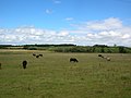 Cows near Spofforth - geograph.org.uk - 490872.jpg 640 × 478; 125 KB
-
 Crossing cycle routes - geograph.org.uk - 248222.jpg 640 × 479; 128 KB
-

-

-

-
 Finger post, Harland Way between Wetherby and Spofforth (3rd November 2018) 001.jpg 3,864 × 5,152; 6.53 MB
-
 Finger post, Harland Way between Wetherby and Spofforth (3rd November 2018) 002.jpg 5,152 × 3,864; 7.13 MB
-

-

-
 Harland Way - geograph.org.uk - 222347.jpg 479 × 640; 149 KB
-
 Harland Way - Wetherby triangle - geograph.org.uk - 490858.jpg 640 × 478; 113 KB
-
 Harland Way between Wetherby and Spofforth (3rd November 2018) 001.jpg 5,152 × 3,864; 7.5 MB
-
 Harland Way between Wetherby and Spofforth (3rd November 2018) 002.jpg 5,152 × 3,864; 7 MB
-
 Harland Way between Wetherby and Spofforth (3rd November 2018) 003.jpg 5,152 × 3,864; 7.38 MB
-
 Harland Way between Wetherby and Spofforth (3rd November 2018) 004.jpg 5,152 × 3,864; 7.18 MB
-
 Harland Way between Wetherby and Spofforth (3rd November 2018) 005.jpg 5,152 × 3,864; 7.08 MB
-
 Harland Way between Wetherby and Spofforth (3rd November 2018) 006.jpg 5,152 × 3,864; 6.67 MB
-
 Harland Way between Wetherby and Spofforth (3rd November 2018) 007.jpg 5,152 × 3,864; 8.36 MB
-

-

-
 Harland Way extension - geograph.org.uk - 490106.jpg 478 × 640; 204 KB
-
 Harland Way Junction - geograph.org.uk - 222356.jpg 640 × 479; 126 KB
-
 Harland Way near Spofforth, North Yorkshire (28th July 2018).jpg 5,152 × 3,864; 7.11 MB
-
 Harland Way near Thorp Arch - geograph.org.uk - 490134.jpg 478 × 640; 195 KB
-

-
 Memorial bench on Harland Way near Spofforth, North Yorkshire (28th July 2018).jpg 5,152 × 3,864; 7.01 MB
-
 Pipe laying by the Harland Way near Spofforth, North Yorkshire (28th July 2018) 001.jpg 5,152 × 3,864; 7.23 MB
-
 Pipe laying by the Harland Way near Spofforth, North Yorkshire (28th July 2018) 002.jpg 5,152 × 3,864; 7.09 MB
-
 Power lines by the Harland Way between Wetherby and Spofforth (3rd November 2018) 002.jpg 5,152 × 3,864; 6.38 MB
-
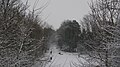
 Railway embankment from Barleyfields Road footbridge, Wetherby (6th February 2013).JPG 3,872 × 2,176; 2.33 MB
-
 Route to Quarry Hill bridleway (geograph 2889751).jpg 1,024 × 768; 231 KB
-
 Steps and path from the Harland Way, Wetherby (geograph 4582031).jpg 1,920 × 2,455; 968 KB
-
 The former Wetherby East railway junction (geograph 2889767).jpg 1,024 × 768; 200 KB
-
-

-

-
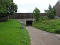 Under the A1 - geograph.org.uk - 490071.jpg 640 × 478; 160 KB
-
 Vegetation management along the Harland Way east of Wetherby (Flickr 17 August 2020).jpg 3,264 × 2,448; 3.84 MB
-
 Wetherby racecourse - geograph.org.uk - 490074.jpg 640 × 478; 143 KB
.jpg)
.jpg)
.jpg)
.jpg)
.jpg)
.jpg)
.jpg)
.jpg)


_001.jpg)
_002.jpg)

_001.jpg)
_002.jpg)
.jpg)
.jpg)


_001.jpg)
_002.jpg)
_003.jpg)
_004.jpg)
_005.jpg)
_006.jpg)
_007.jpg)
_001.jpg)
_002.jpg)


.jpg)

.JPG)
.jpg)
_001.jpg)
_002.jpg)
_002.jpg)
.JPG)
.jpg)
.jpg)
.jpg)
.JPG)
_001.jpg)
_002.jpg)

.jpg)
