Category:Hardtstraße 26 (Remscheid)
Jump to navigation
Jump to search
| Object location | | View all coordinates using: OpenStreetMap |
|---|
Media in category "Hardtstraße 26 (Remscheid)"
The following 4 files are in this category, out of 4 total.
-
 Hardtstraße 26.jpg 3,708 × 2,946; 10.06 MB
-
 Kinderhaus Westerholt.JPG 3,216 × 4,288; 2.91 MB
-
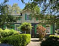
 Remscheid Lennep - Hardtstraße - 26 01 ies.jpg 5,616 × 3,744; 20.22 MB
-
 Remscheid Lennep - Hardtstraße - 26 02 ies.jpg 5,616 × 3,744; 21.36 MB


