Category:Great Busby
Jump to navigation
Jump to search
village in the United Kingdom  | |||||
| Upload media | |||||
| Instance of | |||||
|---|---|---|---|---|---|
| Location | Hambleton, North Yorkshire, Yorkshire and the Humber, England | ||||
| Population |
| ||||
 | |||||
Media in category "Great Busby"
The following 38 files are in this category, out of 38 total.
-
 A bench on Green Bank - geograph.org.uk - 4495710.jpg 6,000 × 4,000; 3.88 MB
-
 Arable land at Hunger Hill - geograph.org.uk - 3824448.jpg 4,320 × 2,160; 1.31 MB
-
 Busby lambs - geograph.org.uk - 6081146.jpg 640 × 427; 143 KB
-
 Busby Lane - geograph.org.uk - 5406228.jpg 2,048 × 1,536; 1.14 MB
-
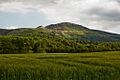 Carlton Bank from Great Busby.jpg 1,024 × 683; 655 KB
-
 Carlton Moor - geograph.org.uk - 5406229.jpg 2,048 × 1,536; 860 KB
-
 Carving on a stone, Lord Stones Country Park - geograph.org.uk - 6565518.jpg 1,756 × 2,000; 1.01 MB
-
 Cleveland Hills from Great Busby, near Stokesley - geograph.org.uk - 4327904.jpg 2,352 × 1,565; 3.52 MB
-
 Country lane, Great Busby - geograph.org.uk - 3824442.jpg 4,320 × 3,240; 1.56 MB
-
 Cricket pavilion near Busby House - geograph.org.uk - 2101527.jpg 3,088 × 2,056; 2.69 MB
-
 Cringle Moor - geograph.org.uk - 5406233.jpg 2,048 × 1,536; 1.03 MB
-
 Cringle Moor - geograph.org.uk - 5931745.jpg 1,024 × 768; 893 KB
-
 Cringle Moor view - geograph.org.uk - 5668160.jpg 640 × 480; 114 KB
-

-
 Green Bank - geograph.org.uk - 2836186.jpg 640 × 480; 69 KB
-
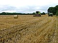 Harvestor Resting, Hunger Hill Fields - geograph.org.uk - 40396.jpg 640 × 480; 123 KB
-
 Horses by the A172 - geograph.org.uk - 2647601.jpg 640 × 428; 91 KB
-
 Kirkby to Busby Road - geograph.org.uk - 1509815.jpg 640 × 427; 227 KB
-
 Lane through Great Busby - geograph.org.uk - 6664121.jpg 4,658 × 3,672; 4.77 MB
-
 Lane, Great Busby - geograph.org.uk - 6565571.jpg 2,000 × 1,500; 1.06 MB
-
 Looking down on Manor Farm - geograph.org.uk - 3810770.jpg 3,020 × 4,162; 1.62 MB
-

-
 Mucky track and footpath - geograph.org.uk - 3824436.jpg 4,320 × 3,240; 2.29 MB
-
 Ordnance Survey Cut Bench Mark - geograph.org.uk - 5420265.jpg 4,000 × 3,000; 2.57 MB
-
 Ordnance Survey Cut Bench Mark - geograph.org.uk - 5420272.jpg 4,000 × 3,000; 3.36 MB
-
 Path on Green Bank - geograph.org.uk - 4495732.jpg 6,000 × 4,000; 4.22 MB
-
 Paths on Green Edge, Lord Stones Country Park - geograph.org.uk - 6565531.jpg 2,000 × 1,500; 1.08 MB
-
 Seat on Green Bank - geograph.org.uk - 2188982.jpg 640 × 427; 113 KB
-
 Starting off on a traverse of Cringle Moor - geograph.org.uk - 2392569.jpg 3,968 × 2,976; 2.74 MB
-
 Stone circle on Green Bank - geograph.org.uk - 4495720.jpg 6,000 × 4,000; 3.92 MB
-
 The A172 road near Busby Bridge - geograph.org.uk - 2101522.jpg 3,088 × 2,056; 2.29 MB
-
 The Cleveland way. - geograph.org.uk - 4324122.jpg 640 × 480; 68 KB
-
 The Hall Cliff Boundary Stone, Lord Stones Country Park - geograph.org.uk - 6565557.jpg 2,000 × 1,500; 1.1 MB
-
 Tom Gill, Lordstones Country Park - geograph.org.uk - 4848552.jpg 640 × 384; 96 KB
-
 Urra Moor and Cringle Moor above Stokesley - geograph.org.uk - 4574279.jpg 1,024 × 339; 77 KB
-
 View across Busby Moor to Roseberry Topping - geograph.org.uk - 2392563.jpg 3,968 × 2,976; 3.01 MB
-
 West along the scarp edge - geograph.org.uk - 3810773.jpg 4,266 × 2,752; 1.15 MB
-
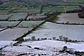 Winter near Great Busby, North Yorkshire.jpg 640 × 426; 269 KB


