Category:Grade II listed buildings in the Borough of Ashford
Jump to navigation
Jump to search
Subcategories
This category has the following 89 subcategories, out of 89 total.
1
2
- 2 The Square, Chilham (9 F)
4
- 4 The Square, Chilham (10 F)
5
- 5 High Street, Charing (4 F)
- 5-6 The Square, Chilham (7 F)
6
- 63 High Street, Ashford (9 F)
A
- The Almshouses, Great Chart (3 F)
- Ashford War Memorial, Kent (3 F)
B
- Barrett House, Wissenden (3 F)
- Black Horse, Pluckley (7 F)
- Bonny Cravat, Woodchurch (4 F)
- The Bothy, Godinton Park (5 F)
- Bucksford Manor, Great Chart (8 F)
- The Bull Inn, Bethersden (9 F)
C
- Chantry Cottage, Chilham (5 F)
- Charing Windmill (5 F)
- The Chequers, Challock (3 F)
- Chilham war memorial (9 F)
- Christ Church, South Ashford (18 F)
- Clements Cottage, Chilham (11 F)
- The Cosway Monument (28 F)
- The County Hotel, Ashford (10 F)
E
- Eastwell Towers (12 F)
- Elephant House, Chilham (5 F)
G
- The George Hotel, Ashford (5 F)
- The George, Bethersden (2 F)
- The George, Molash (6 F)
H
- Haddon Cottage, Chilham (12 F)
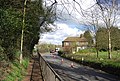
- Ham Street railway station (31 F)
- Heronden Hall Gatehouse (5 F)
- The Honest Miller, Brook (6 F)
K
- Kings Head, Shadoxhurst (5 F)
- The Kings Head, Wye (10 F)
L
- Lacton Oast, Willesborough (3 F)
- Lodge house, Eastwell Park (3 F)
M
- Man of Kent, Ashford (10 F)
- Mark IV tank, Ashford, Kent (27 F)
N
- North Lodge, Godinton Park (4 F)
O
- Old Eastside, Hamstreet (5 F)
- The Old Mill, Kennington (7 F)
- Orion's Cottage, Chilham (4 F)
P
- The Prince Albert, Ashford (10 F)
R
S
- Six Bells, Woodchurch (3 F)
- The Star Inn, Ashford (4 F)
- The Swan, Great Chart (5 F)
T
- Tenterden & District Museum (5 F)
- Tenterden Town Hall (4 F)
- Tenterden War Memorial (2 F)
- Thanet Arms, Hothfield (3 F)
- The Tickled Trout, Wye, Kent (9 F)
- Tudor Cottage, Chilham (12 F)
W
- Wakeley Villas (2 F)
- The Warehouse, Ashford (4 F)
- The White Horse, Chilham (19 F)
- The White Horse, Bilsington (9 F)
- William Harvey pub, Ashford (3 F)
- Wissenden House (2 F)
- The Woolpack, Warehorne (8 F)
- The Woolpack Hotel, Tenterden (10 F)
- Wye Methodist Church (7 F)
Media in category "Grade II listed buildings in the Borough of Ashford"
The following 200 files are in this category, out of 371 total.
(previous page) (next page)-

-
 1 Upper Bridge Street, Wye - geograph.org.uk - 3466550.jpg 1,024 × 768; 228 KB
-
 1, Ashford Road - geograph.org.uk - 4016264.jpg 480 × 640; 111 KB
-
 1, Cosy Cottage, Church Lane - geograph.org.uk - 4362989.jpg 3,264 × 2,448; 3.82 MB
-
 1-3, Upper Bridge St - geograph.org.uk - 4253306.jpg 640 × 430; 79 KB
-
 10 Middle Row, Ashford - 53292053893.jpg 4,608 × 3,456; 4.28 MB
-
 10-12 Middle Row, Ashford - 53291813481.jpg 4,608 × 3,456; 5.58 MB
-
 11 North Street, Ashford - 53292175824.jpg 3,456 × 4,608; 5.35 MB
-
 111 - 115, Bridge St - geograph.org.uk - 4258943.jpg 640 × 404; 66 KB
-
 12-18 High Street, Ashford.jpg 4,608 × 3,456; 5.74 MB
-
 123 - 125, Bridge Rd - geograph.org.uk - 4258936.jpg 640 × 430; 90 KB
-
 123 and 125 Bridge Street, Wye, Kent - geograph.org.uk - 1393600.jpg 640 × 427; 81 KB
-
 125, Bridge Street - geograph.org.uk - 4785019.jpg 2,448 × 3,264; 1.64 MB
-
 127, Bridge St - geograph.org.uk - 3003388.jpg 640 × 388; 67 KB
-
 127, Bridge St - geograph.org.uk - 4258933.jpg 640 × 430; 78 KB
-
 13 Church Yard (Talbot House), The Churchyard, Ashford.jpg 1,536 × 2,048; 1.49 MB
-
 13 Middle Row, Ashford.jpg 3,456 × 4,608; 4.82 MB
-
 13-14 The Churchyard, Ashford - 53291809896.jpg 3,456 × 4,608; 5.7 MB
-
 137 - 139, Bridge St - geograph.org.uk - 4258931.jpg 640 × 430; 89 KB
-
 14-22 North Street, Ashford.jpg 4,608 × 3,456; 5 MB
-
 15-16 The Churchyard, Ashford - 53291807431.jpg 3,456 × 4,608; 5.1 MB
-
 15a-29 High Street, Ashford - 53290930637.jpg 4,608 × 3,456; 5.96 MB
-
 18-32 North Street, Ashford - 53291805571.jpg 4,608 × 3,456; 4.71 MB
-
 1a-1 Middle Row, Ashford.jpg 4,608 × 3,456; 6.36 MB
-
 1B Middle Row, Ashford.jpg 4,608 × 3,456; 6.42 MB
-
 2 Middle Row, Ashford.jpg 3,456 × 4,608; 4.78 MB
-
 20, Bridge St - geograph.org.uk - 4258976.jpg 640 × 430; 75 KB
-
 20, High Street - geograph.org.uk - 4016286.jpg 640 × 480; 101 KB
-
 21 Tufton Street, Ashford - 53292275325.jpg 4,608 × 3,456; 4.95 MB
-
 23-31 High Street, Ashford - 53292185539.jpg 4,608 × 3,456; 5.53 MB
-

-
 24 The Churchyard 2 - 53292272130.jpg 4,608 × 3,456; 6.41 MB
-
 24 The Churchyard, Ashford - 53290928107.jpg 4,608 × 3,456; 5.43 MB
-
 24 The Churchyard, Ashford - 53292050033.jpg 4,608 × 3,456; 5.43 MB
-
 28-32 North Street, Ashford.jpg 4,608 × 3,456; 5.01 MB
-
 3 Middle Row, Ashford.jpg 3,456 × 4,608; 6.04 MB
-
 32 High Street, Ashford - 53292185909.jpg 3,456 × 4,608; 6.52 MB
-
 37, The Green - geograph.org.uk - 4162390.jpg 881 × 1,168; 164 KB
-
 4 Middle Row, Ashford - 53292056618.jpg 3,456 × 4,608; 5.93 MB
-
 46 High Street in Ashford - McDonalds.jpg 1,512 × 1,536; 447 KB
-
 46 High Street, Ashford.jpg 4,608 × 3,456; 6.75 MB
-
 46-52 High Street, Ashford.jpg 4,608 × 3,456; 6.1 MB
-
 48 High Street Ashford Kent TN24 8TE.jpg 2,000 × 1,500; 889 KB
-
 54 High Street, Ashford - 53292278520.jpg 4,608 × 3,456; 4.81 MB
-
 57 High Street, Ashford - 53290930017.jpg 3,456 × 4,608; 4.42 MB
-
 6 The Churchyard, Ashford.jpg 4,608 × 3,456; 6.79 MB
-
 6-7 The Churchyard, Ashford.jpg 4,608 × 3,456; 5.82 MB
-
 60 The Street, Kennington 2.jpg 4,608 × 3,456; 3.99 MB
-
 60 The Street, Kennington.jpg 4,608 × 3,456; 4.4 MB
-
 64-68 The Street, Kennington 2.jpg 4,608 × 3,456; 4.25 MB
-
 64-68 The Street, Kennington.jpg 4,608 × 3,456; 6.09 MB
-
 67-73 High Street, Ashford - 53291811086.jpg 4,608 × 3,456; 4.76 MB
-
 7 East Hill, Ashford.jpg 3,456 × 3,456; 9.6 MB
-
 7 North Street, Ashford.jpg 3,456 × 4,608; 5.56 MB
-
 7-12 The Churchyard, Ashford - 53290925347.jpg 4,608 × 3,456; 5.77 MB
-
 7-9 North Street, Ashford.jpg 4,608 × 3,456; 4.49 MB
-
 7-9 The Churchyard, Ashford - 53292051883.jpg 4,608 × 3,456; 5.7 MB
-
 75 High Street, Ashford.jpg 4,608 × 3,456; 4.5 MB
-
 80 Upper Bridge Street, Wye - geograph.org.uk - 5120867.jpg 4,000 × 3,000; 3.12 MB
-
 83-83A High Street, Ashford.jpg 4,608 × 3,456; 4.83 MB
-
 87, Bridge St - geograph.org.uk - 4258963.jpg 640 × 430; 64 KB
-
 89 - 93, Bridge St - geograph.org.uk - 4258959.jpg 640 × 430; 68 KB
-
 95, Bridge St - geograph.org.uk - 4258954.jpg 640 × 430; 89 KB
-
 97 - 105, Bridge St - geograph.org.uk - 4258952.jpg 640 × 430; 71 KB
-
 98-106 High Street, Ashford.jpg 4,608 × 3,456; 4.5 MB
-
 A28 at Kempe's Corner - geograph.org.uk - 2215670.jpg 4,320 × 3,240; 3.72 MB
-
 Almshouse - geograph.org.uk - 414806.jpg 640 × 480; 229 KB
-
 Almshouse Info at Laurel Tree House.jpg 4,608 × 3,456; 6.01 MB
-
 An old property on The Green Wye - geograph.org.uk - 4621799.jpg 4,608 × 3,456; 2.99 MB
-
 Apple Cottage, Kennington - 53128428487.jpg 4,608 × 3,456; 6.23 MB
-
 Ashford High Street - geograph.org.uk - 4757902.jpg 640 × 480; 179 KB
-
 Ashford Kent, North Street - geograph.org.uk - 1142576.jpg 640 × 480; 78 KB
-
 Ashford Town Centre - geograph.org.uk - 1039347.jpg 480 × 640; 90 KB
-
 Ashford, Kent - 15 The Churchyard.jpg 1,302 × 1,293; 482 KB
-
 Ashford, Kent - 7 North Street.jpg 1,559 × 1,536; 388 KB
-
 Ashford, Kent - geograph.org.uk - 1149363.jpg 480 × 640; 89 KB
-
 Ashford, Kent - Kings Parade.jpg 1,548 × 1,515; 341 KB
-
 Bakery House, The Street, Chilham, Kent-geograph-5072031-by-Jo-Turner.jpg 5,184 × 3,456; 7.58 MB
-
 Barn at Kempe's Corner (geograph 6475028).jpg 1,024 × 685; 165 KB
-
 Barn by the Flying Horse - geograph.org.uk - 2436692.jpg 640 × 480; 130 KB
-
 Barrow Hill Place, Ashford - geograph.org.uk - 4755786.jpg 2,272 × 1,704; 1.09 MB
-
 Barton House, Kennington.jpg 4,608 × 2,592; 2.25 MB
-
 Bay Tree Cottage (geograph 6474954).jpg 1,024 × 684; 276 KB
-

-
 Bethersden, Kent, Post Office - geograph.org.uk - 3427850.jpg 4,320 × 3,240; 7.26 MB
-
 Bockhanger Farmhouse.jpg 3,712 × 2,784; 2.56 MB
-

-
 Bridge St - geograph.org.uk - 4258966.jpg 640 × 430; 82 KB
-
 Bridge St - geograph.org.uk - 4258968.jpg 640 × 430; 99 KB
-
 Bridge Street, Wye - geograph.org.uk - 3466564.jpg 1,024 × 768; 200 KB
-
 Brook Oast - geograph.org.uk - 2821203.jpg 2,256 × 1,496; 922 KB
-
 Brook Oast, The Street, Brook, Kent - geograph.org.uk - 1076231.jpg 640 × 427; 71 KB
-
 Brook Oast, The Street, Brook, Kent - geograph.org.uk - 2477622.jpg 640 × 480; 138 KB
-
 Brook Oast, The Street, Brook, Kent - geograph.org.uk - 2477624.jpg 640 × 480; 99 KB
-
 Brooke Place - geograph.org.uk - 2503357.jpg 640 × 430; 67 KB
-
 Brooke Place, Ashford.jpg 3,456 × 3,456; 9.13 MB
-
 Burgoyne's, Chilham-geograph-2649341.jpg 640 × 480; 51 KB
-
 Caffè Nero and Former Embassy Cinema - geograph.org.uk - 2990772.jpg 640 × 430; 74 KB
-
 Café Rouge, Tenterden - geograph.org.uk - 3966480.jpg 640 × 427; 80 KB
-
 Castle Street, Ashford - geograph.org.uk - 4755751.jpg 2,272 × 1,704; 800 KB
-
 Chilham, Attractive half timbered buildings - geograph.org.uk - 4831941.jpg 3,868 × 2,570; 4.78 MB
-
 Chilham, Attractive half timbered buildings - geograph.org.uk - 4831944.jpg 5,058 × 3,149; 7.2 MB
-
 Chilham, Kent-geograph-3844137-by-Marathon.jpg 4,000 × 3,000; 4.25 MB
-
 Chilham, Taylor's Hill.JPG 2,048 × 1,536; 658 KB
-
 Church Farmhouse - geograph.org.uk - 3233665.jpg 640 × 430; 82 KB
-
 Church Gates Cottages (geograph 6773231).jpg 1,024 × 684; 177 KB
-
 Church St - geograph.org.uk - 3003394.jpg 640 × 430; 65 KB
-
 Church St - geograph.org.uk - 3005422.jpg 640 × 430; 68 KB
-
 Church St - geograph.org.uk - 4197300.jpg 640 × 430; 68 KB
-
 Church St - geograph.org.uk - 4258916.jpg 640 × 430; 75 KB
-
 Church Street, Wye - geograph.org.uk - 4993880.jpg 2,048 × 1,536; 1.47 MB
-
 Church Street, Wye - geograph.org.uk - 793552.jpg 640 × 480; 139 KB
-
 Church Yard Passage, Ashford - geograph.org.uk - 1764216.jpg 1,280 × 856; 190 KB
-
 Church Yard Passage, Ashford 1 - 53292181109.jpg 3,456 × 4,608; 4.8 MB
-
 Claremont House - geograph.org.uk - 3005419.jpg 640 × 430; 68 KB
-
 Conningbrook Lakes Country Park.jpg 4,000 × 3,000; 5.19 MB
-
 Converted Barn by Temple House.jpg 4,608 × 2,592; 1.81 MB
-
 Converted stables off The Street - geograph.org.uk - 3576853.jpg 640 × 427; 106 KB
-
 Cooper's Cottage - geograph.org.uk - 2450879.jpg 640 × 430; 94 KB
-
 Cornerdroft, Church St - geograph.org.uk - 3009926.jpg 640 × 430; 109 KB
-
 Cottage in Chilham - geograph.org.uk - 410550.jpg 640 × 427; 110 KB
-
 Cottage Row - geograph.org.uk - 3230064.jpg 640 × 430; 76 KB
-
 Cottage, The Street - geograph.org.uk - 2489397.jpg 640 × 430; 66 KB
-
-

-
 Cottages, Warehorne Road, Hamstreet - geograph.org.uk - 1764563.jpg 640 × 428; 117 KB
-
 Court Lodge Farmhouse Barn and Tower of the Church of Saint Martin, Aldington (01).jpg 4,526 × 3,353; 10.72 MB
-
 Court Lodge, Westwell - geograph.org.uk - 2928998.jpg 587 × 440; 109 KB
-
 Crossing warning - geograph.org.uk - 3466428.jpg 1,024 × 768; 234 KB
-
 Cumberland House - geograph.org.uk - 5713997.jpg 4,000 × 3,000; 3.1 MB
-
 Cumberland House - geograph.org.uk - 5713998.jpg 4,000 × 3,000; 3.26 MB
-

-
 Door of 14-15 The Churchyard, Ashford 02.jpg 1,536 × 2,048; 1.54 MB
-
 DR Luckhurst (geograph 6773209).jpg 1,024 × 684; 126 KB
-
 East Cross, Tenterden - geograph.org.uk - 4825767.jpg 3,264 × 2,448; 1.75 MB
-
 East Hill, Ashford - geograph.org.uk - 4755829.jpg 2,272 × 1,704; 797 KB
-
 East Lodge on Chart Road, Ashford - geograph.org.uk - 6001845.jpg 5,202 × 3,465; 4.51 MB
-
 Elm Tree listed building.jpg 4,608 × 3,456; 5.33 MB
-
 Elmstone House, Tenterden - geograph.org.uk - 2305362.jpg 640 × 480; 109 KB
-
 Entrance to Goldwyn Community Special School - geograph.org.uk - 3323824.jpg 1,077 × 807; 222 KB
-
 Fir Tree Cottage (geograph 6773260).jpg 1,024 × 684; 144 KB
-
 Forge Cottage - geograph.org.uk - 2448094.jpg 640 × 430; 82 KB
-
 Forge Cottage - geograph.org.uk - 2450876.jpg 640 × 430; 86 KB
-
 Forge Cottage, Bethersden, Kent - geograph.org.uk - 1343709.jpg 640 × 480; 129 KB
-
 Forge Hill House - geograph.org.uk - 2448098.jpg 640 × 430; 94 KB
-
 Forge Stores, Great Chart - geograph.org.uk - 2489385.jpg 640 × 430; 60 KB
-
 Former market building, Ashford - geograph.org.uk - 4757920.jpg 640 × 480; 181 KB
-

-
 Fountain, Victoria Park - geograph.org.uk - 2500112.jpg 640 × 430; 87 KB
-
 Gate Lodge (geograph 6773265).jpg 1,024 × 684; 229 KB
-
 Gates and lodge, Godinton Park - geograph.org.uk - 4757203.jpg 640 × 480; 213 KB
-
 Glovers, Kennington.jpg 4,000 × 3,000; 5.56 MB
-
 Golden Wye Chinese Restaurant - geograph.org.uk - 3005434.jpg 640 × 430; 71 KB
-
 Green Farm - geograph.org.uk - 396865.jpg 640 × 480; 223 KB
-
 Handley Cross - geograph.org.uk - 4253253.jpg 640 × 430; 84 KB
-
 Headstone of William Jordan to the South of the Church of Saint Rumwold, Bonnington (01).jpg 3,326 × 4,381; 11.23 MB
-
 High Street - geograph.org.uk - 5124089.jpg 4,000 × 3,000; 2.5 MB
-
 High Street Ashford 03.JPG 2,048 × 1,536; 1.5 MB
-
 High Street Ashford 09.JPG 2,048 × 1,536; 1.55 MB
-
 High Street, Ashford - geograph.org.uk - 1193555.jpg 640 × 480; 73 KB
-
 High Street, Tenterden - geograph.org.uk - 2948421.jpg 2,520 × 1,680; 437 KB
-
 High Street, Tenterden - geograph.org.uk - 5060296.jpg 4,813 × 2,903; 7.53 MB
-
 Home Farm, Kennington 1.jpg 4,608 × 3,456; 5.31 MB
-
 Home Farm, Kennington 2.jpg 3,530 × 2,648; 1.62 MB
-
 Home Farmhouse, Kennington 1 - 53129427840.jpg 4,608 × 3,456; 6.84 MB
-
 Home Farmhouse, Kennington 2 - 53129427740.jpg 4,608 × 3,456; 6.64 MB
-
 Honeysuckle Cottage - geograph.org.uk - 3451893.jpg 640 × 430; 54 KB
-
 Hooden on the Hill, Willesborough - geograph.org.uk - 4755881.jpg 2,272 × 1,704; 851 KB
-
 Hopewell House, 13 North Street, Ashford - 53291805336.jpg 4,608 × 3,456; 5.22 MB
-
 Hopewell House, 13 North Street, Ashford.jpg 4,608 × 3,456; 4.96 MB
-
 Hopewell House.jpg 2,864 × 2,811; 1.17 MB
-
 House by Blackwall Road North - geograph.org.uk - 2989272.jpg 640 × 430; 58 KB
-

-
 Houses along the High Street - geograph.org.uk - 3736367.jpg 1,142 × 856; 188 KB
-
 Houses in Tenterden High Street - geograph.org.uk - 3426457.jpg 4,000 × 3,000; 4.36 MB
-
 Houses in Tenterden High Street - geograph.org.uk - 3426460.jpg 4,000 × 3,000; 4.33 MB
-
 Houses on Taylors Hill - geograph.org.uk - 2649328.jpg 480 × 640; 107 KB
-
 Houses on the corner - geograph.org.uk - 3466479.jpg 1,024 × 768; 264 KB
-
 Houses on The Street, Appledore, Kent - geograph-2941721.jpg 640 × 424; 75 KB
-
 Island Farmhouse - geograph.org.uk - 1720495.jpg 3,072 × 2,304; 1.51 MB
-
 Junction of Bull Lane and the A28 - geograph.org.uk - 3858879.jpg 3,696 × 2,448; 2.31 MB
-
 K6 Kiosk - geograph.org.uk - 4253311.jpg 640 × 430; 68 KB
-
 K6 Phone Boxes, Ashford Road - geograph.org.uk - 4016256.jpg 427 × 640; 73 KB
-
 K6 telephone kiosk - geograph.org.uk - 2988245.jpg 640 × 430; 82 KB
-
 K6 Telephone Kiosk, Middle Row, Ashford - 53291813651.jpg 3,456 × 4,608; 5.89 MB
-
 Kennington Hall - geograph.org.uk - 1457623.jpg 640 × 480; 96 KB
-
 Kennington Lodge.jpg 4,608 × 3,456; 7.56 MB
-
 Kennington Rd - geograph.org.uk - 2971818.jpg 640 × 430; 121 KB
-
 Kenway Cottage - geograph.org.uk - 2971816.jpg 640 × 430; 111 KB
-
 Kings Parade, Ashford - geograph.org.uk - 4945689.jpg 1,024 × 768; 166 KB
-
 Lambden Cottage, Pluckley Thorne - geograph.org.uk - 1426332.jpg 640 × 480; 87 KB
-
 Lambden House - geograph.org.uk - 4044728.jpg 4,000 × 3,000; 4.09 MB
-
 Laurel Tree House, 56 The Street 2.jpg 3,335 × 2,501; 1.08 MB
-
 Laurel Tree House, 56 The Street.jpg 4,608 × 3,456; 4.1 MB
-
 Lead downpipe on the School house - geograph.org.uk - 396826.jpg 480 × 640; 282 KB
-
 Lees Cottage (geograph 6474916).jpg 1,024 × 684; 201 KB
-
 Listed buildings, Church St - geograph.org.uk - 3005430.jpg 640 × 430; 60 KB
-
 Little Lords - geograph.org.uk - 3005417.jpg 640 × 430; 86 KB
-

-
 Looking NE along The Street, Great Chart - geograph.org.uk - 1272546.jpg 640 × 480; 118 KB


,_The_Churchyard,_Ashford.jpg)


,_Church_View_Tea_Rooms_(63_High_Street),_to_61_High_Street_-_53292276580.jpg)


.jpg)


.jpg)


.jpg)


.jpg)


.jpg)


.jpg)


.jpg)


.jpg)


.jpg)


