Category:Gembling
Jump to navigation
Jump to search
village in the East Riding of Yorkshire, England, UK  | |||||
| Upload media | |||||
| Instance of | |||||
|---|---|---|---|---|---|
| Location | Foston, East Riding of Yorkshire, Yorkshire and the Humber, England | ||||
 | |||||
English: Gembling is a small hamlet in the civil parish of Foston on the Wolds in the East Riding of Yorkshire, England. It is situated 7 miles (11 km) south west of Bridlington town centre and 2.5 miles (4 km) north of the village of North Frodingham.
Media in category "Gembling"
The following 15 files are in this category, out of 15 total.
-
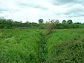 Field Drain, Gembling - geograph.org.uk - 1325341.jpg 640 × 480; 90 KB
-
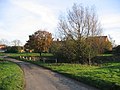
 Gembling - Park House Farm - geograph.org.uk - 82757.jpg 640 × 480; 82 KB
-
 Gembling House - geograph.org.uk - 82759.jpg 480 × 640; 170 KB
-
 Gembling House Farm.jpg 640 × 480; 71 KB
-
 Gembling Lane End - geograph.org.uk - 82752.jpg 640 × 480; 122 KB
-
 Gembling Lane, Gembling - geograph.org.uk - 1325345.jpg 640 × 459; 69 KB
-
 Gembling Primary School.jpg 640 × 480; 87 KB
-
 Gembling.jpg 640 × 480; 112 KB
-
 Lane Towards Northpasture Farm - geograph.org.uk - 1325352.jpg 640 × 480; 116 KB
-
 Long Lane, Gembling - geograph.org.uk - 1325353.jpg 640 × 480; 75 KB
-
 Minor Road Towards Great Kelk - geograph.org.uk - 1325337.jpg 640 × 480; 72 KB
-
 Old Howe Drain - geograph.org.uk - 1325356.jpg 640 × 480; 94 KB
-
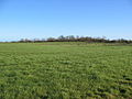 Park House Farmland - geograph.org.uk - 327211.jpg 640 × 480; 93 KB
-
 Track to Field House Farm - geograph.org.uk - 1325335.jpg 640 × 480; 67 KB
-
 Village Pond Gembling.jpg 640 × 480; 118 KB


