Category:Fuar Tholl
Jump to navigation
Jump to search
907m high mountain in Highland, Scotland, UK  | |||||
| Upload media | |||||
| Instance of | |||||
|---|---|---|---|---|---|
| Part of |
| ||||
| Location | Highland, Scottish Highlands, Scotland | ||||
| Topographic prominence |
| ||||
| Elevation above sea level |
| ||||
 | |||||
Media in category "Fuar Tholl"
The following 22 files are in this category, out of 22 total.
-
 Achnashellach railway station - geograph.org.uk - 203415.jpg 640 × 480; 158 KB
-
 Coire Mainnrichean - geograph.org.uk - 753709.jpg 1,000 × 668; 1.09 MB
-
 Footpath - geograph.org.uk - 210284.jpg 640 × 480; 188 KB
-
 Footpath above Achnashellach - geograph.org.uk - 203418.jpg 640 × 480; 162 KB
-
 Fuar Tholl - geograph.org.uk - 1127352.jpg 480 × 640; 82 KB
-
 Fuar Tholl - geograph.org.uk - 203474.jpg 640 × 480; 162 KB
-
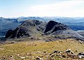
 Fuar Tholl - geograph.org.uk - 829257.jpg 640 × 477; 95 KB
-
 Fuar Tholl from Carn Eite - geograph.org.uk - 1365241.jpg 640 × 424; 75 KB
-
 Fuar Tholl from Creag Mainnrichean - geograph.org.uk - 1007000.jpg 640 × 462; 110 KB
-
 Fuar Tholl from Sgorr Ruadh - geograph.org.uk - 1768784.jpg 800 × 533; 123 KB
-
 Fuar Tholl from Sgurr Ruadh.jpg 1,979 × 1,422; 517 KB
-
 Fuar tholl.jpg 300 × 143; 13 KB
-
 Loch a` Bhealaich Mhoir - geograph.org.uk - 204108.jpg 640 × 480; 147 KB
-
 Loch Coire Lair - geograph.org.uk - 66692.jpg 640 × 480; 87 KB
-
 Loch Coire Láir and Fuar Tholl - geograph.org.uk - 829143.jpg 640 × 467; 98 KB
-
 Mainreachan Buttress.jpg 1,974 × 1,410; 515 KB
-
 On the eastern slopes of Sgorr Ruadh - geograph.org.uk - 209967.jpg 640 × 480; 141 KB
-
 On the slopes of Sgorr Ruadh - geograph.org.uk - 203470.jpg 640 × 480; 129 KB
-
 On the southern slopes of Sgorr Ruadh - geograph.org.uk - 210280.jpg 640 × 480; 166 KB
-

-
 The steep north slope of Fuar Tholl - geograph.org.uk - 652717.jpg 405 × 640; 70 KB
-


