Category:Franciscanessenplein, Breda
Jump to navigation
Jump to search
| Object location | | View all coordinates using: OpenStreetMap |
|---|
urban square in Breda, the Netherlands | |||||
| Upload media | |||||
| Instance of | |||||
|---|---|---|---|---|---|
| Location | Breda, North Brabant, Netherlands | ||||
| Street address |
| ||||
 | |||||
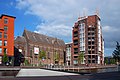
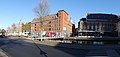
Nederlands: Afbeeldingen van de straat de Franciscanessenplein, Breda gelegen nabij de straat de Nieuweweg, Breda en de Markendaalseweg. Gelegen nabij het centrum van Breda. Niet ver van de Haven van Breda.
Media in category "Franciscanessenplein, Breda"
The following 5 files are in this category, out of 5 total.
-
 2010-05-21-breda-by-RalfR-11.jpg 3,008 × 2,000; 2.26 MB
-
 Franciscanessenplein Breda P1340011copy.jpg 4,000 × 2,672; 2.51 MB
-
 Liefdegesticht Marquant.jpg 2,048 × 923; 385 KB
-
 Nieuweweg, Breda P1330994.jpg 4,000 × 2,672; 5.75 MB
-
 Nieuweweg, Breda P1340008.jpg 4,032 × 1,920; 4.52 MB


